
Several of the latest models with their new “cloud physics” modules seem to over-state low level cloudiness. I’ve seen that often with the HRRRv4 and RAPv5 model versions that were released in the fall of 2020.
Forecast Update Sat 8:20AM — Just some timing updates. There had been some uncertainties with Sunday’s forecast. Last night’s models suggest that the rain on Sunday will last later into the afternoon (3-4 PM) with a second line of showers/thunderstorms associated with the cold front between 6 and 7 PM.
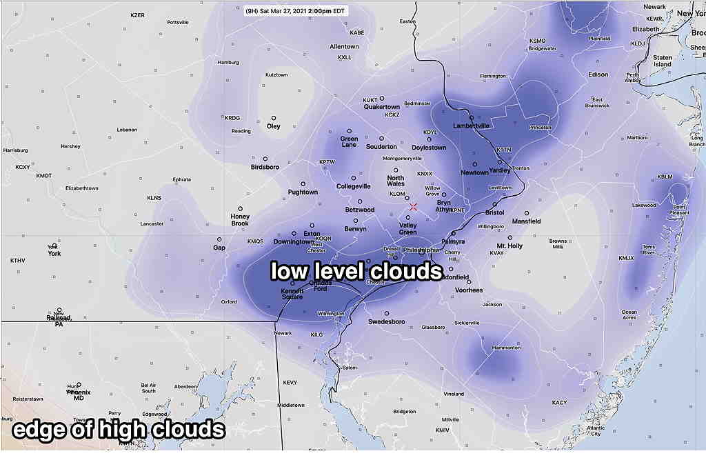
Additionally, several models show an area of low clouds about 1-4PM today (Saturday) associated with an upper air feature. Sometimes the new HRRR and RAP models over-state cloudiness. We’ll see.
From Friday evening…
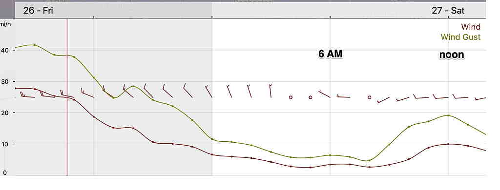
Today’s weather was indeed interesting, with wind gusts exceeding 50 mph and temperatures exceeding 80º!
The weekend will start more tranquil. High pressure builds in for Saturday. Saturday will be mostly sunny, although high clouds move in during the afternoon. High temperatures 68º ± 2.5º (NBM Model, Blue Bell). Winds will be more manageable than today—
Yet another low pressure system moves to our west on Sunday, bringing rain for Sunday morning ahead of another warm front. Rain will begin early morning, about 6-8 AM. Total QPF expected 0.6 inches.
The warm front moves north of us and rain will end Sunday afternoon. It will become WINDY (but nothing like Friday).
There’s uncertainty whether the rain ends as early as 1-2 PM or as late as 4 PM. Some models have some break in the clouds Sunday afternoon, maybe some sun after the warm front passage. High temp 68º± 3.3º
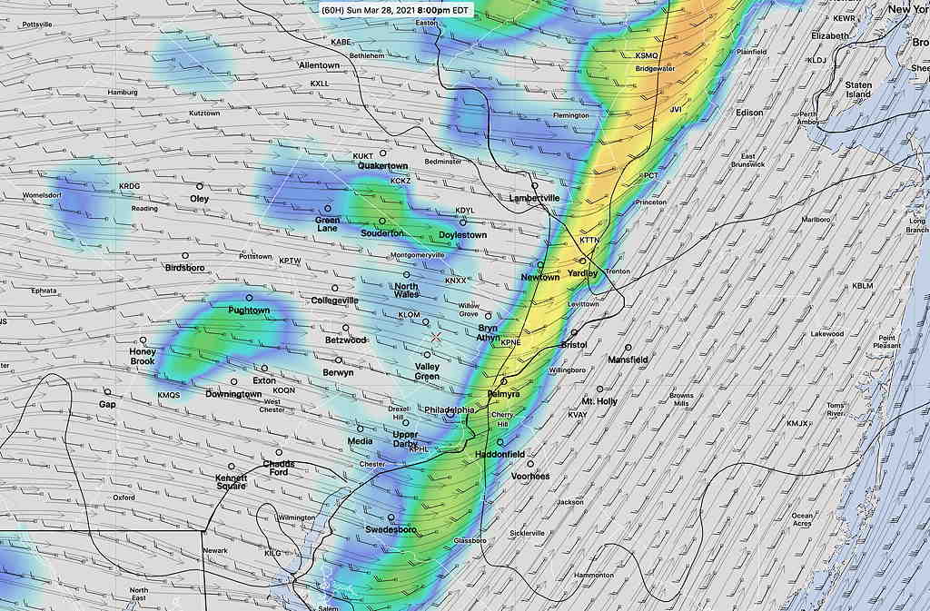
A strong cold front associated with the same system moves through late Sunday afternoon or Sunday evening. Several models are forecasting a line of showers and thunderstorms Sunday late afternoon or evening with the cold front passage.
Monday will be much cooler than the prior few days.