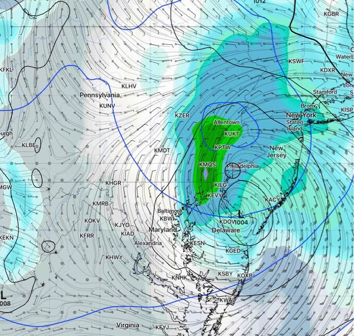
Updated Wed 10:42 PM — Tonight’s NAM NEST model has generalized 4 inches of rain Friday, starting early morning and ending in the evening.
The coastal low expected to take on tropical characteristics and affect our area Friday has had an interesting history as far as the model predictions are concerned.
It was just a day ago that the much touted European model (ECMWF) and the GFS model were predicting it to just brush the coastline, missing us. Meanwhile the current track had been predicted by the NAM and SREF models, often wrong about such storms.
The new GFS, still under development and experimental, had picked up the current track sooner than the current operational GFS model. It suggests that weather forecast accuracy may improve when the new GFS is released in 2021.
It appears that the storm will affect us starting early Friday morning. About 1.5 -2 inches of rain will fall on Friday, with locally heavier amounts possible. Heaviest amounts just west of Philadelphia.
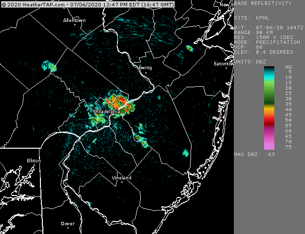
Updated Mon 01:39 PM — The storms developed around 1 PM, but not where predicted by the models. Also, the storm movement is different than predicted as well (or there’s something wrong with my data.) We’re getting some small size hail around here.
Live Radar at 12:56PM- Starting Thunderstorm development. (Click on image for a larger view.)
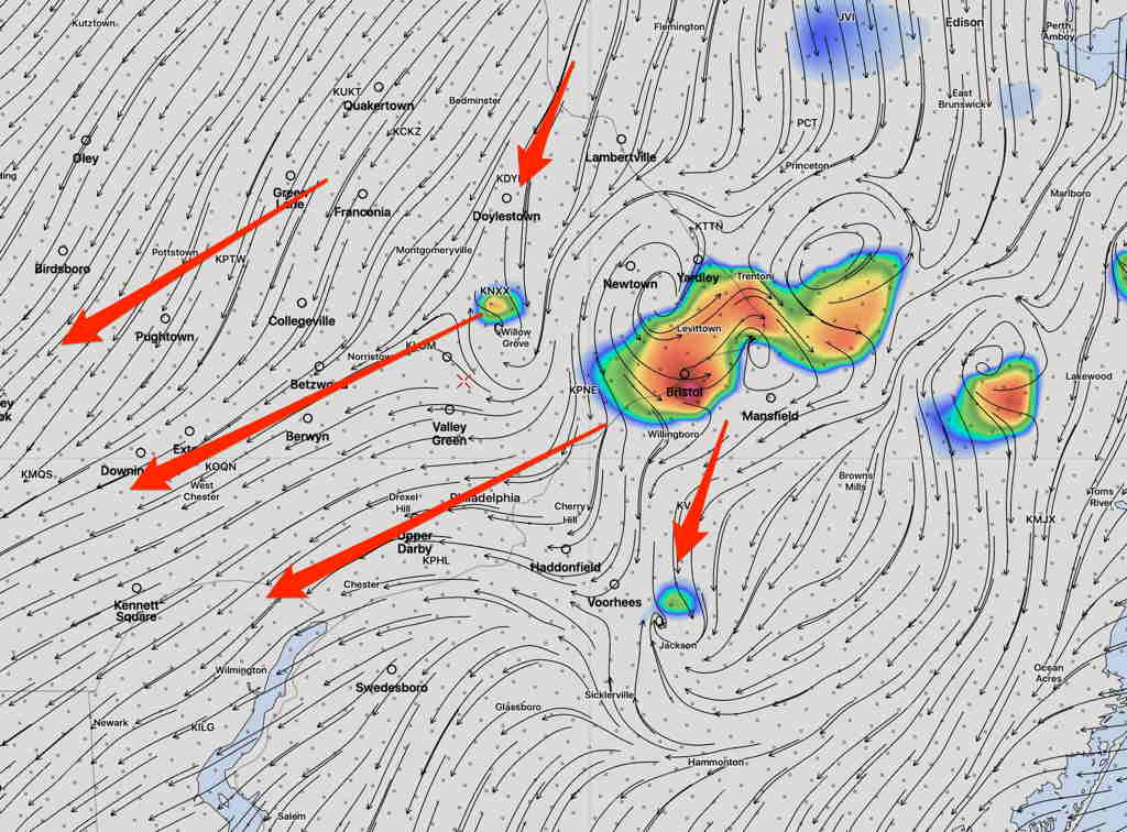
The models from last night and this morning show thunderstorms developing over central NJ near Bucks County about 1-3 PM today and moving from northeast to southwest! Some of these thunderstorms will have very heavy rain!
HRRR storm motion direction at 3 PM
Most areas near Philadelphia will have showers and thunderstorms, but some areas which have been dry over the past few weeks may again miss some of the heaviest rains.
(There’s a negative feedback loop where there are existing dry conditions. When soil moisture is low, it negatively affects the development of thunderstorms. Dry begets dry!)
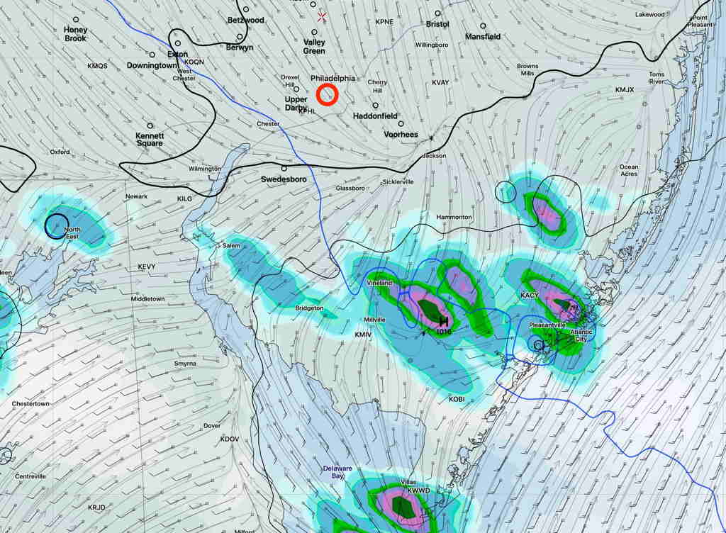
Updated Sun 07:29 AM — The latest NAM NEST keeps the showers south of the immediate PHL area. High temperature 93.6° sd 1.3º (Blue Bell), 94.9º sd 1.3º (Phila Airport)
NAM NEST 1 hour precip forecast 3 PM Sunday. (Click on image for a larger view.)
Updated Sat 10:42 PM — Tonight’s models keep the scattered showers south of Philadelphia. The position in the GFS graphic below remains unchanged. High temperatures 94°.
The focus of this weekend’s weather has been the very warm (hot) temperatures expected. But there’s a forecast change regarding showers.
The frontal boundary that passed through Friday night had been expected to ‘wash out’. Instead, it has stalled to our south and is now expected to become an area of weak moisture convergence for this evening and Sunday.
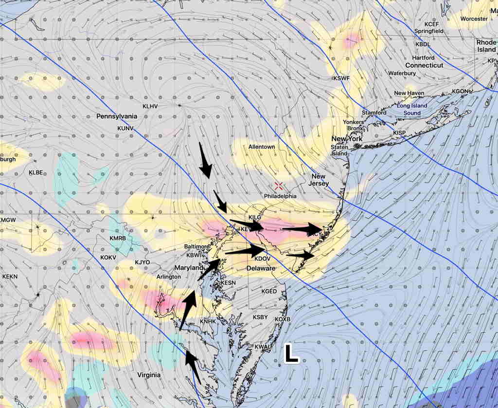
GFS Forecast vertical velocity (yellow/pink) and lower wind flow. (Click on image for a larger view.)
With daytime heating and the vertical motion from the wind flow convergence, scattered showers and thunderstorms are possible in the area shown in pink above. (South of the Philadelphia area.)
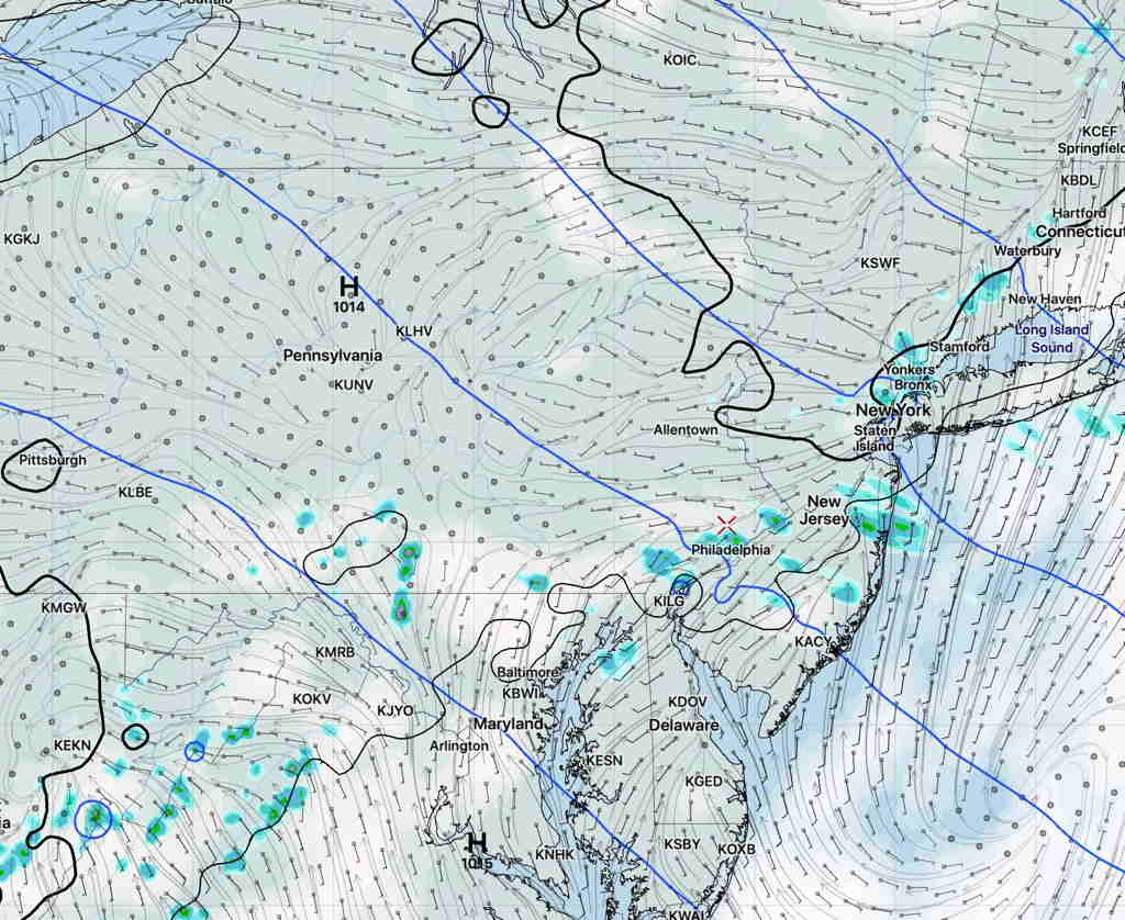
This afternoon’s NAM NEST has this area of convergence a little further north, and a ripple ( vorticity disturbance) in the upper air flow with showers developing closer to Philadelphia area tomorrow afternoon—
NAM NEST 2 PM Sunday precipitation forecast (Click on image for a larger view.)
So there’s some uncertainty about the exact location of these possible showers. Also timing uncertainty, with the GFS having these showers as early as late morning and NAM NEST as early as 2PM Sunday.