WEEKEND FORECAST

Friday’s upper air disturbances set off showers and even wet snow flurries. While captured by this morning’s models, this wasn’t forecast by last night’s models.

For the weekend…

For Saturday, high pressure builds in as low pressure departs to our east.  Winds will subside, but it will still be breezy. Sunshine expected for all of Saturday.  High temps: 54-56º.

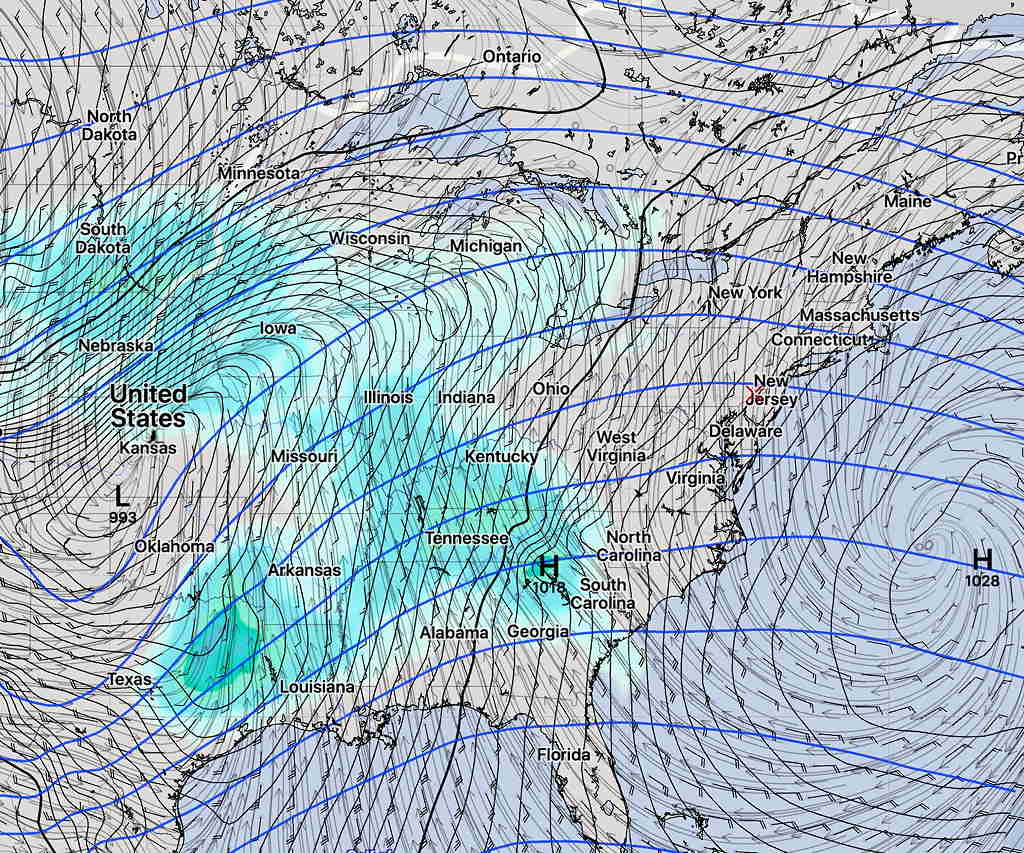
For Sunday— Some uncertainty has cropped into Sunday’s forecast. Originally, it was expected to be sunny and very mild.  However, deep low pressure is intensifying in the Midwest and a return flow of warm air ahead of it will create a warm frontal type passage to our area.

SREF Sunday

Most models have us dry with increasing clouds during the day Sunday,

However this afternoon’s high resolution NAM NEST has showers breaking out to our west and moving in during the day—

NAM NEST Sunday precip and cloud forecast 9 AM  (Click on image for larger view)

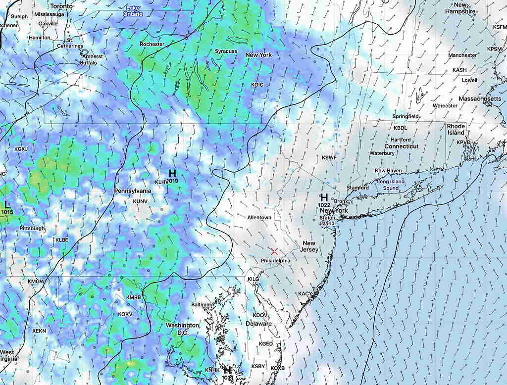
Most models (GFS, GEFS, SREF, ICON, CMC-GDPS) are not on-board with this, but the NAM NEST is the only high resolution model to extend 60 hours into Sunday right now.

The model consensus is forhigh temps on Sunday to be 67-71º    The more pessimistic NAM NEST has highs in the upper 50s.

So I’m thinking that the drier forecast is most likely for Sunday, but the NAM NEST shouldn’t be ignored.  I’ll update over the weekend.


A very intense storm will affect us on Monday—

GEFS Monday 11 AM forecast showing rain.  (click on image for larger view.

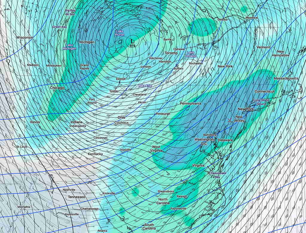
Monday will have heavy rain. Extremely high winds are possible on Monday (GFS has gusts of 60 + mph) along with rainfall of about 1.5 inches.

Yet another storm and colder weather for Wednesday (in early March this setup might be a snow storm.)

So an active period setting up.


FRIDAY FORECAST

The cold front moved through pretty much on schedule today. Tomorrow, our weather will be influenced by the deep low pressure system over eastern Canada and its associated cyclonic flow.

Friday will be unseasonably cool. It will continue to be windy with occasional gusts.  While there will be considerable sun, the cold air aloft will result in considerable instability cloudiness in the afternoon with some upper vorticities moving through.  (Areas south of Philadelphia will have more sun.) High 49-50º.

The weekend will feature gradual moderation of temperatures and the models are showing temperatures approaching  69º by Sunday.

Another system moves through on Monday.

THURSDAY FORECAST

Low pressure in the Great Lakes will spawn a very intense coastal low near Maine.  The associated warm front moves through early morning and then a sharp cold front moves through about noontime Thursday.  The models agree with the cold frontal timing, but disagree with the precipitation regarding the warm front.

The NAM and associated models have showers and perhaps some thunderstorms breaking out with the warm frontas early as 8AM in our area.  The GFS waits for the actual cold front passage timing for the showers, about noontime.

It will become windy at daybreak and increasingly windy with the frontal passage— gusts near 40-50 mph.  It will remain very windy in the afternoon.  The winds are due to an intense pressure gradient between the intensifying low and the large high pressure system moving in.


This front ushers in a short-term upper air pattern change with an upper air cold cyclonic flow.  Look for unseasonably cold weather, windy conditions and changeable skies, again with another frontal passage on Monday.