WEATHER OUTLOOK UPDATE

[su_note note_color=”#defcdc”]Update Tue 09:01 AM —Cancel that Friday storm!

Last night’s models totally moved away from predicting a highly phased storm along the coast for Friday.  Wow, what a change in forecast! Most of the rain will move much further south without jet stream phasing.

So I think that’s probably it with any snow this winter.  [/su_note]

Well, there hasn’t been much ‘weather action’ here this winter.  However, this coming Friday might be the last possibility for any winter weather this year.

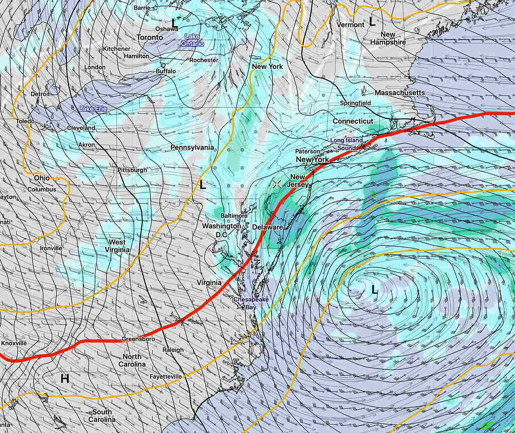
There’s much uncertainty about the nor’easter that’s expected to develop in the western Atlantic, but the trend has been for a deep and jet stream phased storm that comes closer to the coast. All models have some form of precipitation, mostly rain for our area.

However, thermal profiles suggest that while we might not get much, if any accumulation, the precipitation may fall as wet snow Friday afternoon.   Basically, the temperatures near the surface are expected to be above freezing, but this highly dynamic system with a closed upper low will have cold air at critical levels for snow to form.

Here is the current GFS forecast for Friday afternoon—

GFS Forecast Friday afternoon

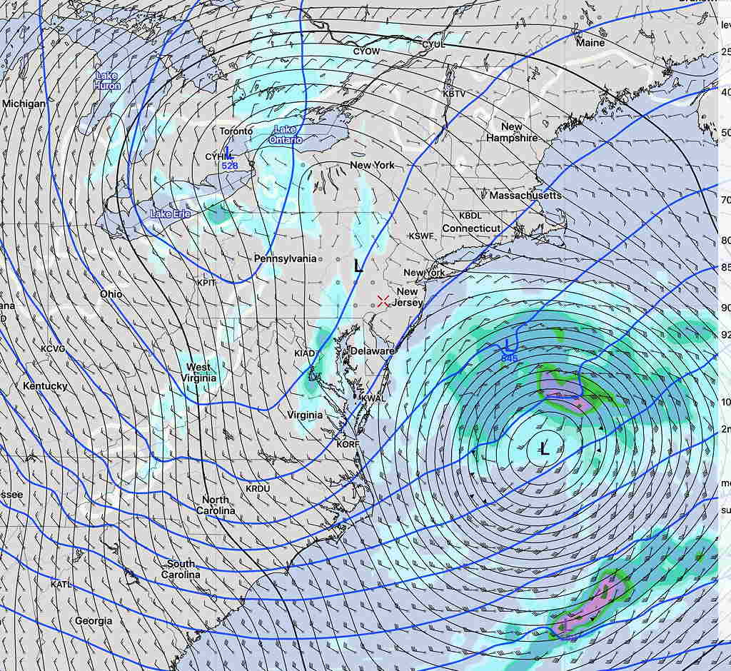
Here’s the current Canadian GDPS  forecast—

Canadian (CMC) Global Deterministic Prediction System Model (GDPS)

It just bears watching.  Sometimes these storms seem to come out of nowhere this time of year, when in fact, the models are suggesting something interesting in this time frame.  Stay tuned.


WEEK WEATHER OUTLOOK

We’ve gotten through February with virtually no snow.

As mentioned with my “Weather Outlooks” on February 12th and again on February 18th, the weather pattern of the past few months has been highly predictable and consistent, but changes are in the pattern are inevitable and usually come around just before the change in seasons.

“The current pattern has been with us for almost three months. Like bull stock markets, weather patterns don’t last indefinitely. Weather patterns tend to change as the seasons change.”

Back on February 18th, I saw large increases in the “spread” of the statistical members of the EKDMOS for the last week in February and the first week in March, suggesting a weather pattern change might be on tap.

Well, we’re here in March and indeed, a pattern change is being discussed by the NWS Extended Weather Forecasters Group.

Specifically there are now large spreads and differences in the extended statistical  models and there are hints of a deep storm  forming in the western Atlantic which may bring some interesting weather for us around this Friday’s time frame.  (Hey, it’s the Philadelphia Flower Show week and how many years has some portion of the show been plagued by bad weather forecasts!)

Here’s the current Canadian GEM (GDPS) forecast for Friday morning—

Canadian GDPS forecast for 10 AM Friday

A little far offshore, but this should watched.  I’ll keep an eye on this.