[su_note note_color=”#defcdc”]Sun AM Update: Rain and showers linger and end 1-2 PM. Clouds hang in until clearing about 3-4:30 PM Sunday, earlier south and west. [/su_note]
[su_note note_color=”#defcdc”]Sat AM Update: Rain starts Saturday evening about 7PM.
This morning’s models have the showers lasting until 12-1 PM Sunday. Some sun possible 2-4 PM Sunday. [/su_note]
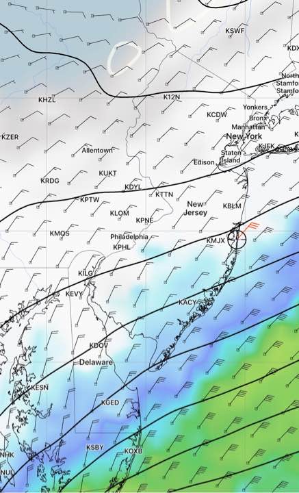
Fast moving systems will affect our weather over the coming weekend.
High pressure builds in for early Saturday, with mostly sunny skies in the morning that will be followed by increasing cloudiness late morning and early afternoon as low pressure approaches from the southwest. High 48. The daytime hours will be dry.
Tonight’s models are in reasonably good agreement that rain moves in between 5 and 7 PM Saturday evening.
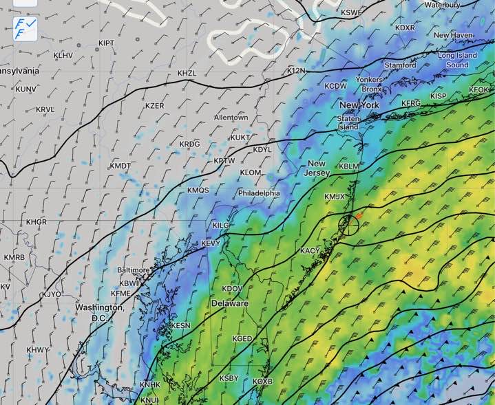
Moderate rain expected Saturday night into Sunday morning.
Light showers may linger through the morning hours Sunday as an upper air disturbance behind the main surface low passes through.
It’s expected that skies clear during Sunday afternoon, but there are differences in the models with the timing of the clearing. High 49. It will be windy.