Sunday Weather Update

[su_note note_color=”#d9f2da”]Some cloudiness did develop mid afternoon, especially north of the city. But, it really wasn’t worth focusing on…essentially, this was a beautiful, sunny day. [/su_note]

The most recent NAM and WRF models continue to show upper air disturbances rotating through our area early to mid afternoon from an upper cyclonic flow around a closed upper low off northern New England. (The GFS does not have it this far south.)

Areas of upward vertical motion (pink-blue-magenta) and vorticity (yellow lines) at 2:30 PM today

Some cloudiness is expected about 1-4 PM from this disturbance. Widely scattered sprinkles also possible, especially far north. Skies clear out later afternoon.   High today 85-87.

So without the GFS on-board with this forecast, we’ll see how the WRF does.

WEEKEND WEATHER UPDATE SATURDAY

[su_box title=”Quick Mobile Update” box_color=”#defcdc” title_color=”#000000″]Heavy shower/storms Sat evening.

May need to move that up an hour to 4 PM today.

Sunday- chance of clouds and showers early afternoon.

[/su_box]

The GFS joined last night’s mesoscale models with showers and thunderstorms between 5-8 PM tonight.  The GFS has the activity mostly in Bucks county, but that’s likely an outlier.

For Saturday, the mesoscale models (NAM, WRF, HIRES)  continue with a forecast of showers and thunderstorms, some very heavy, for all of the PHL area. While some activity may break out in the far northwest suburbs as early as 3 PM, the models show most of the activity will be between 5PM and 8 PM. The heaviest activity appears to be in Bucks county, but the models aren’t really capable of pinpointing this so accurately.   Clouds should increase by 4 PM.

For Sunday, the upper low over New England will cause a disturbance to rotate through our area to our north.  Some areas north of Allentown will have showers on Sunday.

The immediate Phladelphia area will have sun in the morning and some cloudiness in the early to mid afternoon.  Temps reduce to the mid 80s with lower humidity.

WEEKEND WEATHER FORECAST

[su_box title=”Weather Update Fri 11 PM” box_color=”#defcdc” title_color=”#000000″]Tonight’s NAM and WRF models have scattered thunderstorms as early as 3 pm Saturday. In the immediate Philadelphia area, it seems that the most activity and the strongest dynamics will be between 5-8 pm.

Sunday may have significant cloudiness, as mentioned below.[/su_box]

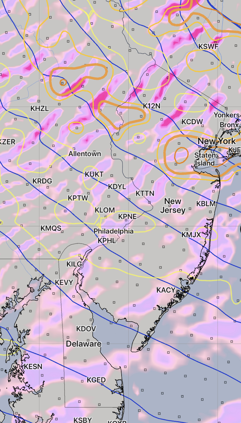
Today’s thunderstorms did materialize and dissipated as expected about 8 PM.

The heat will be with us through Saturday. A front will move through on Saturday, the result of an upper low pressure system dropping down over the New England coastline.

There are significant differences between the GFS global model and the mesoscale models regarding showers and thunderstorms Saturday afternoon. The GFS has the showers remaining in the  northwest suburbs and dissipating before reaching the immediate Philadelphia area.

The mesoscale models (NAM, WRF and the HIREF ensemble) have showers and thunderstorms moving through Philadelphia late Saturday afternoon and evening.

The mesoscale WRF and HIREF models did well today and I’m leaning towards their forecast, but the discrepancy between the GFS and these models can’t be overlooked.  So confidence in the chance of showers in Philadelphia Saturday is below average.

Most models are forecasting high temperatures Saturday 92-94 with high clouds and increasing lower level cloudiness during the afternoon. It will be humid. If the WRF and HIREF are correct, showers are likely far northwest suburbs mid afternoon and they move through Philadelphia between 4-8 PM.

Sunday will have a mix of sun and some clouds. The upper low cyclonic flow may result in more clouds than currently forecast. It will be breezy. High temps 86.

I’ll update later this evening after 11pm when the new model runs come in.