Just a quick update that last night’s models showed a much higher chance of thundershowers this afternoon and Saturday afternoon. Today’s showers and thunderstorms will be the ‘pop-up’ variety; they will dynamically form in position and fall apart without moving much. Some areas won’t see any; other’s might have a significant quick downpour. The showers may pop up anywhere and anytime after 1 PM Friday and persist popping up until about 8 PM.
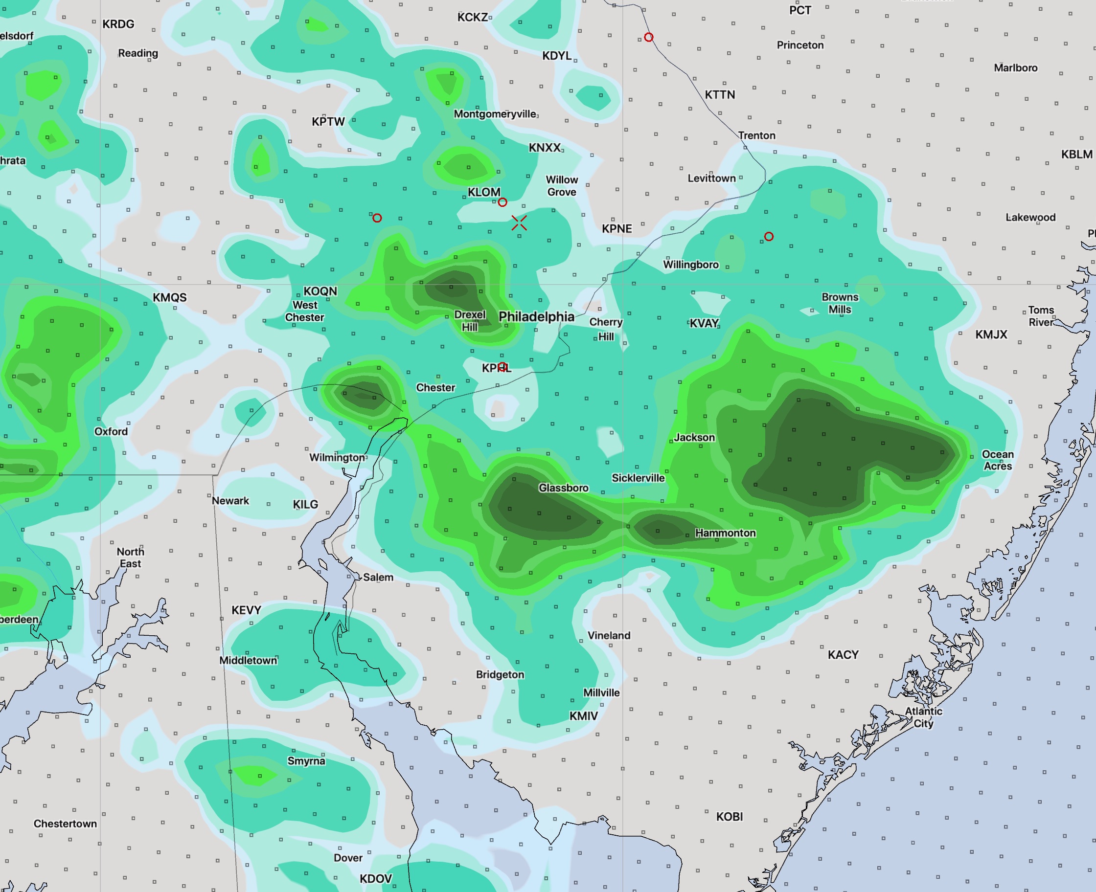
Here’s the High Resolution Ensemble Forecast (HIREF) for 5:30 PM today showing accumulated precipitation:
HIREF 5:30 PM Fri Accumulated Precip
(These accumulated Precip maps as well as the TV “future tracker” stuff can’t be taken literally in terms of exact timing, position and intensity. They just give a general idea about timing and the mostly likely areal coverage. That said, the HIREF model depiction isn’t bad for these things.)
Saturday’s showers and thunderstorms will be associated with a weak front moving through. Some of the models keep these mostly to our west and barely make it into Philadelphia. Will have to see. I’ll update tonight.
The typical summer weather that has finally come to town will be with us through the end of the week and most of the weekend. High temperatures in the low 90s and dew points moving into the increasingly uncomfortable mid to upper 60s will be the trend through Saturday.
Despite thermodynamic instability from the heat and humidity, the high pressure system aloft and at the surface will prevent much vertical motion, greatly reducing the possibility of thundershowers through Friday.
A weak front will move through on Saturday afternoon. Mostly sunny skies still expected with some clouds in the afternoon. Some widely scattered showers and thunderstorms are possible, but many areas will stay dry, according to the NAM and GFS.
Sunday will be partly to mostly sunny and a bit less humid. The forecast for Sunday is a bit lower confidence. There’s a question about how far south the front will drop.
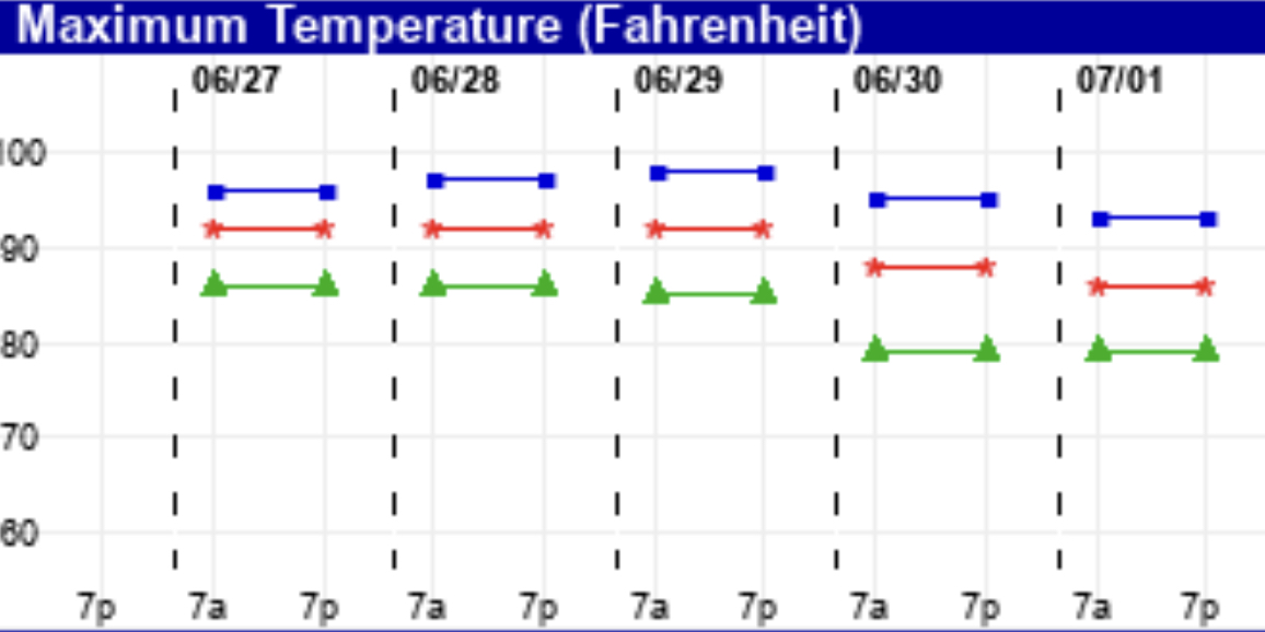
Here are the EKDMOS temperatures for the next few days. There’s a bit more spread in the temps on Sunday, suggesting a lower confidence forecast .
The incredibly wet weather that has been with us for the past week has finally come to an end. A cold front moved through Friday morning and the winds have changed to a northwesterly direction.
This weekend’s weather will be influenced by high pressure building in behind the departing low pressure system. The weather should be great and compared to this past week, spectacular.
Both Saturday and Sunday will be sunny and near average temperature-wise (average high 83). It will be breezy on Saturday with some fair weather cumulus in the afternoon, and less so on Sunday. High Saturday 81-83 and 82-85 on Sunday, based on the EKDMOS. (Ensemble Kernal Density Model Output Statistics)
Temperatures turn much warmer on Monday.
[su_note note_color=”#d9f2da”]In sync with the arrival of summer, the coming week looks to have typical summer weather with high temperatures approaching 90 with increasing humidity. A Bermuda high pressure system will control our weather. Very little in the way of organized low pressure systems or jet stream dips in the medium or extended range GFS model forecasts.[/su_note]