STORM UPDATE 5:30 PM

Well, I said if it were January, I’d be predicting 8-10 inches. The March sun angle did little to reduce accumulations at this high precipitation rate.

So I may have underestimated totals.

In the far northwest suburbs, considerable snow accumulation has occurred. Nearer Philadelphia and adjacent NJ, there’s been quite a range, significantly lower in some cases.

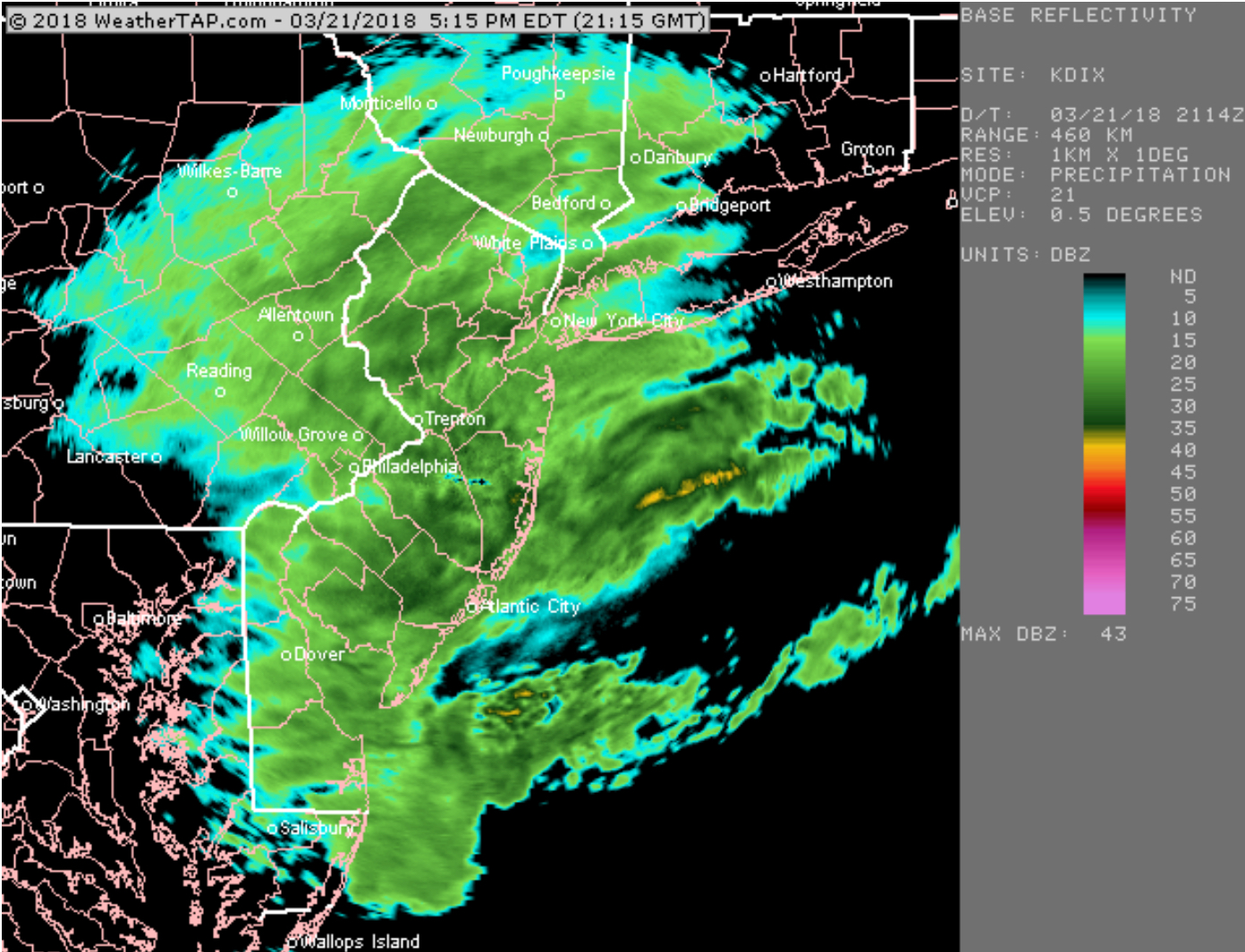
Current radar is impressive, but upper air analysis shows dryer air moving in above 22,000 feet (in brown)

Courtesy of weathertap.com
Drying in upper atmosphere moving in (brown shade)

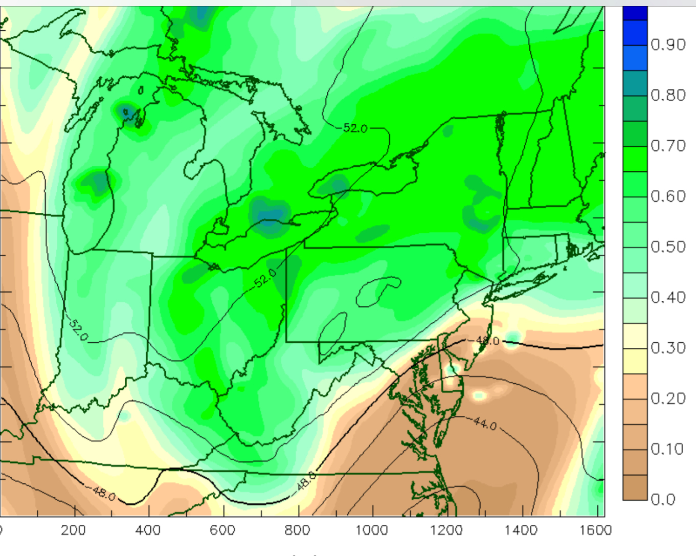
A few more inches of snow possible north and west, but the high precipitation rates should start diminishing around Philadelphia soon, as the dry air rotates in.  Some snow still likely until after midnight.

Official snow reports can be found here.

STORM UPDATE -WEDNESDAY 12 noon

The latest GFS has become available and QPF values are now similar to the NAM – about 0.85 inches water.

I’m inclined to stay with my earlier forecast—

[su_note note_color=”#ebf2d9″]With March sun angle, I’m still going with 4-7 inches of snow, measured on grassy surfaces, with higher part of that range more likely. (This means 7 inches.) This is for Philadelphia and immediate suburbs.  [/su_note]

An additional 2 inches could be added to that range (meaning 6-9 in ) for far northwest suburbs.


STORM UPDATE 10:15 AM

This morning’s NAM data just coming in. QPF still high at 0.85 in water.  If this were January, I’d be forecasting 8-10 inches with this thermal profile.

[su_note note_color=”#ebf2d9″]BUT With March sun angle, I’m still going with 4-7 inches of snow, measured on grassy surfaces, with higher part of that range more likely. This is for Philadelphia and immediate suburbs.  I’m also assuming that the GFS (not available yet) will have a lower QPF as it almost always has.[/su_note]

Snow continues into the evening.  Highest accumulation rate during the afternoon, according to the NAM

10:40 am update-  NAM FOUS data available. The winds will not be as high as originally thought.  18mph plus higher gusts. A good thing.  Areas far northwest may have snowfall 2 inches higher than the above range.