
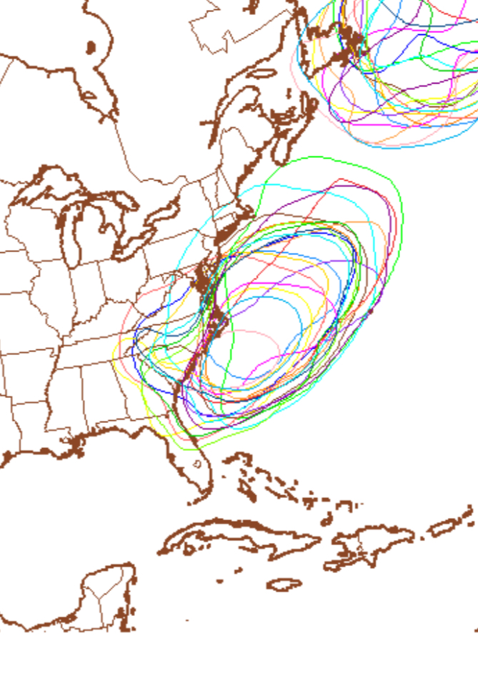
Here’s an update on the storm potential for Monday. Latest trend continues to keep the storm to our south, missing Philadelphia. Even the GFS has joined in the other models with this trend. That said, the NAM moves the storm closer to us then last night’s run, still missing us.
There’s still a possibility that things may still change, The statistical version captures the uncertainty of this forecast —
What is becoming apparent that for next week, we’re entering a hopefully short period of below average temperatures.
I’ll post my regular Philly weekend weather forecast later this evening.