Updated Tue @ 7:50 AM— The model blend (NBM) has the median snow accumulation of 0.00”. Just some snow flurries. High pressure will block moisture to our south and east and a flat jet flow is not optimum for storm development. The ICON model was one of the first to move in this forecast direction while the NAM group of models were stuck in the higher accumulation mode through yesterday afternoon’s model run. I’d be surprised if there were any other changes in this forecast.
Updated Mon @ 9:55 PM— Tonight’s NAM, NAM-NEST and HRRR models are now forecasting NO snow accumulation on Wednesday for most of the area.
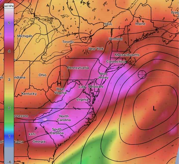
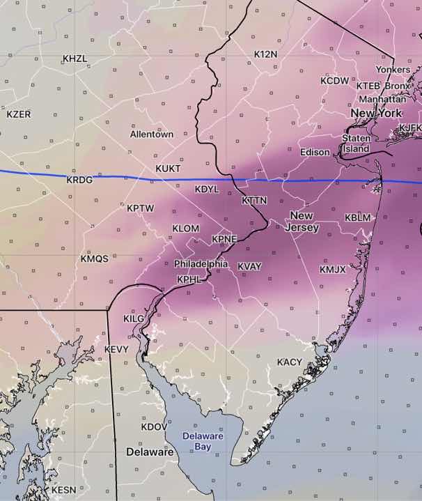
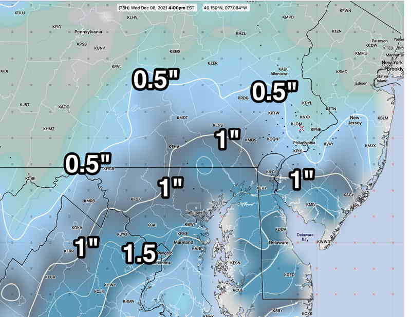
Updated Mon @ 7:46 PM— Today’s models continued with a snow forecast of anywhere from 0.25” to as much 1.5” for Wednesday morning (Blue Bell PA) . The NBM (model blend) snow accumulation percentiles for Blue Bell were 0.53” (median) to 1.4” for the 75 percentile which means that half the models forecast not more than 0.53” and 75% of the models comprising the NBM forecast 1.4” or less. Of interest is that 25% of the models forecast 0.00”!
Specifically, the NAM and HRRR are currently in that higher camp while the GFS and Canadian GEM and German ICON were towards the lower accumulations.
Tonight’s model runs will include the HIRESW models (there are 3 of them) which forecast out 48 hours and are now in range for the Wednesday forecast.
I’ll update later tonight if there’s more consensus.
Updated Mon @ 7:38 AM— Last night’s model runs (06z runs) continue with the trend towards even lower snow totals (median snow ~ 0.20”) With predicted snow totals already less than 1/3 inch and surface temperatures predicted to be just above freezing, this is looking to be much ado about nothing. But I’ll keep an eye on it.
Updated Sun @ 8:45 PM— Tonight’s NBM and this afternoon’s ICON have trended towards even less snow and it’s beginning to look like this “light snow” event may be a non-event.
I’ll update tomorrow morning.
Initial Post Discussion—[post_published]
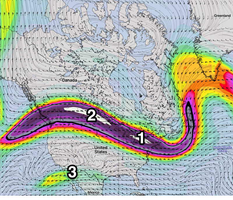
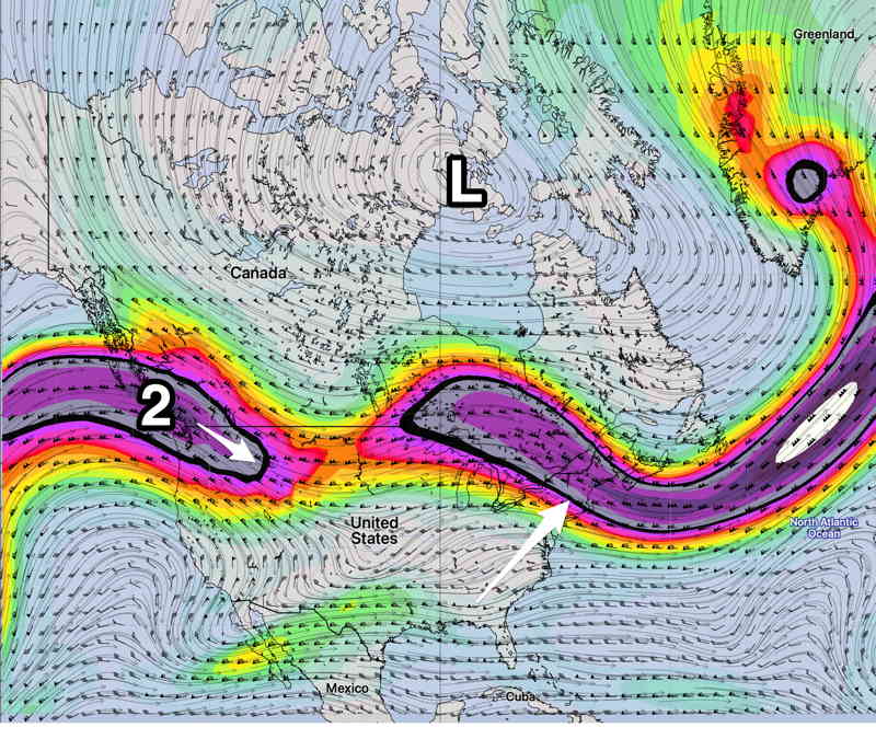
While temperatures are expected to get fairly mild on Monday, a strong cold front Monday night will set the stage for the possibility of some wintry weather on Wednesday as a shallow upper air trough develops and low pressure develops and moves off to our east in the Atlantic.
The snow setup is less than ideal for our area — the upper air configuration is not highly amplified and the limited cold air will reduce the already low availability of moisture for snow from a system expected to move well to our east.
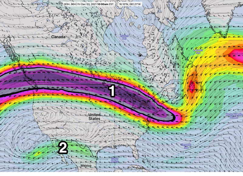
The forecast period, until late last night, had only been in the range of the extended range models. (GFS CMG-Global, ICON, ECMWF and their respective statistical “ensemble” models.
The forecast period of interest is now within 84 hours and just enters within the range of a few more models (NAM, CMC-GEM, SREF).
The current trend is for it to be colder with snow more likely as the form of precipitation, but the amount of moisture available will be less.
The overall impression is that this will be a light coating, on the order of 0.25″ -1.25 ” of snow, where it is able to accumulate. Temperatures near the surface will be close to or above 32º, limiting accumulation.
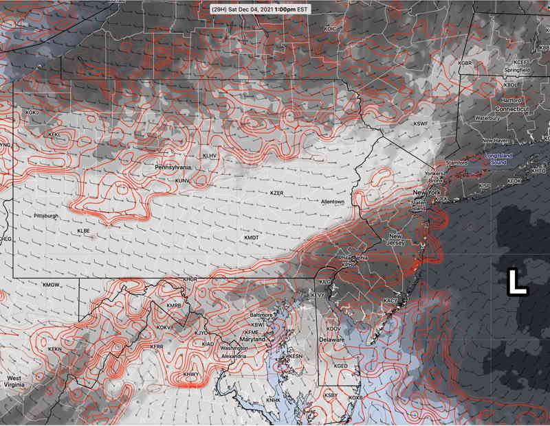
For this storm, we’ll need to wait for the 48-60 hour high resolution models to do their thing. There’s plenty of uncertainty with this forecast, as shown by the high spread (uncertainty) with the SREF model pressure. This forecast is likely to change.