Update Sun 3/12 7:39 PM — Several of this afternoon’s higher resolution models show enough cold air being brought in to this system by early Tuesday morning that the precipitation will be falling here as snow. Surface temperatures above freezing will limit or prevent accumulation. Solar effects (insolation) through clouds and high March sun angle will further prevent accumulation on dark roadways.
Still a very dynamic system that needs to be watched.
Previously Posted Sun 4:38 PM —
This week’s weather will start out with a coastal storm that is expected to first give us rain Monday through at least early Tuesday as it moves northward. This storm is then expected to retrograde toward Cape Cod and undergo “explosive cyclogenesis“. (yes, the “bombogenesis” as they like to call in on TV.)
Extremely low central surface pressure with blocking high pressure in the North Atlantic will result in very high winds and heavy rains and inland snow to New England. We will be indirectly affected by this storm in it’s advanced form.
It appears that the light rain tonight will move in later tonight (Sun), after midnight. Monday will be increasingly rainy and windy.
Here’s the NAEFS forecast for 11 PM Monday night —
By Tuesday evening, the low has retrograded close to the Massachusetts coastline and undergone the extreme cyclogenesis. Notice it’s still raining here!
By Wednesday, things dry out here and it will become milder towards the end of the week. Another rainstorm, faster moving, affects us next weekend.
Update Sat 3/11 8:54 PM — Sunday’s forecast below is unchanged. High temp 46.5° sd 1.4°
Update Sat 03/11 @ 10:08 AM — We had the wet snow here before 8AM. The balance of precip will be light rain. There’s a wide range of model opinion regarding clearing today.
After reviewing the models, it appears that a considerable amount of low cloudiness will remain, but there’s a chance of some short-lived breaks of sun in some areas this afternoon. Some additional showers possible.
The HRRR shows another band of light showers moving through about 3-5 PM or so—
That area is visible on this morning’s hybrid radar—
Update Fri 3/10 11:02 PM — Tonight’s models continue to show non-accumulating wet snow showers, from the just outside of the city and north and west, Saturday morning.
Previously Posted Fri 4:51 PM —
This weekend will mark the transition into a different weather pattern than we’ve seen in awhile. Two low pressure systems will move in and develop – one Friday into Saturday and another late Sunday into Monday. These systems will pull cold air down from Canada and the jet stream pattern will become cyclonic and somewhat amplified along the Eastern US.
This translates into below average temperatures, windy and quite unsettled conditions, starting today (Friday) and into much of next week.
Saturday
Low pressure that brought rain Friday night will blossom in the western Atlantic. Upper level low pressure will merge with this storm. Wrap around moisture from this surface low will bring continued cloudy conditions and showers/snow showers on Saturday morning. It will be windy and cold. Some widely scattered showers may linger into the afternoon.
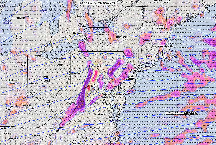
Despite temperatures well above freezing, snow showers are expected to develop in some areas. It would not surprise me if the snow shower coverage is greater than predicted below—
High temperature 45.7º sd 1.5º ( NBM model location Blue Bell, PA)
Sunday
Another low pressure system approaches during the day. Sunday starts sunny through increasing high cloudiness.
Thickening and lowering cloudiness in the afternoon.
Some precip moves in during Sunday evening, which most likely will be rain in most areas.
High temperature 46.9º sd 1.5º ( NBM model location Blue Bell, PA)
Winds
For next week, very deep low pressure develops near Cape Cod. We’ll be affected by windy conditions and cold temperatures.
GFS for Tuesday shows deep upper and surface low pressure systems—
Daylight Saving Time and Weather Forecasts
Sunday morning is the beginning of Daylight Saving Time. I love the extra daylight at the end of the day, but for “weather nerds”, Daylight Saving Time means the models come out an hour later. For those of us on EasternTime, the evening models become available inconveniently late for the next day’s forecasts!
I’ve written extensively about this in past years—