#weather #paweather #wx #pawx #philadelphia
Forecast Update
Update Sat 03/25 @ 4:38 PM — The models have backed away from thunderstorms developing in the immediate PHL area. The area of development may be South Jersey, about 10 PM
Sunday looks suuny. A bit windy. Temps upper 50s to near 60.
Update Sat 03/25 @ 10:33 AM — There have been some changes in the forecast.
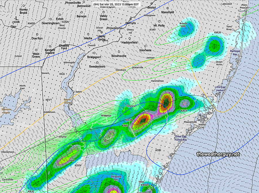
The rain will be moving in over the next hour or so. Rain ends about 5-6 PM. Total rainfall about 0.2-0.5 inches. A second batch of rain and thunderstorms about 9-11:30 PM
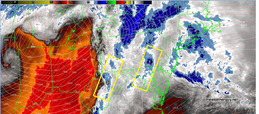
Here’s the current water vapor image. The first boxed area (1) is the area of upward motion bringing the rain in the next few hours. The second boxed area (2) may bring some thunderstorms between 9-11:30 PM, (maybe missing the immediate PHL area, maybe not.) Some model uncertainty in the placement of the second batch of rain/thunderstorms.
Update Fri 3/24 11:20 PM — Tonight’s models show breaks in the rain Saturday with total rainfall on the light side. The warm front gets further north and temperatures rise to upper 50s late afternoon.
Update Fri 03/24 @ 7:59 PM — Minor update to include the mention of thunderstorms mid-day with the rain. The latest models have very high levels of helicity and vertical shear, greater than that which spawned Thursday evening’s surprise thunderstorms . Nothing severe expected because CAPE values are expected to be low.
The cold front that moved through Friday night has stalled to our south and will try to return as a warm front later Friday night as a cold front moves in from the northwest later on Saturday.
It appears that the warm front won’t make it north of our area, as low pressure is expected to form near the Delmarva coast.
The warm front, the low pressure system and the cold front will result in periods of rain for much of Saturday. Thunderstorms appear possible Saturday evening, especially north and west of the city.
Saturday
Cloudy with rain becoming heavier late morning and continuing on and off during the day. Some thunderstorms mixed in with the rain possible mid day. Becoming very WINDY and gusty. Scattered thunderstorms again possible between 6 and 10 PM, mostly northwest of the city. Clearing after midnight.
High temperature 53.5º sd 2.4º ( NBM model location – Blue Bell, PA)
Sunday
Sunny and mild. Still quite windy.
High temperature 60.3º sd 1.7º ( NBM model location Blue Bell, PA)
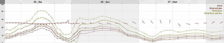
Winds