Bow-Echo line of storms possible Friday
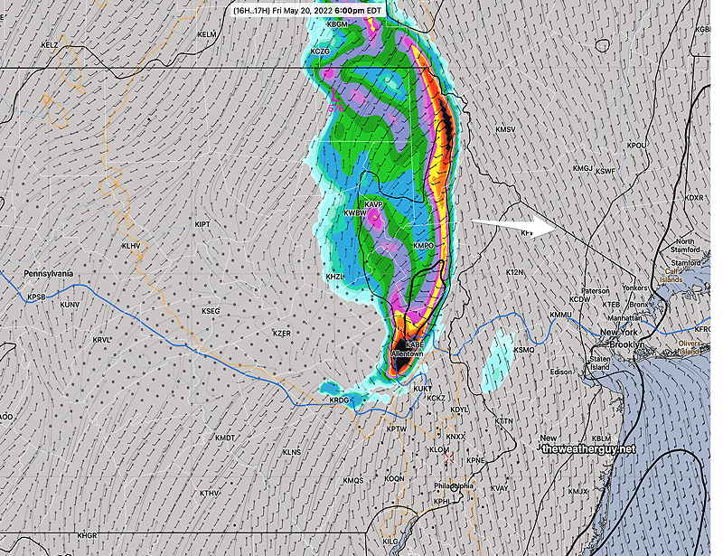
Update Fri @ 3:31 PM — Latest radar shows storms have broken out ahead of the main line (not forecast by the models) and the main line of storms will move in about 4 PM
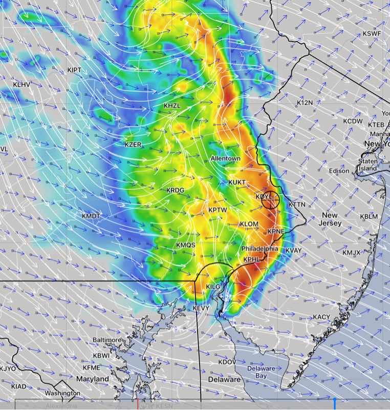
Updated Fri 11:20 AM — Mobile update: Latest HRRR 13z has the storms closer to 6-7 PM and has reduced shear and helicity values, but still high. Still affecting PHL area.
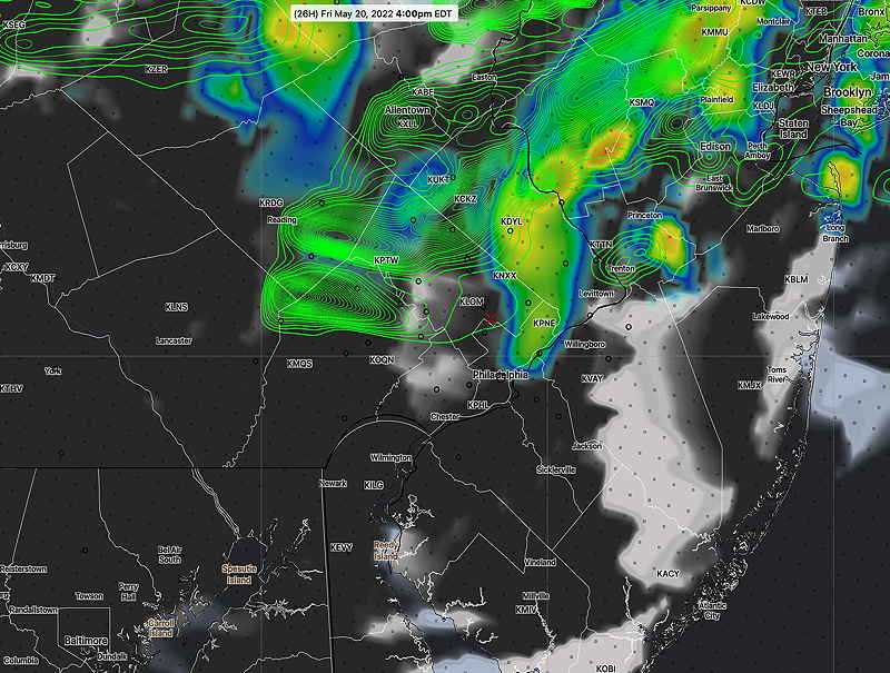
Update Fri @ 10:12 AM — One more thing…the latest NAM just available keeps the severe weather near Allentown. So quite a bit of uncertainty here with the exact placement of the storms.
Update Fri @ 9:41 AM — Latest HRRR just available—

These storms DO have the potential to be fast moving and SEVERE.
| Last September‘s Tornadoes | Monday’s Storms RAP 17z | Today’s Forecast HRRR 12z |
| CAPE 3500-4200 Joules/kg | 2200 | 2500-2700 |
| Helicity 800-1100 m^2/s^2 | 130 | 900-1100 |
| Vertical Shear 35-45 | 15-20 | 22-24 |
| Precipitable Water 2.0″ | 1.6″ | 1.6-1.8” |
| Lifted Index (minus) 7-9 | minus 6-7 | minus 6 |
| Peak Wind Gusts 40-50 | 25-30 | 45-50 mph |
| Aligned Storm Motion and Shear Vectors- YES | NO | YES |
| Jet stream- Highly Cyclonic | Cyclonic | Locally Cyclonic |
| 500mb – Highly Cyclonic | Cyclonic | Cyclonic |
I’ll be out the rest of the day. I’ll try to update via mobile.
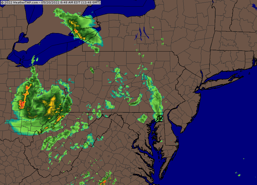
Update Fri @ 9:20 AM — Some additional showers have developed in western suburbs this morning, showing the answer to the ? in the graphic below. The NAM-NEST shows these as weakening as they approach the city.
Update Fri @ 9:12 AM — The current water vapor imagery shows a lack of agreement between the real world (water vapor) and last night’s GFS NAM (contours) superimposed.

This suggests the models may not be accurately capturing the storm. The water vapor image suggests that the storm is moving faster than forecast.
Update Fri @ 9:01 AM — For this storm, I decided to dust off the recently updated Canadian high resolution model (HRDPS), a model I don’t routinely download because it takes a lot of post-processing time. Anyhow, it continues with several other model’s northern track of this storm line. So the northern track, missing Philadelphia, appears to be the model-preferred track except for the HRRR.
I’m waiting for the latest 12z HRRR and RAP models to get a better handle on the likely track of this mesoscale complex.
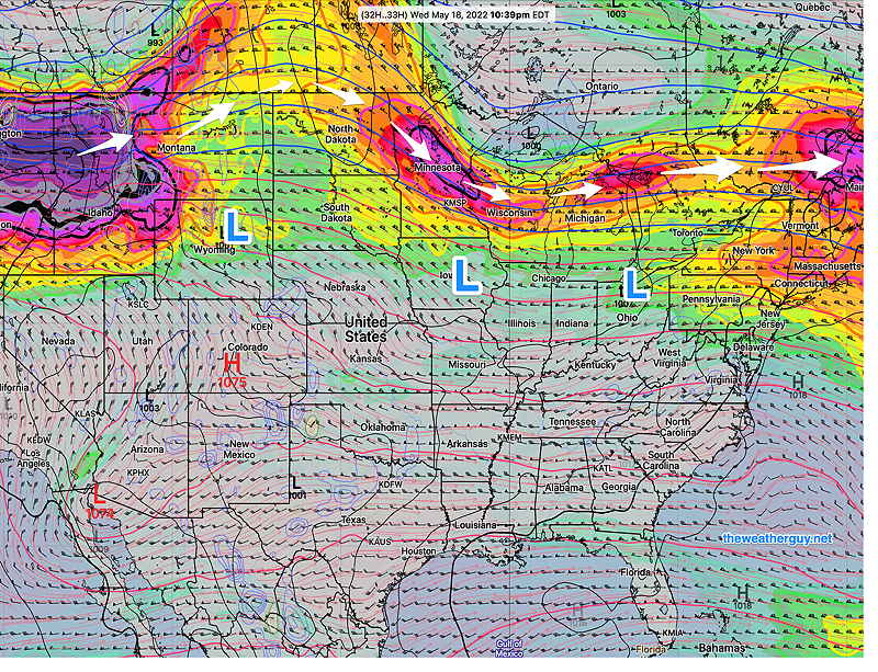
Updated Fri 7:34 AM — A quick update. Last night’s models are suggesting the possibility of a fast moving line of strong to severe thunderstorms between 3:30 PM and 6 PM tonight. The latest HRRR and RAP forecast a ”Bow Echo” mesoscale complex associated with a derecho type clusters, a long-lived line of severe storms in bow formation.
I’ll update later with the 12z HRRR that becomes available about 9:35 AM.
Updated Thu 9:53 PM — The term ‘severe’ may actually become appropriate to describe the thunderstorms now forecast to move through late Friday afternoon 4 PM -6 PM. (The timing may change with this sort of system.)
The HRRR model graphic below still captures the current forecast track, with the most intense weather north of the immediate PHL area.
Tonight’s early models, along with the ECMWF, take a disturbance, currently in Illinois, through northern Montgomery, Lehigh and northern Bucks counties.
Thu 10:59 PM — Tonight’s HIRESW has the line closer to Philadelphia
I’ll update tomorrow morning.
Updated Thu 3:11 PM — What had been expected to be an uneventful warm front passage on Friday afternoon now appears to possibly be a little more noticeable: the latest models show clouds and even some showers/thunderstorms late afternoon Friday with the warm front. The heaviest activity (if any) will be far northern suburbs.
Continuing with my earlier theme of the week regarding thunderstorm severity, it will be interesting to see if ‘severe’ thunderstorm watches will be issued. (I expect it won’t be issued or needed.)
Here’s representative severe weather parameters from today’s 15z RAP model for Friday late afternoon compared to Monday and the superstorms of 9/1/21—
| Last September‘s Tornadoes | Wednesday’s NAM-NEST | Friday’s Forecast RAP 15z |
| CAPE 3500-4200 Joules/kg | 2000-4000 | 1900 |
| Helicity 800-1100 m^2/s^2 | 130 | 460 |
| Vertical Shear 35-45 | 15-20 | 24 |
| Precipitable Water 2.0″ | 1.6″ | 1.6” |
| Lifted Index (minus) 7-9 | minus 6-7 | minus 5-6 |
| Peak Wind Gusts 40-50 | 25-30 | 25-28 mph |
| Aligned Storm Motion and Shear Vectors- YES | NO | YES |
| Jet stream- Highly Cyclonic | Cyclonic | Anticyclonic** |
| Jet Stream Speed – High | High | Low ** |
| 500mb – Highly Cyclonic | Cyclonic | Cyclonic |
The ** asterisked parameters may be critical here for not supporting severe weather.
Update Thu @ 9:54 AM — Latest NBM high temperatures Saturday—
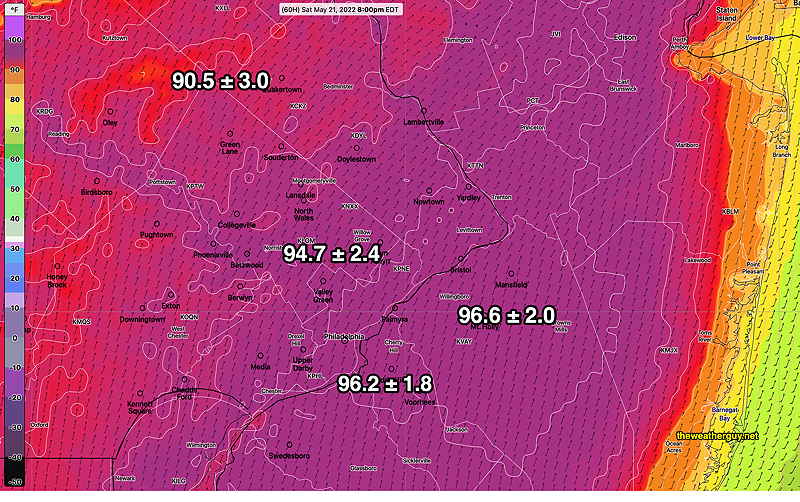
The ICON model was the first to show these temperatures. It has highs in the 97º range.
Updated Wed 8:09 PM — Some rain expected tonight which should end by mid morning Thursday.
An uneventful warm front moves through mid day Friday, possibly causing a short period of cloudiness. An increase in humidity will be noticeable Friday afternoon.
The big story will be the very hot temperatures for the weekend, especially Saturday. Highs look to be 93-96° with dew points approaching an uncomfortable 68-70°. Hot, even if this were July!
Thunderstorms are forecast to stay to our west on Saturday, but clouds and thunderstorms may move in late afternoon Sunday
Updated Tue 10:46 PM — The latest NBM model shows a high temperature of 93° on Saturday.