
Updated Thu 9:55 PM — Here are the forecast trends for Friday through Sunday—
Light scattered showers/sprinkles early Friday especially southeast of the city, low clouds. Much of the day cloudy but dry. There may be some breaks in the cloud cover especially west of the city. Updated Thu 10:43 PM —Tonight’s high resolution models have some sunny breaks in the afternoon along with some widely scattered showers.
For Saturday, the models (with the exception of the ECMWF) have further reduced the chance of showers except far western suburbs. Brightening skies and some sun expected. Increased chance of some showers late afternoon and evening. Possibly some thunder. Updated Thu 10:54 PM — Tonight’s. NAM-NEST shows a fairly nice day for Saturday
Sunday should be a lot like Saturday, but with more sunshine and warmer. Some showers possible late in the day or evening.
Update Thu @ 9:43 AM —The GFS and other models are in agreement with clouds and showers on Friday as a jet streak associated the closed upper level low affects us.
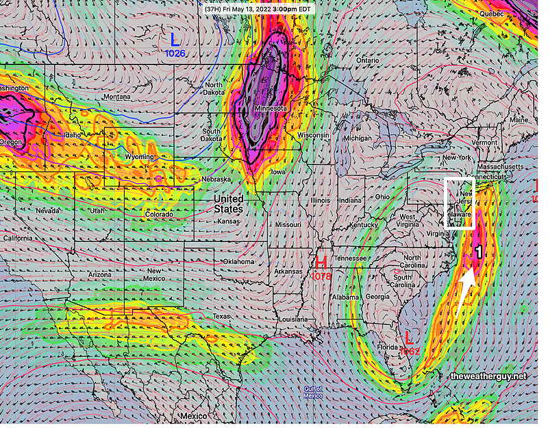
3 PM Friday—
3 PM Saturday—

The latest ECMWF model, just available, has a different jet flow and forecast than the GFS. The ECMWF continues with a wetter Friday and Saturday.
Updated Tue 11:15 PM — Tonight’s models are showing the chance of clouds and scattered showers as soon as Thursday, with moisture brought inland from the retrograding coastal low.
Updated Tue 7:15 PM — Looking towards the weekend, the same low that gave us the rain last weekend, threatens to rotate back into our area by Friday (see image below).
For Wednesday and Thursday, the same cloud deck that moved in late Tuesday may affect our area at times. Temps in the 70s
As for Friday, there are differences between the ECMWF and the GFS, with the ECMWF showing showers moving in during the day, while the GFS keeps us just with some clouds.
Saturday looks unsettled with clouds and occasional scattered showers but not looking like a rain-out. Again, the ECMWF shows more rain than the GFS. Highs mid to upper 70s.
Sunday may feature warm temperatures and breaks of sunshine ahead of an advancing cold front. Highs may reach near 80º.
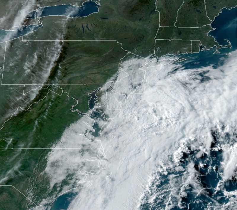
Updated Tue 6:53 PM — Well, the clouds from the retrograding coastal low moved in eventually, about 7 hours later than had been forecast last night.
Updated Tue 8:43 AM — The 06z models backed away from the clouds making it into Philadelphia today.
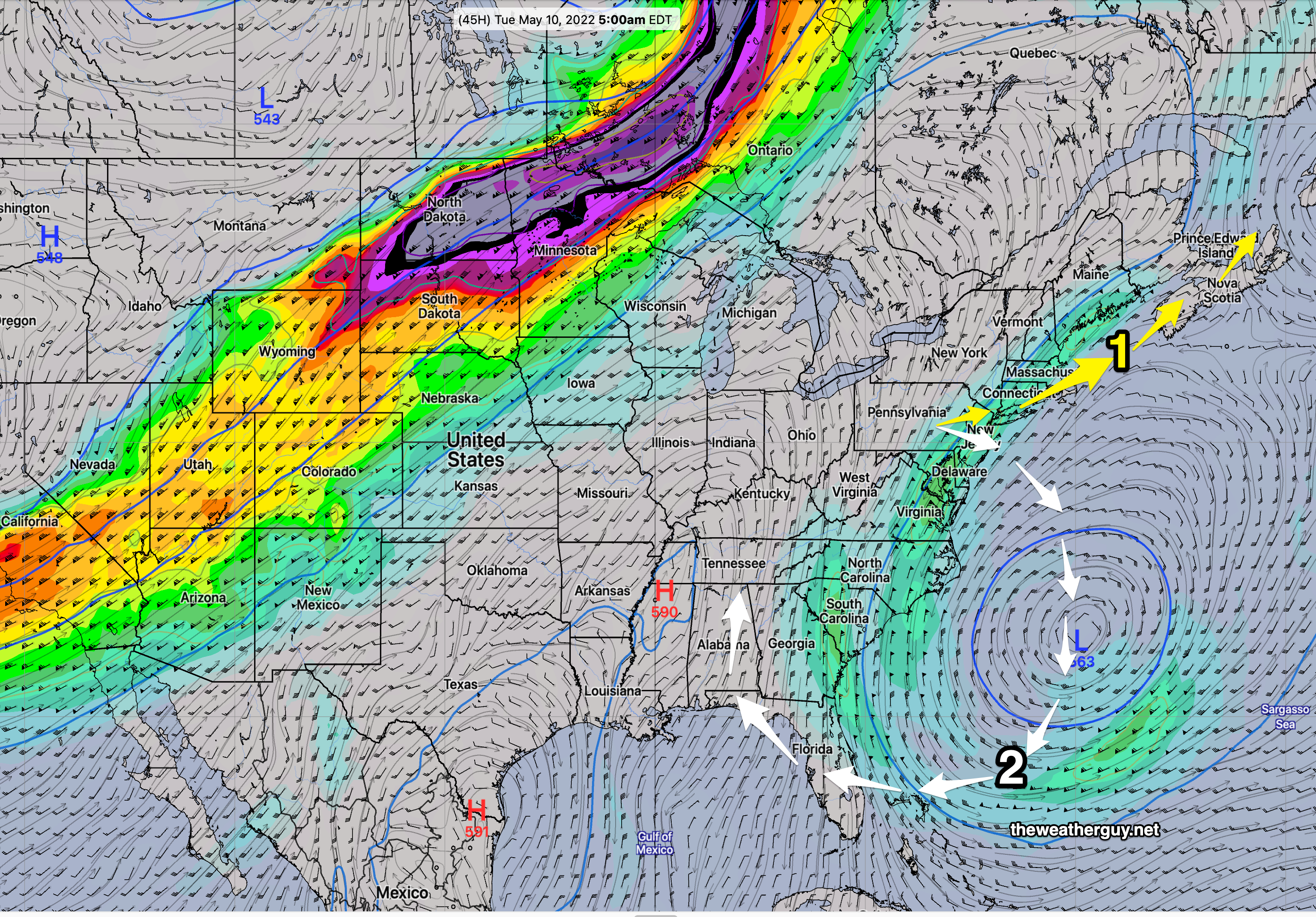
Updated Mon 10:47 PM — Tonight’s models are suggesting a slight forecast change for Tuesday. The retrograding low pressure system off the coast may throw back some low level cloudiness far west enough to make it into the immediate Philadelphia area.
Previously Posted Sun 7:33 PM —
This coming week’s weather will feature a blocked pattern, the other side of the coin of this past weekend’s cold, cloudy, rainy and slow moving upper air low pressure system.
Indeed, the same upper low that gave us the rain will retrograde to our southeast instead of the usual path moving off to the northeast.
This week, upper air winds will come from the north and northeast. We should have dry conditions through Friday.
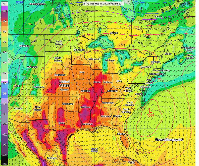
Meanwhile the same blocked pattern will allow temperatures to build to record levels in the mid section of the country.
Incredibly, the same low is forecast to retrograde westward over Florida and then move back over our area for next weekend with more rain.