Hurricane Delta is expected to move onto the Gulf Coastline and its remnants are expected to move over our area over the weekend. The current time line has shifted to a somewhat faster approach, with clouds and possibly some light rain moving in as early as Saturday.
(Previous model runs had it affecting us on Sunday.)
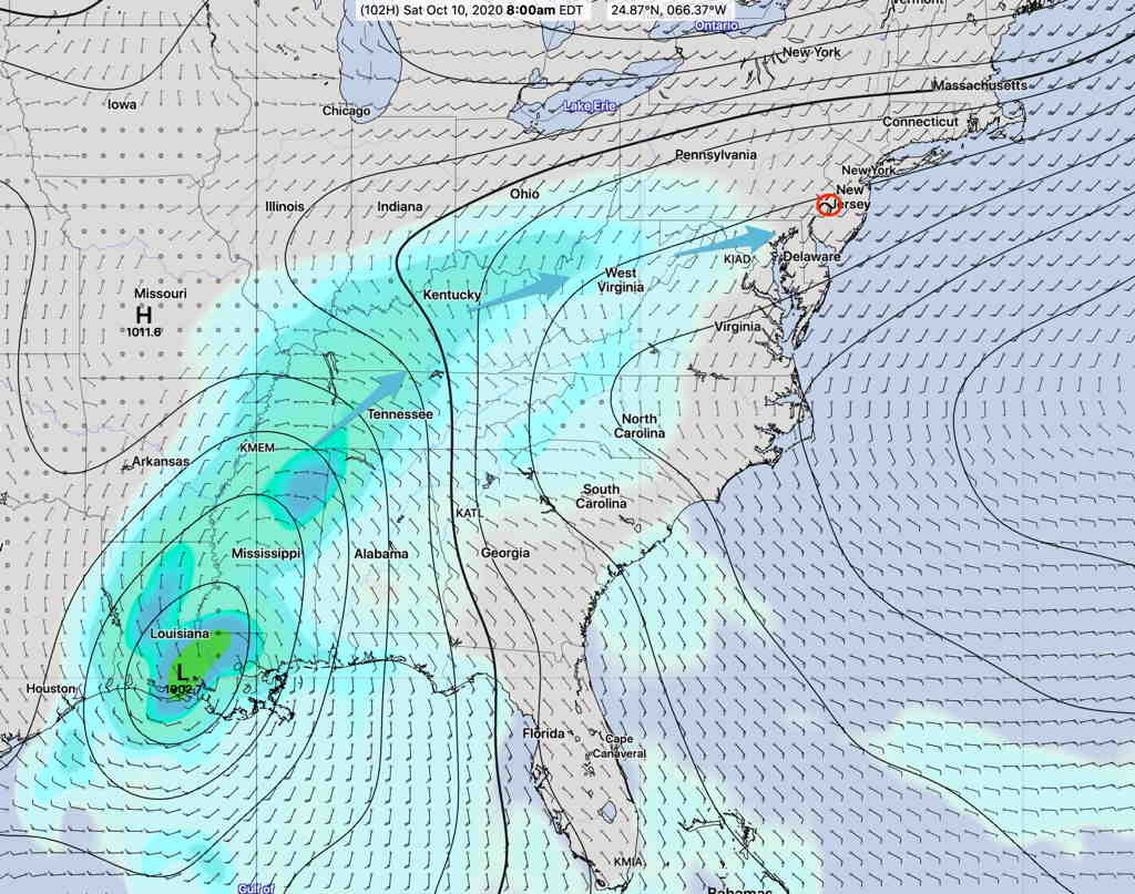
Here’s the latest GEFS forecast for Saturday morning—
GEFS Forecast for Saturday 8 AM (Click on image for a larger view.)
This storm has been difficult to forecast over recent days, since it appeared it might interact with tropical storm Gamma. It looks like will absorb the circulation of Gamma as it heads towards the Gulf coastline.
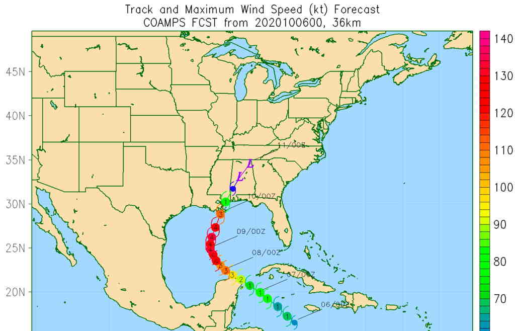
Navy COAMPS forecast. (Click on image for a larger view.)
Additional changes in timing and track are likely. Stay tuned.
Sun 09:10 AM Update — The optimistic sunshine forecast of the NBM looks to be correct for today.
Here’s the latest German Icosahedral “ICON” model which handles one of its cloud cover parameters a bit differently, shows the sunny area sandwiched in directly over us today—
From Saturday…
As mentioned in yesterday’s posted weekend forecast, the Philadelphia area will be sandwiched between two areas of clouds and low pressure. Clouds fill in by the end of the day.
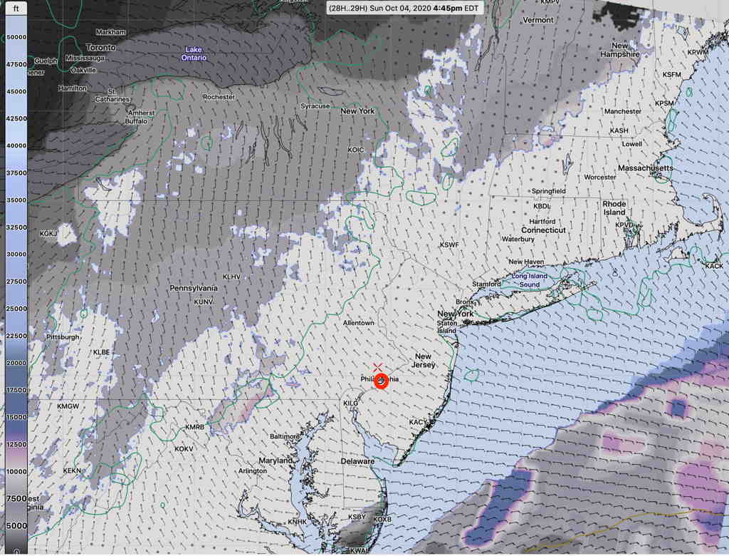
The NBM (National Blend of Models) has the most optimistic forecast, with significant sunshine and some high/mid level clouds for most of Sunday.
NBM Cloud Ceiling forecast 4:45 PM Sunday (Click on image for a larger view.)
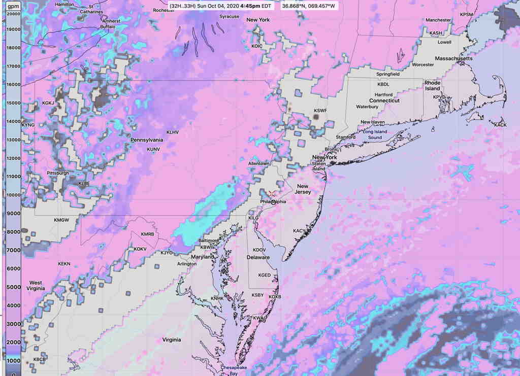
The GFS and HIRESW-FV3 (experimental) are somewhat more pessimistic with their cloudiness forecasts, significant high and mid level clouds. The models also predict a band of clear skies; the models are consistent about this band of clear skies, but differ regarding its exact location.
Here’s the HIRESW-FV3 cloud ceiling forecast, showing the clear sky band just west of Philadelphia—
HIRESW-FV3 (pre-release version) cloud ceiling 4:45 PM (Click on image for a larger view.)
So,there’s a range of possibilities around the cloud cover for Sunday. The GFS is often my preferred choice for cloud cover predictions, but but I can’t ignore the new NBM. I guess we’ll see.