
Wednesday 10PM Update— Tonight’s models just becoming available have delayed the heavy rain onset to just after daybreak and have shifted the heaviest rain southward. Reduce the rain totals posted below by about 1 inch less than the amounts, shown except for Delaware.
Based on the latest GFS model, here’s the current total rain forecast expected from our encounter with the remnants of Zeta on Thursday—
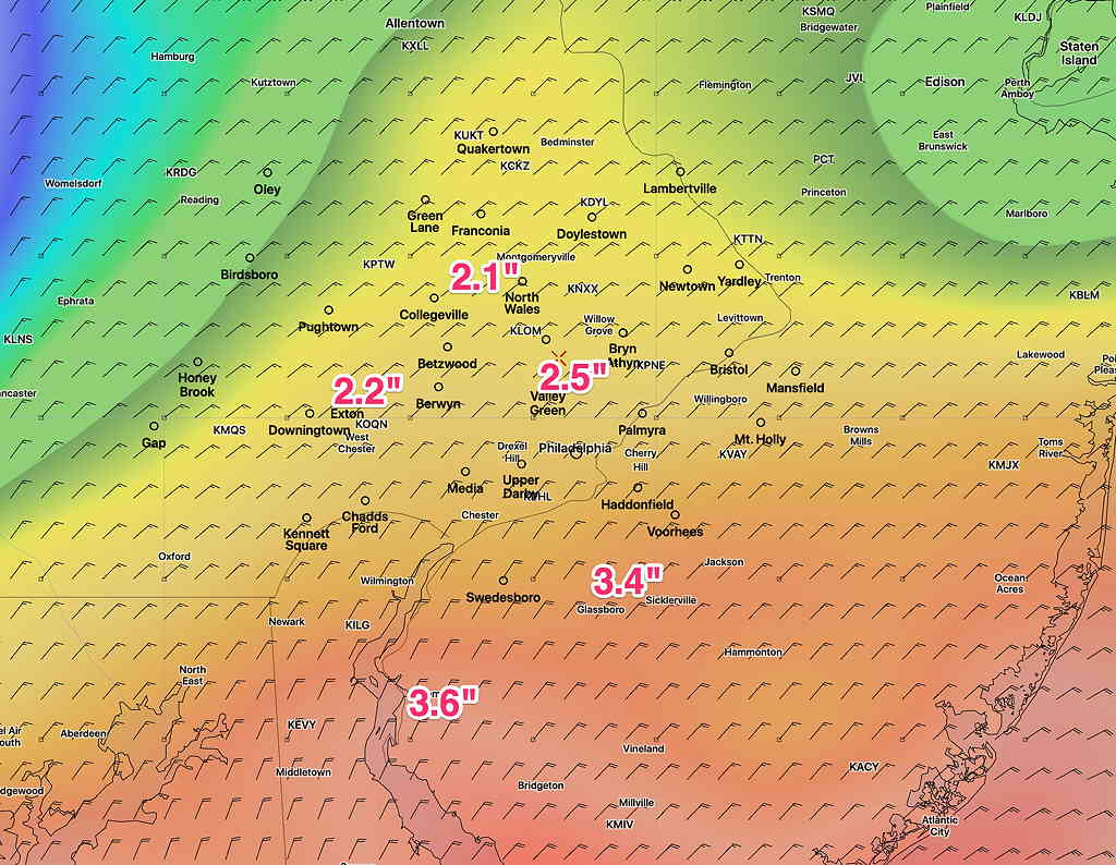
Rain will start between midnight and daybreak Thursday. The heaviest rain will occur in the afternoon, tapering after 8 PM. Highest wind gusts about 5 PM into early evening, about 30-35 mph.
Showers will continue into Friday morning or early afternoon as colder temperatures move in for Friday night, as discussed in yesterday’s post.