LABOR DAY WEEKEND FORECAST

It’s been a long time since we had an uneventful three day forecast, and it seems even longer that this occurred on a major holiday weekend.

The  general pattern is one of high pressure building in from Canada, bringing clear skies and comfortable temperatures with low humidity.

The model blend (NBM) should be more than adequate for this forecast —

Sunny skies Saturday, Sunday and Monday.  Highs 78°, 83° and 84°


THURSDAY THUNDERSTORM UPDATE

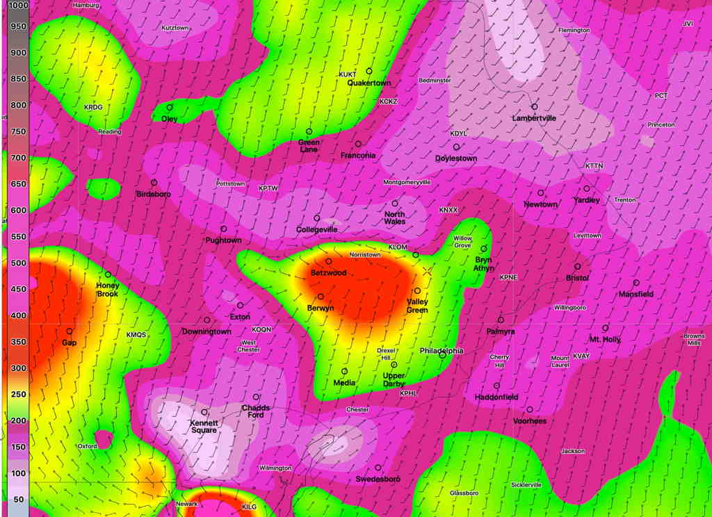
Forecast Review — Last night’s models, which had been more conservative with the forecast severe parameters, were more on target with their thunderstorm forecast than this morning’s models.  We had several hours of clouds this afternoon which reduced the available energy when the storms arrived. It’s not the first time I’ve seen the 24 hour forecast be more accurate than the “latest models”.  
With thunderstorms, sometimes you’ve got wait for the latest models.

This morning’s models just becoming available have a significant increase in the severity parameters- helicity, CAPE and vertical shear.  Precipitable water values (PWAT) are very high.

So my previous post is off the mark.

Expect thunderstorms, 5-8 PM in the immediate Philadelphia area.   Some could be severe.

HRRR Helicity forecast for 7 PM Thursday. Anything over 300 J/Kg is high. (Click on image for a larger view.)