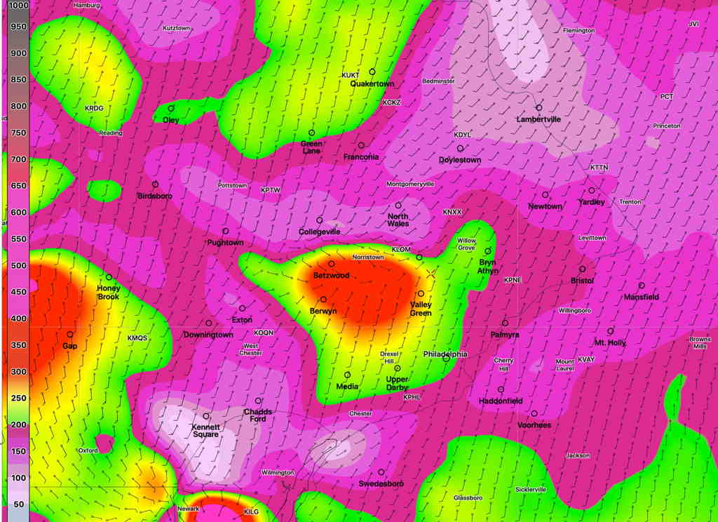
Forecast Review — Last night’s models, which had been more conservative with the forecast severe parameters, were more on target with their thunderstorm forecast than this morning’s models. We had several hours of clouds this afternoon which reduced the available energy when the storms arrived. It’s not the first time I’ve seen the 24 hour forecast be more accurate than the “latest models”.
This morning’s models just becoming available have a significant increase in the severity parameters- helicity, CAPE and vertical shear. Precipitable water values (PWAT) are very high.
So my previous post is off the mark.
Expect thunderstorms, 5-8 PM in the immediate Philadelphia area. Some could be severe.