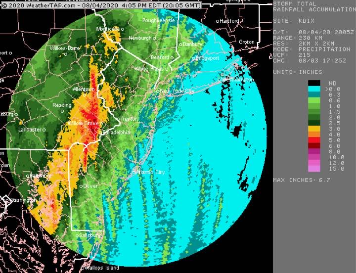
Tues 4:45 PM Update — A review of the day’s weather shows that the heaviest (5-6 inches) rain fell in the immediate western suburbs as shown below—
Cumulative rain totals (radar estimated)
The NBM did the best with max rain placement and amounts. The GFS and NAM NEST were too far west with the max precipitation.
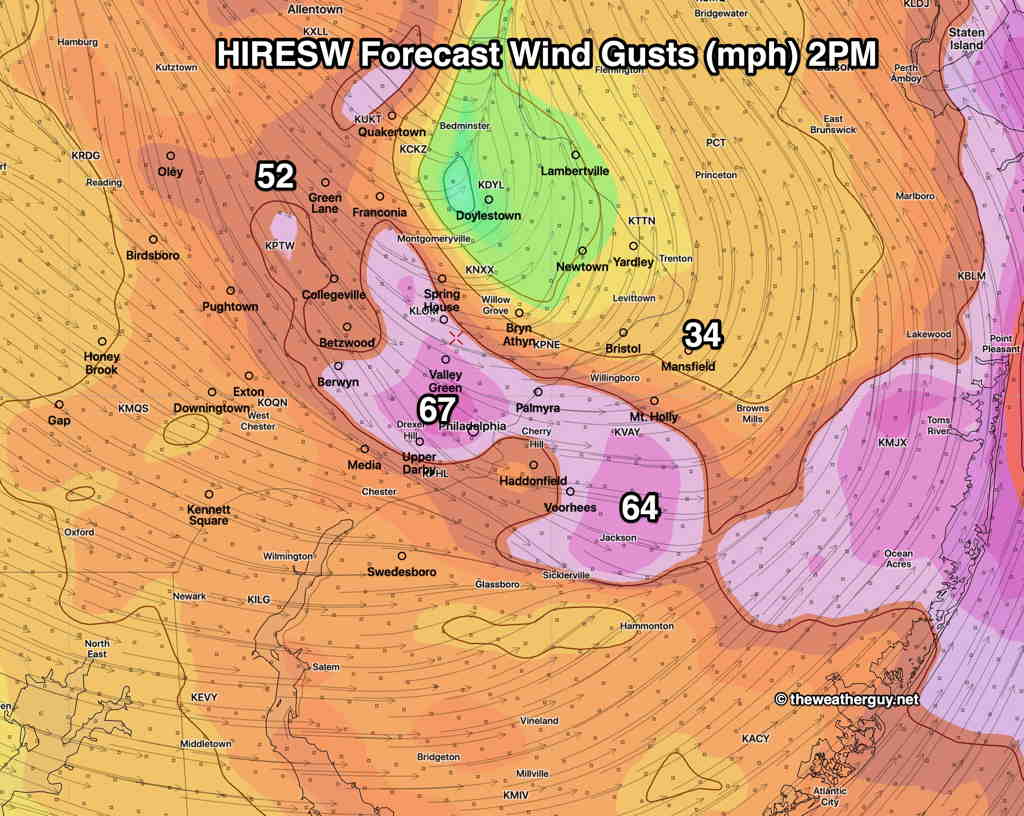
The forecast wind gusts were overdone by the HIRESW model, but the models did reasonably well predicting the two wind peaks in the late morning and again around 2 PM.
From earlier today…
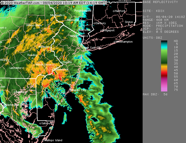
At 10:35 AM, the heaviest rain is making it through Philadelphia.
The 2 AM (06UTC) runs of the models show the following changes in the forecast for tropical storm Isaias—
The storm is moving faster than previously forecast- peak winds and rain rate will reach us between 10 AM and 1 PM.
The track of the storm is a bit further westward.
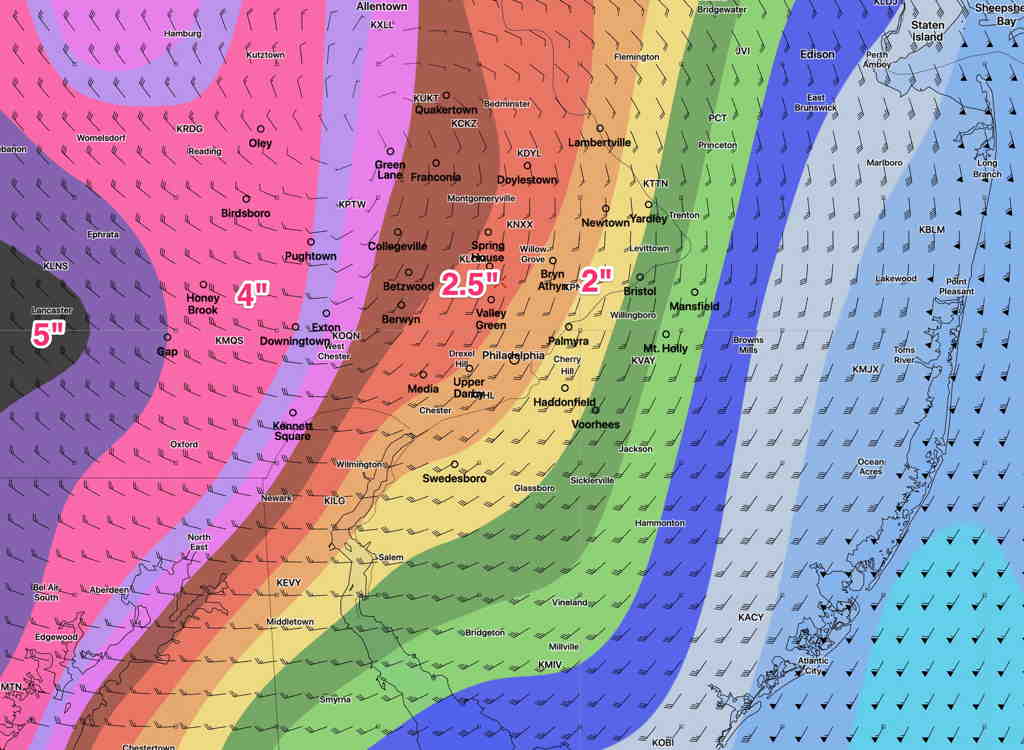
Rain totals will be the highest to the west of Philadelphia, in Lancaster county. Still an additional 2-4 inches to fall. The precipitation maps posted yesterday still hold.
Higher localized rain amounts in thunderstorms.
Wind gusts will peak about 11 AM and again at 1 PM. Wind gusts around 60 mph possible in the Philadelphia area, higher in NJ.
Rain will be ending by 2-3 PM
Some differences exist with areas of max rainfall.
Below is the latest GFS model accumulated rain forecast (from 2 AM, which does not include the rain from last night prior to 2AM. )
GFS forecast accumulated Rain from 2 AM onward (Click on image for a larger view.)
Here’s the very latest HRRR (High Resolution Rapid Refresh) hourly model from 7 AM —