SUNDAY FORECAST UPDATE & HURRICANE ISAIAS

Sat 10:31 PM Update — Tonight’s models just coming in seem to keep most of the thunderstorms early Sunday morning to our west and north.
NAM NEST precip forecast 8 AM Sunday


Update Saturday 7:56PM— Some scattered thunderstorms also possible Sunday afternoon.  The main events will be early Sunday morning and evening as outlined below.

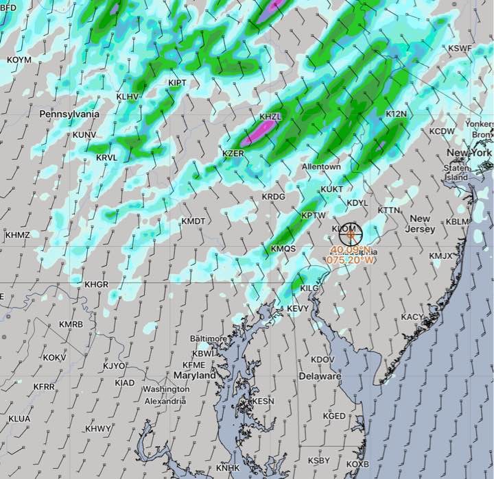
A warm front will move through our area between 4 AM and 8 AM Sunday morning.  Several models show showers and thunderstorms developing and moving through during this timeframe.

Showers end during the mid morning and we’ll have sunshine by the afternoon.  It will be very hot and humid!  Dew points move into the 70s and temperatures will reach a high of 91.7º sd 2.2º (high spread!)

Another round of thunderstorms are forecast during the early evening hours, between 6 PM and 9 PM Sunday.


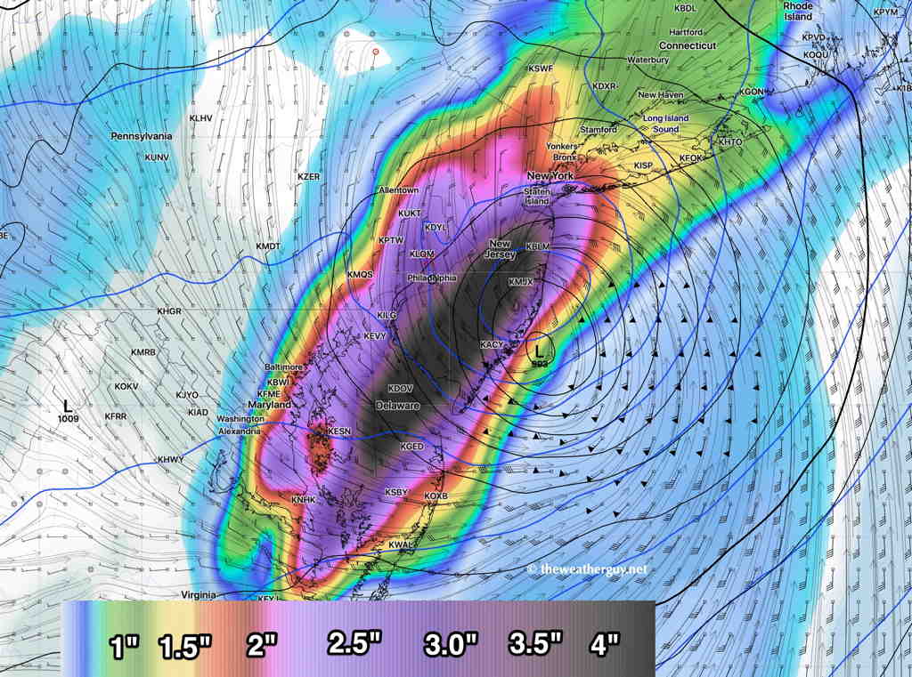
As for Hurricane Isaias, the storm is expected by all models to move up the coast and affect our area Tuesday into early Wednesday.  The chief concern will be very heavy rain in the Philadelphia area.  Models are showing 3-5 inches of rain total. 

Last season, the Navy experimental COAMPS tropical model did very well with forecast tracks—

Navy COAMPS forecast track

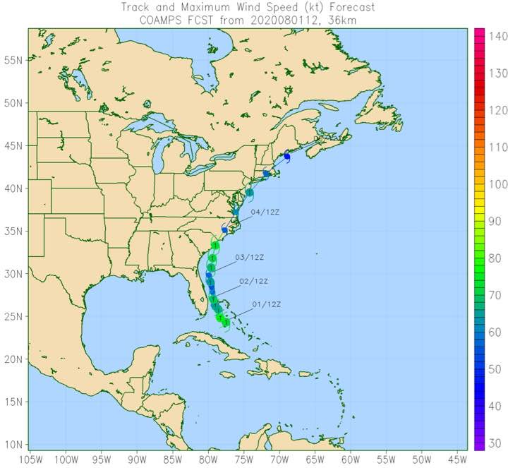
As always, various hurricane models have different tracks—

Various hurricane model current forecast tracks

FORECAST CHANGE

The model runs from last night (06z – 2 AM EDT) show a change in the forecast for today, Saturday.

  • More sun and less high cloudiness until about 4 PM, when clouds move in.
  • High temps 88.4º sd 1.9º.  My guess is that it might hit 90º.
  • Increasing chance of scattered thunderstorms as early as 5 PM in PHL.

Sunday has an highly elevated chance of scattered thunderstorms throughout the day.

The storm with the difficult name to pronounce will hopefully be an easier forecast to track — Hurricane  Isaias.

The track of Hurricane Isaias appears to be somewhat more westward, affecting more of our area on Tuesday—

GFS (pre-release version 16.) 12 hour rain forecast 2 PM Tuesday  (Click on image for a larger view.)