
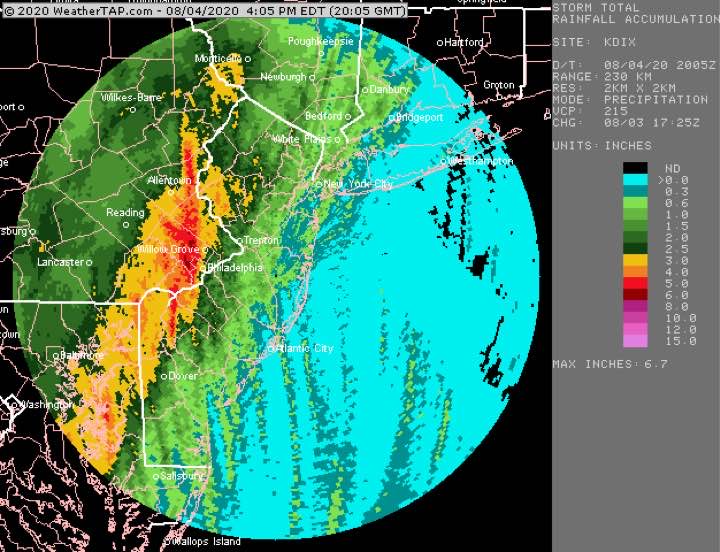
Tues 4:45 PM Update — A review of the day’s weather shows that the heaviest (5-6 inches) rain fell in the immediate western suburbs as shown below—
The NBM did the best with max rain placement and amounts. The GFS and NAM NEST were too far west with the max precipitation.
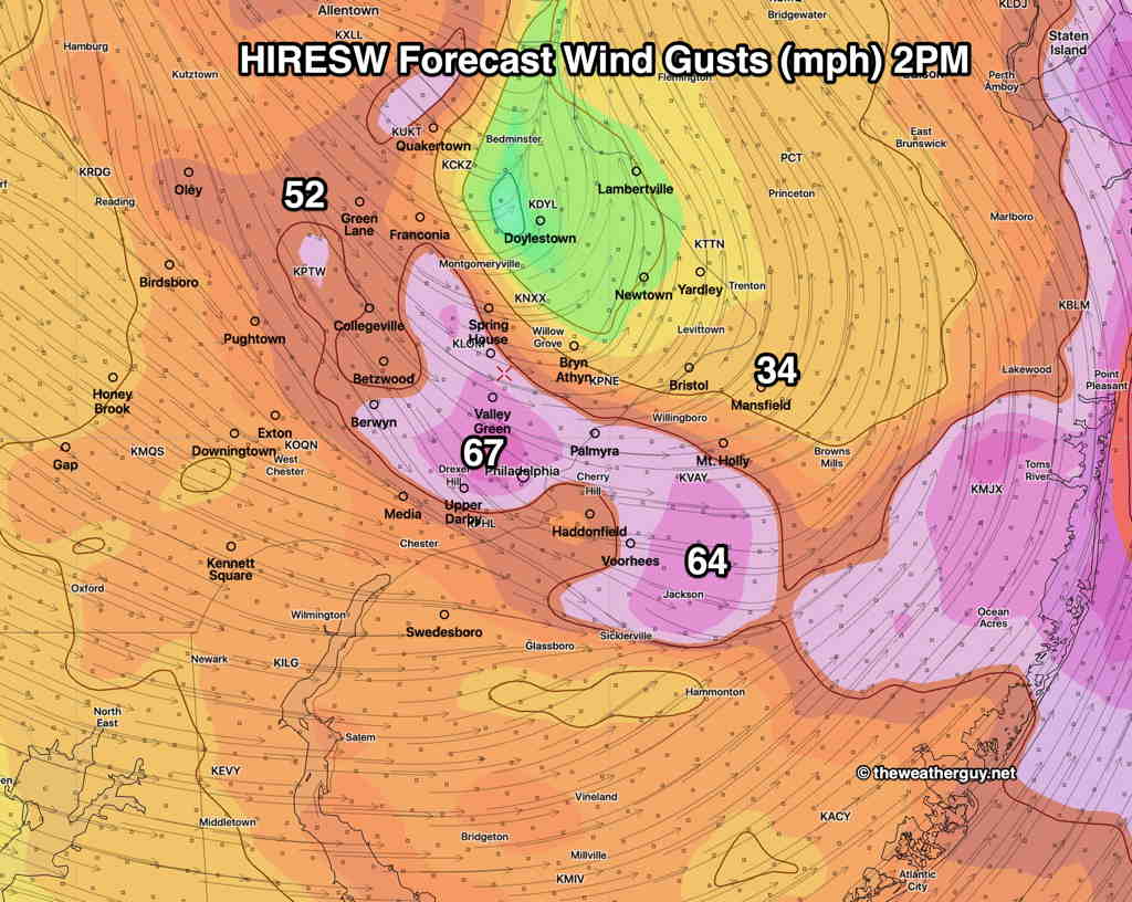
The forecast wind gusts were overdone by the HIRESW model, but the models did reasonably well predicting the two wind peaks in the late morning and again around 2 PM.
From earlier today…
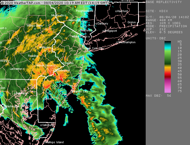
At 10:35 AM, the heaviest rain is making it through Philadelphia.
The highest wind gusts will follow shortly, about 11AM to 12 noon.
A second peak in wind gusts about 2 PM—
Can we get a storm named with a more difficult pronunciation??