
Tue 08:41 AM Update — graphics added below
The 2 AM (06UTC) runs of the models show the following changes in the forecast for tropical storm Isaias—
- The storm is moving faster than previously forecast- peak winds and rain rate will reach us between 10 AM and 1 PM.
- The track of the storm is a bit further westward.
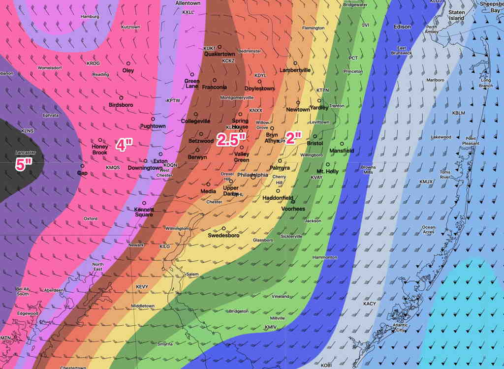
- Rain totals will be the highest to the west of Philadelphia, in Lancaster county. Still an additional 2-4 inches to fall. The precipitation maps posted yesterday still hold.
- Higher localized rain amounts in thunderstorms.
- Wind gusts will peak about 11 AM and again at 1 PM. Wind gusts around 60 mph possible in the Philadelphia area, higher in NJ.
- Rain will be ending by 2-3 PM
Some differences exist with areas of max rainfall.
Below is the latest GFS model accumulated rain forecast (from 2 AM, which does not include the rain from last night prior to 2AM. )
Here’s the very latest HRRR (High Resolution Rapid Refresh) hourly model from 7 AM —
