THURSDAY FORECAST

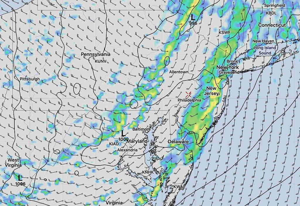
Updated Thu 08:34 AM — This morning’s models show little change from last night’s update. Considerable cloudiness, but breaks of sunshine possible during the day. Some models have some light sprinkles as early as 4 PM, but the bulk of the rain comes in 6- 8 PM.


Updated Wed 10:10 PM – Tonight’s models have the rain starting in the early evening instead of late afternoon. Still some sprinkles early morning, then clouds with occasional sunny breaks before the rain arrives 6-8 PM.


[su_note note_color=”#ffffff”]After those sunny skies today, I’m not going to use the RAP pre-release version until it’s ready for prime time. See my previous forecast post.[/su_note]

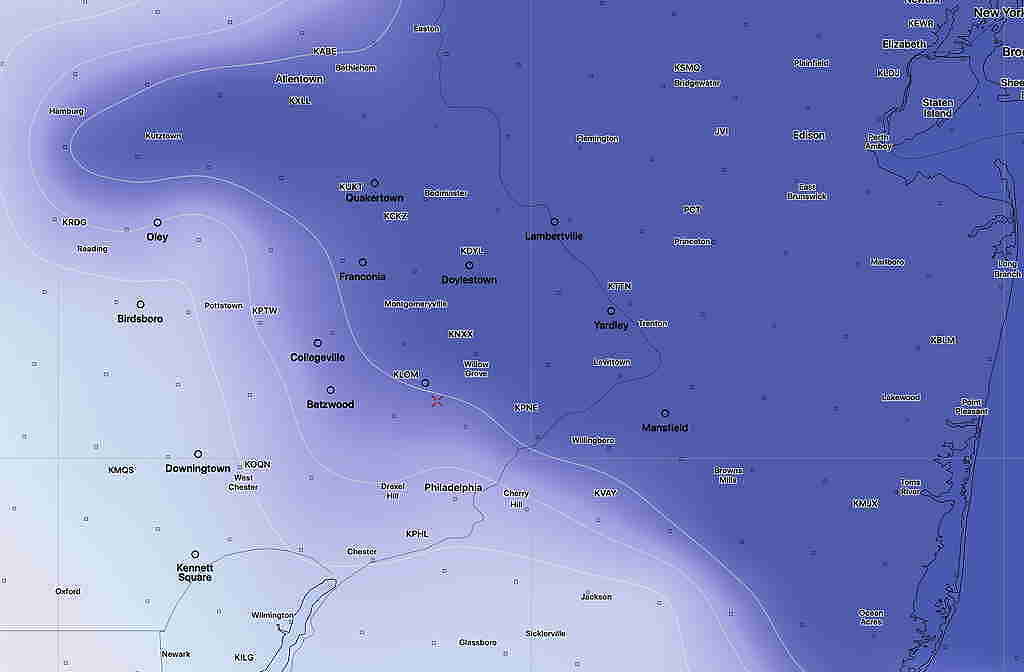
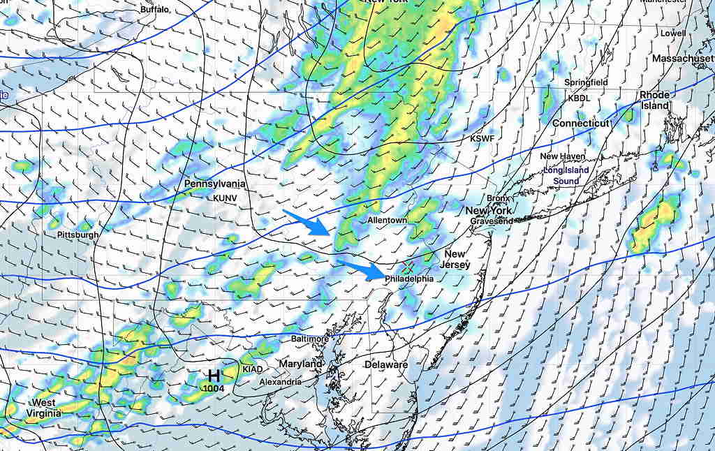
A well-advertised rain event will be moving in late in the day Thursday.  Model runs earlier in the week had the rain starting early afternoon, but the trend has been for a light sprinkle around daybreak and then the rain moves in between 3- 5 PM.  Most of the daytime hours will be cloudy but dry.  (There are a good number of models that have the rain coming in a bit later than 5PM)

High temperature: 58.4º sd 3.8º   Breezy.

GFS Cloud Precip Wind Pressure forecast 4:30 PM Thursday

The rain will be heavy Thursday night. About 1.5-2 inches of rain expected before ending Friday morning

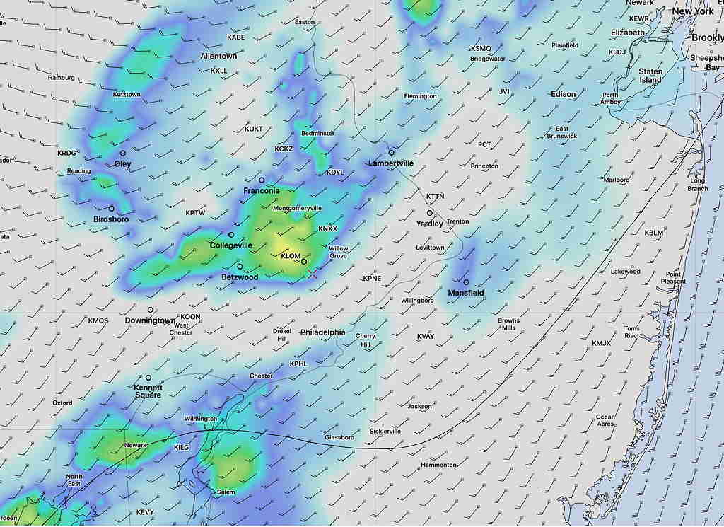
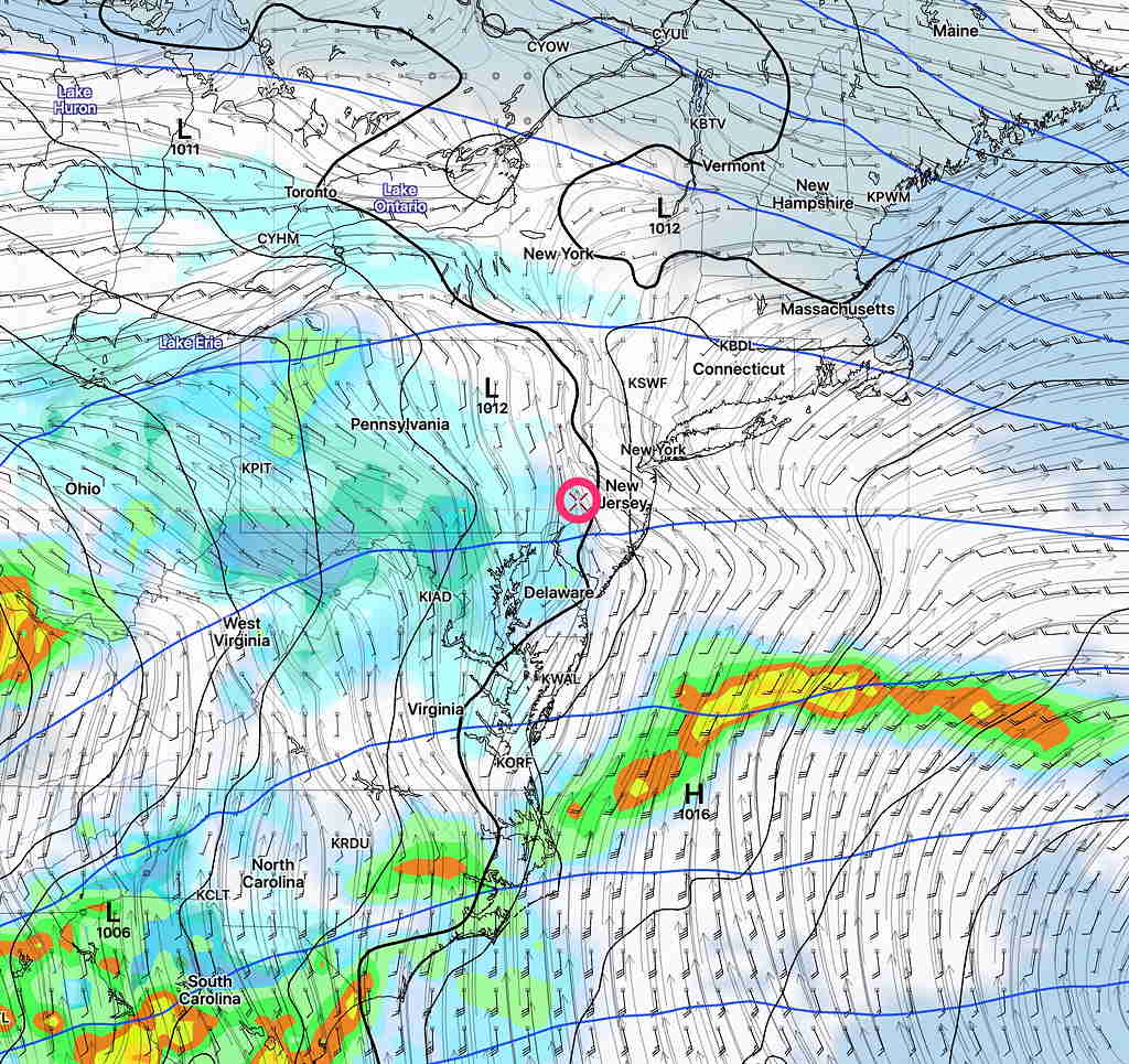
The heaviest rain ends early Friday morning, but the GFS keeps clouds and some scattered showers through much of the daytime Friday.  There’s some uncertainty whether skies clear Friday afternoon,  but the GFS keeps us wet and it did well during the last rain that we had.

WEDNESDAY FORECAST

Apparently, I left this post in draft mode and I never posted it last night. Maybe that’s a good thing, since there were big differences in cloud cover predicted.

Most models have it very sunny today, but last night’s RAP (“Rapid Refresh”)  (pre-release version) had significant instability cloudiness at noon.

Here’s the latest RAP (pre-release v 5) cloud forecast (blue) stiil showing significant cloudiness for noontime—

RAP (v5 pre-release) Model cloud forecast 12:30 PM Wednesday  Significant clouds!

Here’s the current operational RAP (v4.0) cloud forecast showing NO clouds!—

RAP v 4 (current operational version) No Clouds!

I guess we’ll see around noon whether the new RAP version 5 is ready for prime time!


 From Tuesday night….

Cool high pressure builds in for Wednesday. Still a bit windy.

Tonight’s RAP model has instability low level cloudiness move in late morning Into early afternoon, then sunshine returns.

The HRRR and NAM has much more sun and little cloudiness.  I’m leaning towards the RAP’s cloudiness.   High temp 50.6°sd 1.0°


TUESDAY FORECAST

Updated Tue 08:40 AM — The latest HRRR still has showers breaking out between 11AM and noon.   The expected two lines of thunderstorms are becoming less distinct.  Additional activity from 12 noon through 3 PM.  Heaviest storms will be in New Jersey about 3 PM.

7AM HRRR model showing thunderstorms developing at 11:30 AM today.  Click on image to enlarge

Updated Mon 10:30 PM — Tonight’s models have moved the two batches of storms a hour later. Starting about 11 AM and again about 2- 3 PM . High temp 60.6° sd 2.2°  Higher sd (standard deviation) means higher uncertainty.


A strong cold front will pass through Philadelphia about 2-3 PM Tuesday.  Ahead of the front will be showers and thunderstorms.

The models are suggesting that two lines of showers and thunderstorms will move through ahead of the front, one as early as  10 AM -12 noon and another between  12 noon and 2 PM.  There may be a break of sun between the two groups of storms.

As usual, there are some differences in the timing of the showers.

Today, I’m going to use the new, pre-release version of the HRRR (High Resolution Rapid Refresh)  showing the two lines of showers—

HRRR version 4.0 pre-release version Simulated Radar and Showers forecast 11 AM Tuesday

The HRRR is showing a good chance of hail with these storms.

Some other hi-resolution models have more distinct lines of showers and thunderstorms.

Here’s the HIRESW-ARWMEM2 (boy, that’s a mouthful!) for 1 PM Tuesday showing more distinct lines of showers—

HIRESW-ARWMEM2

Total rainfall (QPF) is about 0.25-0.5 inches of rain.

I’ll update later with tonight’s models.