Last night’s model runs have provided some much-needed clarity to the forecast for late Saturday into Monday. Each model has previously gone through a series of forecasts which were in poor agreement with each other; last night’s model forecasts are in better agreement and perhaps closer to the likely reality.
Let’s cut to the chase — it appears that recent GFS and prior ECMWF model snow forecasts were very overdone.
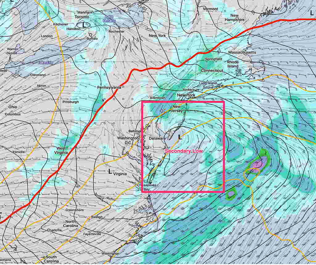
A secondary low will form off the NJ coastline late Sunday and move northeastward, not lingering as previously forecast. The more northern development of this coastal low will keep us in the warmer sector of the storm. Rain on Sunday will likely not change to accumulating snow, only a few snow flurries on Monday. There’s still a chance that the precip starts as light snow before daybreak Sunday, but quickly changes to rain.
Additionally, it appears that precipitation will be slower to arrive. Saturday should be dry for much of the day and evening.
We’ll see if further model forecast changes occur. Stay tuned.
[su_note note_color=”#defcdc”]Tues PM Update: The latest models forecasts are all very different, making it impossible to make a definitive forecast at this time for the time period late Saturday into Monday.
The only trend supported by the models is that start of precipitation has been pushed back into Saturday evening, instead of Saturday afternoon.
The general trend is for a secondary coastal low to form.
The GFS puts the low to our south, allowing cold air to move in late Sunday night. It’s still looking like predominantly rain, except for the start and the end where snow may fall.
The GFS has the storm lingering on the coast through Monday, as it waits for an upper low to catch up to it and become “vertically stacked”.
With so many different model forecasts, we’ll need to wait for things to clarify. [/su_note]
[su_note note_color=”#defcdc”]Tues AM Update: The storm forecast for the Thanksgiving weekend continues to evolve. The GFS is faster and brings precip (as wet snow) in late Saturday afternoon.
The ECMWF (European) is slower and has the precip starting late Saturday night and continues into Monday. It remains mostly rain for us before ending as light snow.
The general scenario is wet snow—> rain—> light snow before ending.
Canadian CMC forecast 4PM Sunday showing coastal secondary low formation. (The wavy red line is the 500-1000mb “thickness” line which is often (but not always) the rain-snow line.)
Secondary coastal low pressure development is again in the picture which will affect how much snow falls towards the end of the storm and how long it lingers into Monday. [/su_note]
…from yesterday—
A stormy weekend looking likely…
As mentioned over the past week or so, an outbreak of winter cold air will affect our area the first week in December. The journey to this cold dip in the jet stream promises to bring an “interesting” weather event for a large area of the country including our area.
Let me cut to the chase— most of our immediate region will have rain as the predominant precipitation type (PTYPE). That said, a number of thermal changes will occur during a rather prolonged low pressure passage.
Originally, the low pressure system was expected to affect us on Sunday. The timing has changed— precipitation will arrive on Saturday afternoon.Thermal profiles are suggesting a possibility of wet snow at the start late Saturday afternoon or evening.
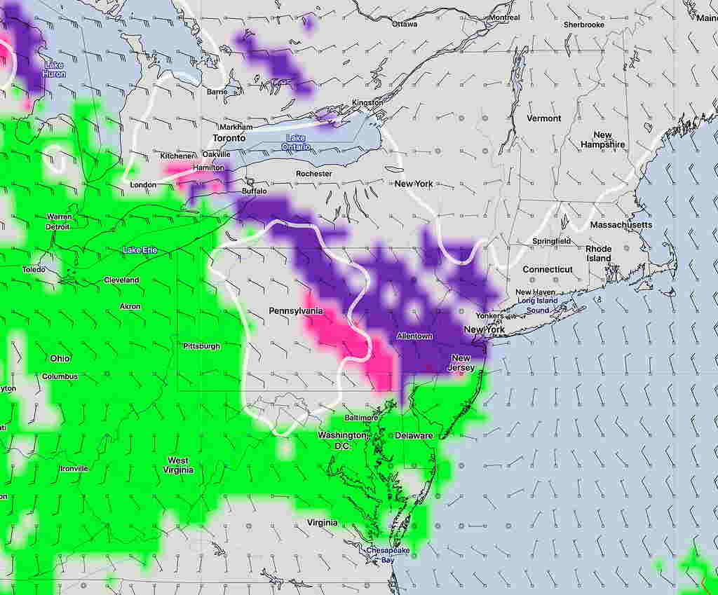
Current GFS Forecast for Saturday 4PM- Precipitation Type (green – rain, purple – snow, pink – ice) (I tend not to rely too much on the built-in model PTYPE forecasts)
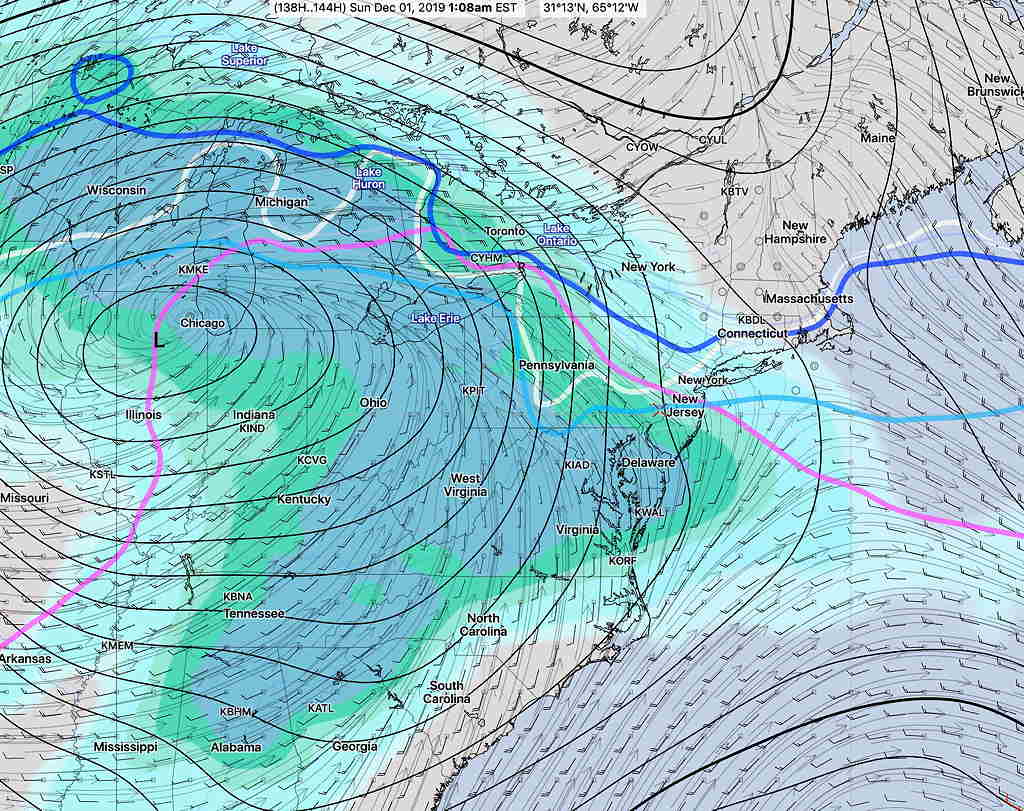
Below is the latest GFS Ensemble Forecast for 1 AM Sunday—
GFS Ensemble forecast 1 AM Sunday showing critical snow temperatures in our region (Lavender, blue, light blue, white lines) The model shows much of our area will be rain by 1 AM.
This precip will change to rain overnight and continue into Sunday.
As it stands now, much of Sunday will have heavy rain. A changeover to light snow or flurries is possible towards the end of the storm Sunday evening.
As always, there are differences in the models. The European ECMWF has a bit more snow for us Saturday late afternoon and Saturday night before a changeover to rain. The Canadian CMC is a bit warmer.
The forecast for this weekend has changed considerably over the past day. I expect more changes. Stay tuned.
So what’s with the snow falling (which was not forecast)? That’s a great question. Here’s the short answer—
I wasn’t even looking for the possibility of snow today. But as soon as I saw the snow, I went back to the high resolution NAM NEST model and saw that it was forecast to 32º or below at key levels of the lower atmosphere with plenty of precipitation occurring after 11 AM.
NAMNEST model 32º F (isotherm) temperatures at 6000 and 3000 feet above sea level (lavender and violet lines) and simulated radar (blue/green shading)
Add to this strong vertical motion and heavy precipitation with dynamic cooling and we got the brief period of snow.
I wish I had forecast that possibility, but I skipped over the thermal profiles this weekend, thinking snow wasn’t a consideration.
As for the professional forecasters and the talking heads on TV, I don’t know what their excuse is.
Anyhow, this is what makes the weather so interesting. The forecast might have been off, but at least we know why.
Put another way, often we blame the models for being wrong. This time, the wrong forecast was due to the forecasters.