
[su_note note_color=”#defcdc”]Tues PM Update: The latest models forecasts are all very different, making it impossible to make a definitive forecast at this time for the time period late Saturday into Monday.
The only trend supported by the models is that start of precipitation has been pushed back into Saturday evening, instead of Saturday afternoon.
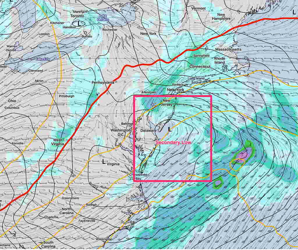
The general trend is for a secondary coastal low to form.
The GFS puts the low to our south, allowing cold air to move in late Sunday night. It’s still looking like predominantly rain, except for the start and the end where snow may fall.
The GFS has the storm lingering on the coast through Monday, as it waits for an upper low to catch up to it and become “vertically stacked”.
With so many different model forecasts, we’ll need to wait for things to clarify. [/su_note]
[su_note note_color=”#defcdc”]Tues AM Update: The storm forecast for the Thanksgiving weekend continues to evolve. The GFS is faster and brings precip (as wet snow) in late Saturday afternoon.
The ECMWF (European) is slower and has the precip starting late Saturday night and continues into Monday. It remains mostly rain for us before ending as light snow.
The general scenario is wet snow—> rain—> light snow before ending.
Secondary coastal low pressure development is again in the picture which will affect how much snow falls towards the end of the storm and how long it lingers into Monday. [/su_note]
…from yesterday—
A stormy weekend looking likely…
As mentioned over the past week or so, an outbreak of winter cold air will affect our area the first week in December. The journey to this cold dip in the jet stream promises to bring an “interesting” weather event for a large area of the country including our area.
Let me cut to the chase— most of our immediate region will have rain as the predominant precipitation type (PTYPE). That said, a number of thermal changes will occur during a rather prolonged low pressure passage.
Originally, the low pressure system was expected to affect us on Sunday. The timing has changed— precipitation will arrive on Saturday afternoon. Thermal profiles are suggesting a possibility of wet snow at the start late Saturday afternoon or evening.
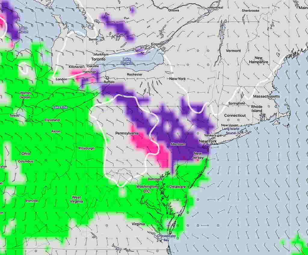
Below is the latest GFS Ensemble Forecast for 1 AM Sunday—
This precip will change to rain overnight and continue into Sunday.
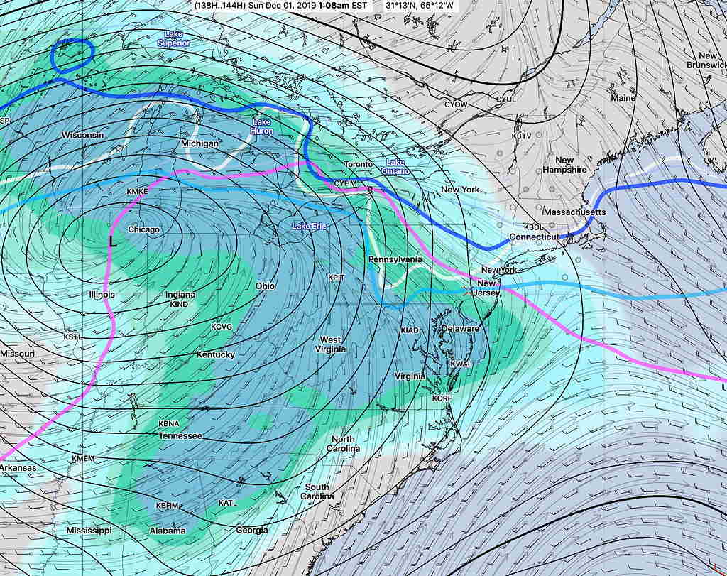
As it stands now, much of Sunday will have heavy rain. A changeover to light snow or flurries is possible towards the end of the storm Sunday evening.
As always, there are differences in the models. The European ECMWF has a bit more snow for us Saturday late afternoon and Saturday night before a changeover to rain. The Canadian CMC is a bit warmer.
The forecast for this weekend has changed considerably over the past day. I expect more changes. Stay tuned.