STORM UPDATE 10 PM

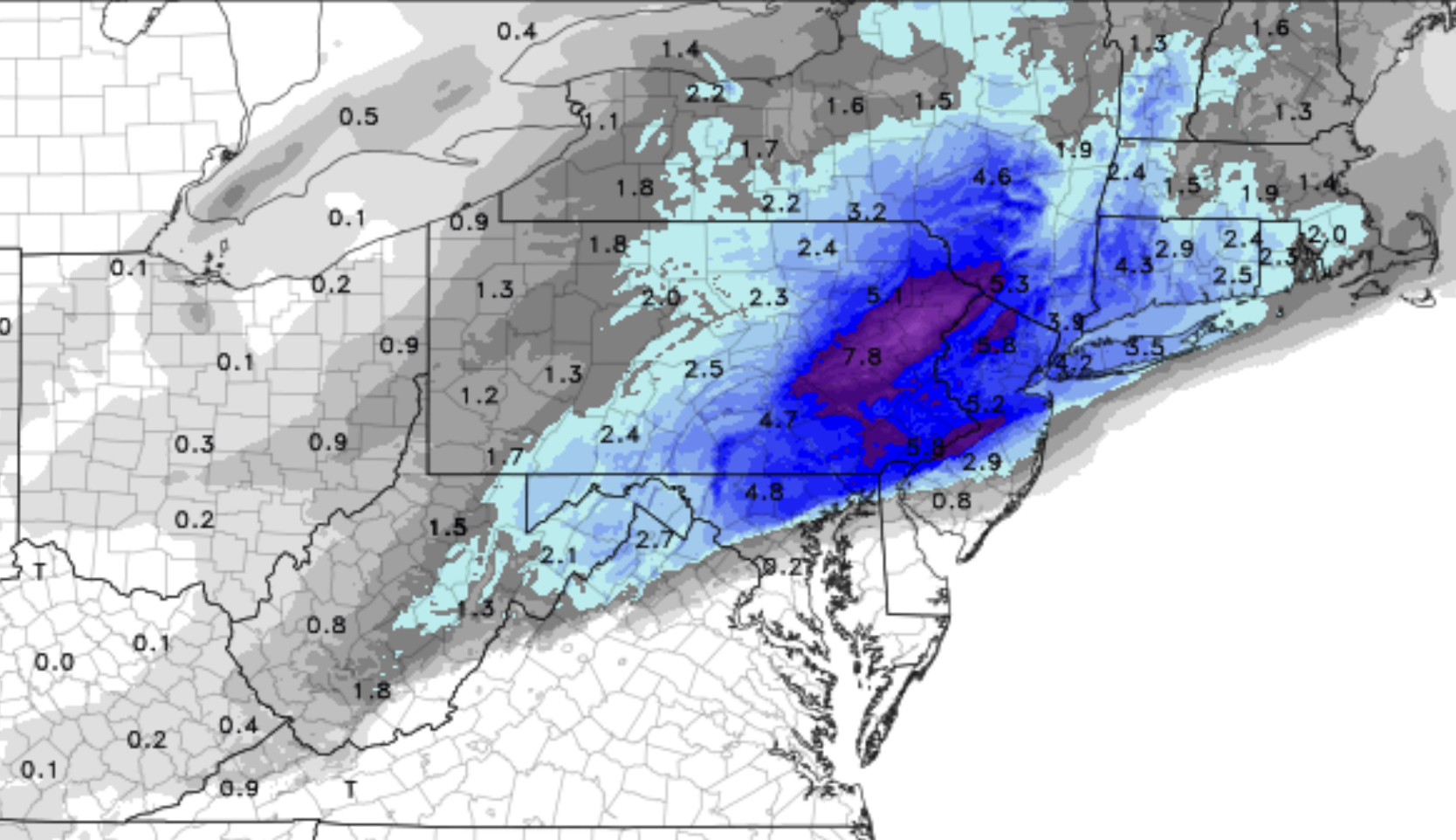
Tonight’s NAM has become available.  It cranks out an amazing amount of precipitation.  QPF from 7 PM to 2 AM is 0.72 inches of water.  We’re already half-way through.

In my neck of the woods just northwest of the city, it’s been a mix for several hours.   We have about 2.5 inches of snow/sleet accumulation on the wooden deck, less on paved surfaces.

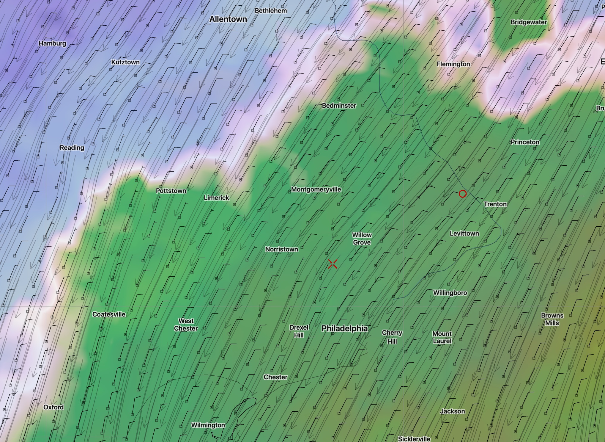
The mix of sleet,  snow and rain should expand northwestward until about 11 PM to the position shown in green.

Latest NAM- northwestern extent of mixed precipitation (green shaded) at 11 PM

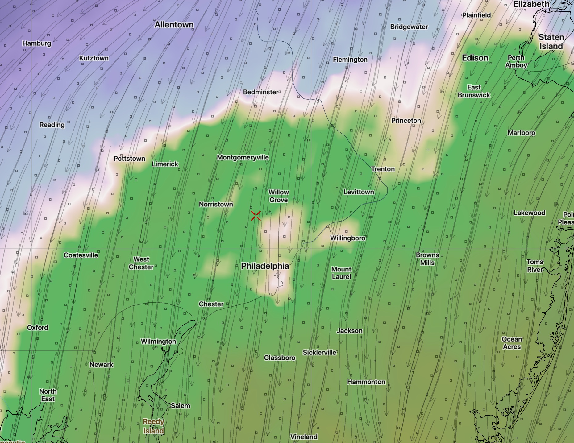
After 11 PM, it should start  moving back southeastward, changing the mix back to all snow. By midnight to 1 AM, even Philadelphia will have the mix change to snow.

Depending upon your location, additional accumulation will occur, possibly 2 more inches, more north and west.  Temperatures remain in the 32 to 33 degree range.

However, the remaining snow tapers off rapidly and ends after 2 -3 AM tonight.


WINTER WEATHER UPDATE SUN 4:15 PM

This afternoon’s NAM model (yes, the model run I would prefer not to rely on) is in.    QPF has increased to 1.26 inches water. Precipitation tapers off around 2 AM.  So, some heavy rain, even some convective rain (thunder) possible with the mix of sleet and snow.

The rain we have will mix with sleet and snow.  And it may be all-snow for a period.

No change in my forecast. The upper atmosphere remains too warm to support all-snow in much of the immediate Philadelphia area.  While some snow will fall, accumulations will be highly limited by a mixing in of sleet and rain.

The areas (in green) in the graphic below will also have significant sleet and rain, reducing the snow accumulations considerably.  If you look back at the postings of the past several days, this white line is further north and west than previous forecasts.

critical temp
White line- Critical temperatures. Northwest of the line mostly snow,  Southeast of the line, a mix of sleet, snow and rain.

Combined with temperatures that are at or above freezing at the surface, I don’t expect snow accumulations to be very impressive in the areas in green above.

Philadelphia, south NJ (east of the Delaware) will have minimal accumulation. Immediate suburbs north and west about 2-3 inches of heavy mixed snow and sleet, increasing to 7-10 inches in the far north and west. The further north and west, the more accumulation.

It’s not that you won’t see some snow in these green shaded areas, but how much can really accumulate? I guess we’ll see.