
#Phillywx #Philadelphia #weather #PAwx
There are comments, but they’re not necessarily showing. Click on “Post a Comment” to see comments if they’re not showing as a default. Possible bug in WordPress(?)
Sunday Forecast Update
Updated Sat 9:21 PM — No major change in the the forecast. Sunny skies. High 66° with temperatures around 63° with winds NNW around 7-10 mph for the start of the Eagles game.
Weather and Daylight Savings Time-> Standard Time
Twice a year, I feel compelled to talk about Daylight Saving Time and how it negatively affects timely access to updated evening weather model data before bedtime for those of us on the east coast.
Frankly, I love Daylight Saving Time and the extra hour of daylight we get in the late afternoon. The problem for us weather people is that major weather models are run worldwide at “00z” (Coordinated Universal Time or what used to be called Greenwich Mean Time). This corresponds to 7 PM Eastern Standard Time, but 8 PM Eastern Daylight Time. That hour makes a difference.
Since numerical weather models take 2-5 hours to ingest data, compute and process, many of the major models become available too late in the night to be any use for us on the East Coast for planning our activities the following day.
When you hear “tune back in at 11″, you’re not going to see any change in the 5 day forecast at 11PM and likely to see little change in the next day forecast; new model data simply hasn’t become available yet.
So for us weather people, the return to Eastern Standard Time makes a big difference for last minute evening updates about snow storms.
Here’s some of the changes in some model availability (eastern time) :
| Model Name (00z model run) | Daylight Time | Standard Time |
| GFS 24 hour | 11:46 PM | 10:46 PM |
| GFS 5 day | 12:20 AM | 11:20 PM |
| NAM 24 hour forecast | 10:05 PM | 9:05 PM |
| NAM-NEST 24 hour forecast | 10:12 PM | 9:12 PM |
| HREF 48 hour forecast | 11:25 PM | 10:25 PM |
| Canadian HRDPS 24 hour forecast | 11:20 PM | 10:20 PM |
| Canadian RGEM 24 hour forecst | 11:10 PM | 10:10 PM |
| ECMWF* | 2:00 AM | 1:00 AM |
| ECMWF (free open data version) | 3:15 AM | 2:15 AM |
I’ve written extensively about Daylight Saving Time in past years—
Little Known Facts about Daylight Saving Time and TV Weather Forecasts
Oh, I just remembered, I have a forecast for Saturday and Sunday!
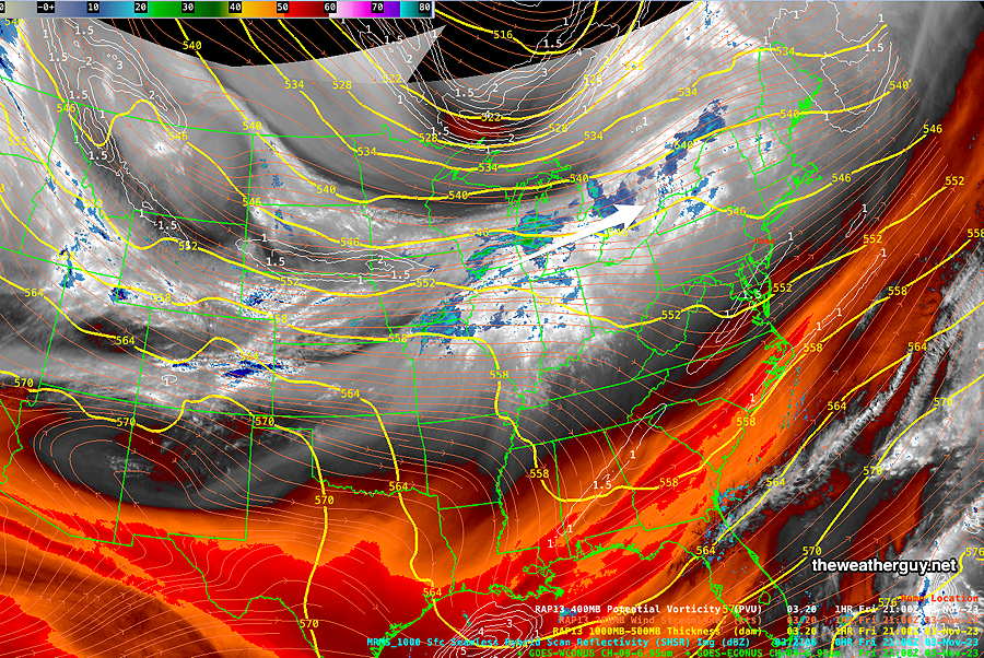
An upper air disturbance and a very weak trough will move through to our north on Saturday. The disturbance is visible in satellite water vapor imagery—
Previously Posted Fri 8:27 PM —
Saturday
A mix of mid level clouds with some breaks of sun possible and some bright spots. Somewhat thicker clouds in the early afternoon, clearing late afternoon towards sunset. No rain. (The Canadian HRDPS has less cloudiness than our NOAA models and my forecast reflects that.)
High temperature 59º ( NBM model— location Blue Bell, PA)
High temperature 61º ( NBM model— location Philadelphia, PA)
uncertainty ± 2.6º (somewhat more spread than average)
Sunday
Mostly sunny. Light winds.
High temperature 62º ( NBM model— location Blue Bell, PA)
High temperature 64º ( NBM model— location Philadelphia, PA)
uncertainty ± 1.7º (less uncertain than average)
Thanks for the discussion on Daylight Savings Time Glenn. I find your discussions educational and helpful to me. Especially the timings of the forecasts. I wish I had thought to look up the timings of forecasts in mid-October when I was wrestling on whether to host a Star Party. The forecast information was very mixed but poor in a lot of key areas for me that I decided it best to cancel. Of course the evening turned out to be clear enough after all. Frustrating for me in that I knew prior that not matter what I decided, it would likely be wrong.
Stan, I’m glad you find my forecast information useful. The actual model production “train schedule” can be found at this link https://www.nco.ncep.noaa.gov/pmb/nwprod/prodstat/ These are the times each day that the data will available for direct download from the NOAA servers. But direct download of data is a programming science and art in itself. The best site for direct model data is to go the the College of DuPage site — https://weather.cod.edu/forecast/