
#Phillywx #Philadelphia #weather #PAwx
Friday
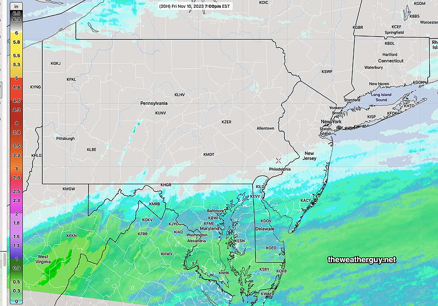
Updated Thu 11/09 @ 10:50 PM —An interesting Friday forecast. All of tonight’s earlier models have the light showers well to our south. Interestingly, the Canadian HRDPS and tonight’s GFS just came out and both show very light showers extending north of Philadelphia. The HRDPS has been consistently forecasting this. Will see what happens.
Updated Thu 11/09 @ 7:59 PM — A weak system will move up from the south Friday and a secondary cold front will move through. Most of the rain is expected to be suppressed to our south. Very light sprinkles in the immediate PHL area at most.
The extended range model forecasts for the weekend and next week have changed somewhat over recent days with less of an upper air trough. Still very dry weather in the foreseeable future.
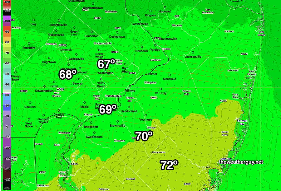
We finally got some sun west of the city, but there were more clouds than forecast in the afternoon. As a result, high temperatures were only 68º at KPHL and 64º at KLOM (Blue Bell Wings Field)
While some morning models showed the very light sprinkles that went through about 3 PM, they easily could have been interpreted as model noise and not all models showed these light sprinkles.
One of the value-adds that I try to offer on this web site is reporting the NBM high temperature standard deviation (sd) , which reflects the degree of spread in the models and gives an easy clue into confidence in the model forecast.
From basic statistics, remember that among a group of models (the NBM is based on a group of over 40 models) , about 66% of the model forecasts will fall within 1 standard deviation (±) if their forecasts are normally distributed.
When the standard deviation is larger, there’s a wider spread of model forecasts and therefore more uncertainty.
Based on the consistently higher than usual sd in today’s high temperature forecast, it was no surprise that today’s forecast was not spot on.
Thursday Update
Updated Thu 11/09 @ 10:16 AM — This morning’s model’s high temps are coming in 2º -3º lower than the NBM graphic posted below.
Updated Thu 11/09 @ 9:00 AM — Clouds should break for sunshine around noontime. High temperatures are somewhat lower than previously forecast, but still with low confidence, with a standard deviation of about 2.4º
There’s still a chance of very light showers Friday afternoon—

Update
Update Wed 11/08 10:28 PM — Tonight’s models are leaning towards some light showers early Friday afternoon as a secondary cold front moves through. Somewhat heavier showers in southern Chester and Delaware counties.
Thursday
Updated Wed 11/08 @ 8:05 PM — A warm front still to our south will pass through about daybreak Thursday. Some residual cloudiness is expected during the morning hours Thursday before sun breaks out around noon.
A cold front comes through during the early afternoon, but cold air will take time to move in. High temperatures may reach 70º in Philadelphia and 68º in Blue Bell.
(Both high temperatures are ± 3.2º. That’s a high level of forecast spread. The Canadian models are forecasting 73º, but they tend to run high. )
It will become WINDY and gusty before and after the cold front, late morning and early afternoon.
Enjoy the warm weather if you can. By Sunday and Monday, we’ll be closer to the low 50s and even lower on Monday for highs.
Still no rain forecast.
Wednesday Thursday Update
Updated Wed 11/08 @ 9:36 AM — The warm temperatures for Thursday have been well-advertised. The warm front is to our southwest and will move through tonight. High temperatures near and above 70º are likely Thursday.
Not as well-advertised is a sharp drop in temperatures possible late Sunday into Monday.
Wednesday and Beyond
Updated Tue 11/07 @ 4:38 PM — We could really use some rain.
The front moved through as forecast and another cold front will move through Friday. It will cool down tonight and more so this weekend.
Wednesday will be cooler with highs in the low 50s.
Thursday will be warmer again with highs in the mid 60 to upper 60s!
A cold front moves through Friday.
It appears that our area will miss out on rainfall with Friday’s cold front as well. As mentioned yesterday, some models have as little as 0.05″ of rain later Friday. (The Canadian GEM is currently forecasting a bit more, about 0.15″) The latest NBM model has our area dry—
The weekend looks dry but a sharpening trough over us will bring some chilly weather by Sunday into Monday.
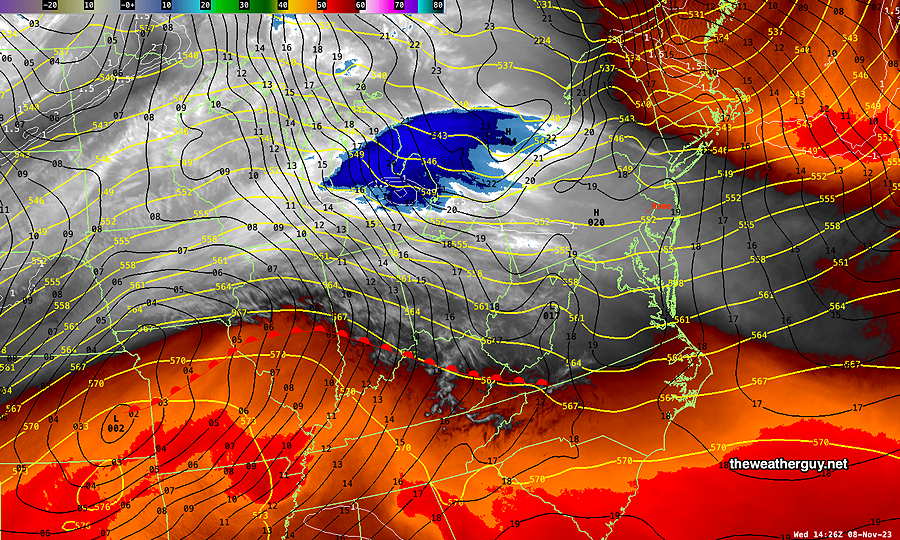
The NAEFS suggests that light wintry mix might fall far northwest of Philadelphia—
Tuesday
Updated Tue 11/07 @ 9:04 AM — A weak surface cold front will move through later today, but not before temperatures have risen to warm levels.
Clouds should thin and clear between 1 PM and 3 PM as winds become northwesterly behind the cold front.
Another Overview
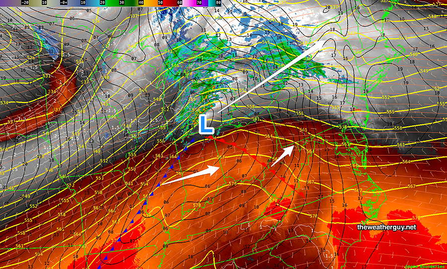
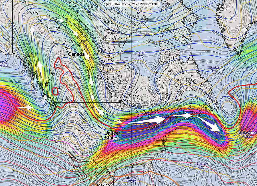
Updated Mon 11/06 @ 7:51 PM — There’s not much happening and it’s expected to stay that way weather-wise. An anomalous ridge expected to develop in the west coast with a flat to slight ridge here will keep systems from moving towards us.
There remains a very low chance of light rain late Wednesday night and Friday. Total rainfall amounts are very low, on the order of less than 0.06″ total and likely less.
A chill down this coming weekend. but dry as surface high pressure takes over.
Our dry pattern continues into next week. What does this portend for the coming winter? Who knows!
Previously Posted Sun 10:14 PM —
Overview
We’ve moved into a dry pattern with several storms moving to our north and to our south. The same appears to be true for the coming week, as a low pressure system moves to our north on Tuesday and another disturbance approaches for Thursday into Friday with a cold front.
The models are unimpressive with rainfall for our area, especially the latest GFS.
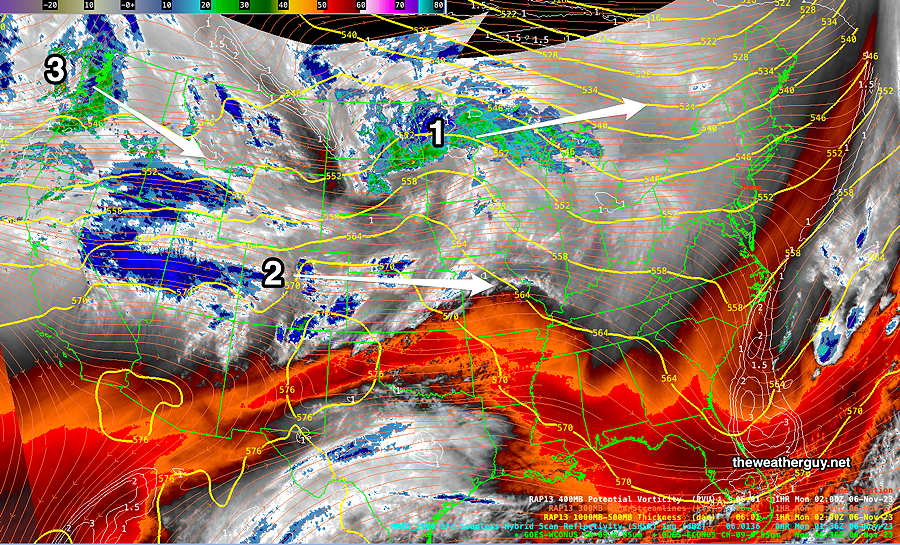
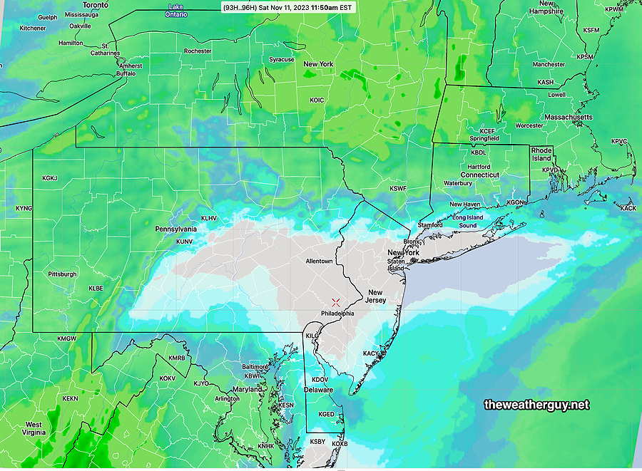
Disturbance 1 will move to our north on Tuesday. Disturbance 2 will move to our south on Wednesday night/Thursday morning. Disturbance 3 will drop south and drag a cold front through later on Friday. Any rain from these systems will be minimal here, with the best chance on Friday. (Click on image for a larger view.)
So mild temperatures, some cloudy days (Tuesday, possibly Thursday, Friday) Little in the way of rain except Friday.