#Phillywx #Philadelphia #weather #PAwx
Forecast Change for Saturday Update
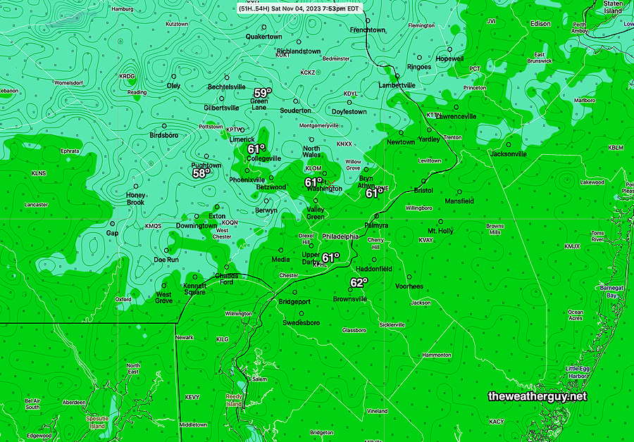
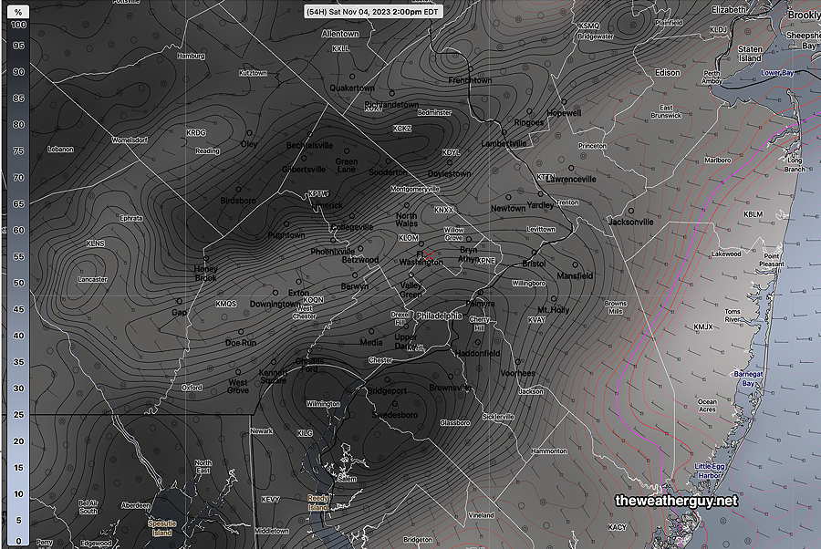
Updated Thu 11/02 @ 8:33 PM — It looks like a weak upper trough will affect our area on Saturday with more cloudiness than previously forecast, especially during the afternoon hours.
So while Saturday will be milder than Friday (Friday’s highs are expected to be upper 50s, just short of 60º in most places), the highs on Saturday will only reach about 61º-(62)º in some places, somewhat less than previously forecast due to the increased cloud cover. These highs may be different by Saturday.
Forecast Change for Saturday
Updated Thu 11/02 @ 6:21 PM — A quick update; I haven’t reviewed today’s models in detail. It appears on the latest GFS that a weak cold front tries to approach on Saturday with an increase in clouds. This was not previously forecast. I’ll update later with some new models.
Thursday through Sunday Outlook
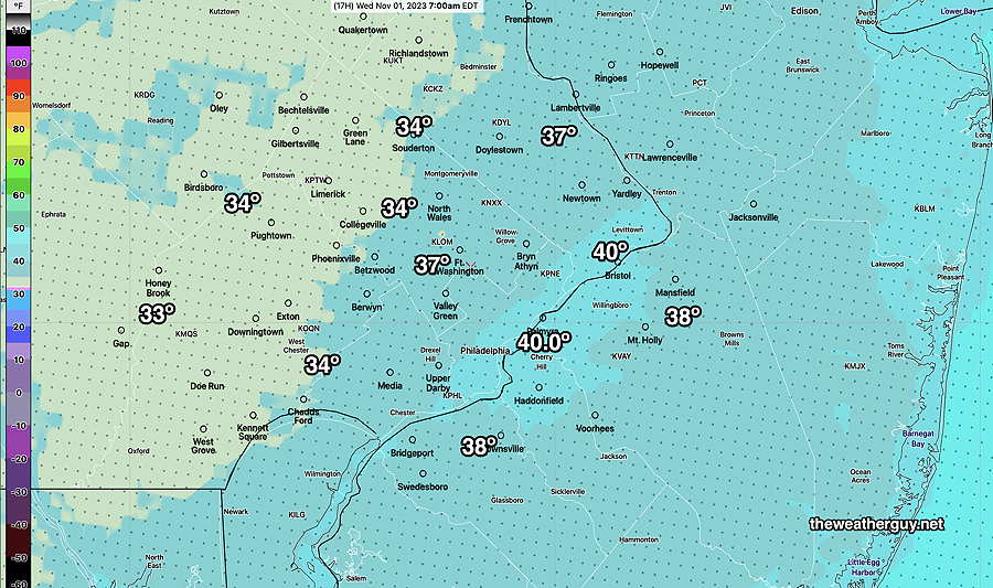
Updated Wed 11/01 @ 8:27 PM — The cold weather expected tonight is being somewhat hyped on TV/radio, in my opinion. It’s going to be cold, but it’s already November and guess what, it sometimes gets pretty cold in November.
In case you missed it, here’s the low temperatures expected tonight (with an uncertainty of ± 2º) —

There isn’t much else to talk about regarding the weather. A sprawling area of cold high pressure will affect our weather for the next several days, with moderating temperatures over the weekend.
Next chance for rain is Monday into Tuesday.
Wednesday Outlook
Updated Tue 10/31 @ 7:53 PM — Some showers may move in later tonight (Tuesday), especially from the city eastward.
The cold temperatures expected for tonight have been well-advertised. Here’s the 18z NBM model forecast lows—
Clouds linger in the morning. There’s uncertainty with the degree of clearing we get on Wednesday. The GFS, HRRR, HREF all show low clouds until noon to 2 PM. The Canadian models have clearing with partly to mostly sunny skies. I’m going with the Canadian models with more sun than clouds mid day into the afternoon.
Tuesday Wednesday Outlook Update
Updated Tue 10/31 @ 9:47 AM — Perhaps you’ve noticed that the forecasts have been less than consistent in recent days? There have been larger than average spreads in the model forecasts since the weekend. Luckily, the model forecasts have begun to come closer together.
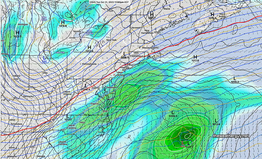
The models guidance forecasts low pressure development in the western Atlantic and the position and track are close enough for some moisture and clouds to be thrown back towards us later today, Tuesday and early Wednesday.
Sometimes I wonder if the TV forecasters put too much stock in the ECMWF forecasts. (They’re paying thousands of dollars a year to get the ECMWF; maybe they figure they have to use it?)
The ECMWF model data has been available for free as a reduced resolution and limited parameter format for about a year and a half. It’s been very nice to have, but so far, I haven’t been that impressed with its forecasts. Our GFS, GEFS combined with the Canadian models have provided better guidance for these forecasts, in my opinion.
For longer term forecasts, the NAEFS (which combines the GEFS and Canadian Ensembles) has been more useful for these forecasts.
Tuesday: Some cloudiness moves back in from the east about 4 PM today and some showers are possible late Tuesday night into Wednesday morning.
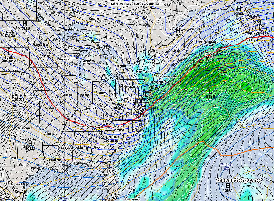
Wednesday: Some cloudiness and even some widely scattered showers linger from Philadelphia and eastward into mid afternoon Wednesday as a weak surface low develops near us.
Forecast Update
Updated Mon 10/30 @ 5:23 PM — The question for this week is how much will the developing low pressure system in the western Atlantic affect our area?
It appears now that the answer is that some clouds may spill up into our area later on Tuesday and some shower activity is possible in eastern areas on Wednesday, especially early Wednesday morning. Here’s the latest NAEFS—
Monday Update
Update Mon 10/30 8:30 AM — The fog many areas are encountering this morning was forecast by last night’s models, but not yesterday afternoon’s models. It appears that we’ll move from fog to mostly cloudy today. The front is moving slowly, even more slowly than forecast yesterday, with the actual front now expected to move through early to mid afternoon (instead of this morning.)
Due to the slow movement, another weak low pressure system is forecast to develop along the front and affect us with rain showers starting about 4-5 PM.
Monday
Previously Posted Sun 8:09 PM —
A cold front is to our northwest and its energy and associated rain is sliding up past us to our northwest—
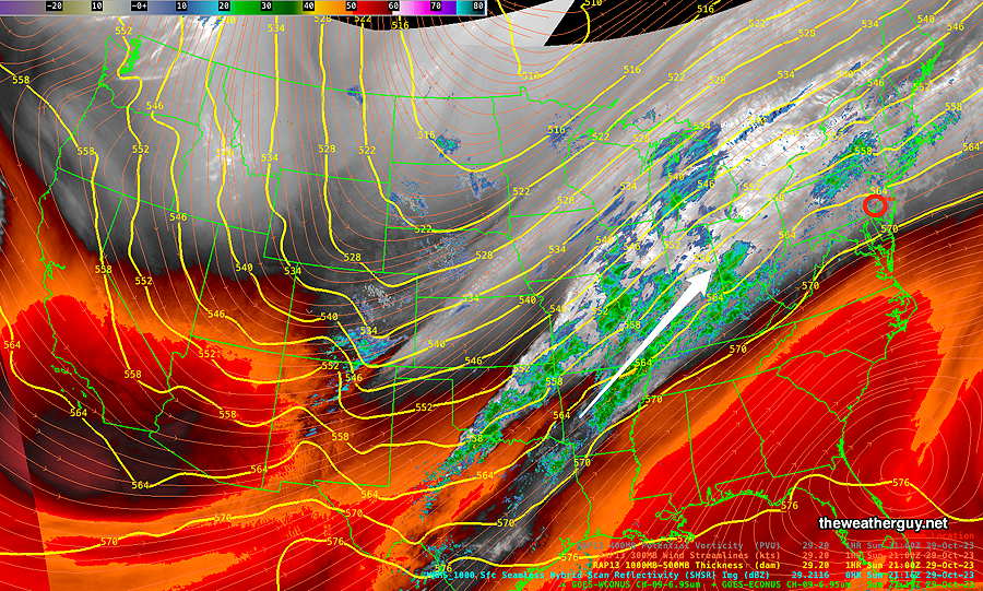
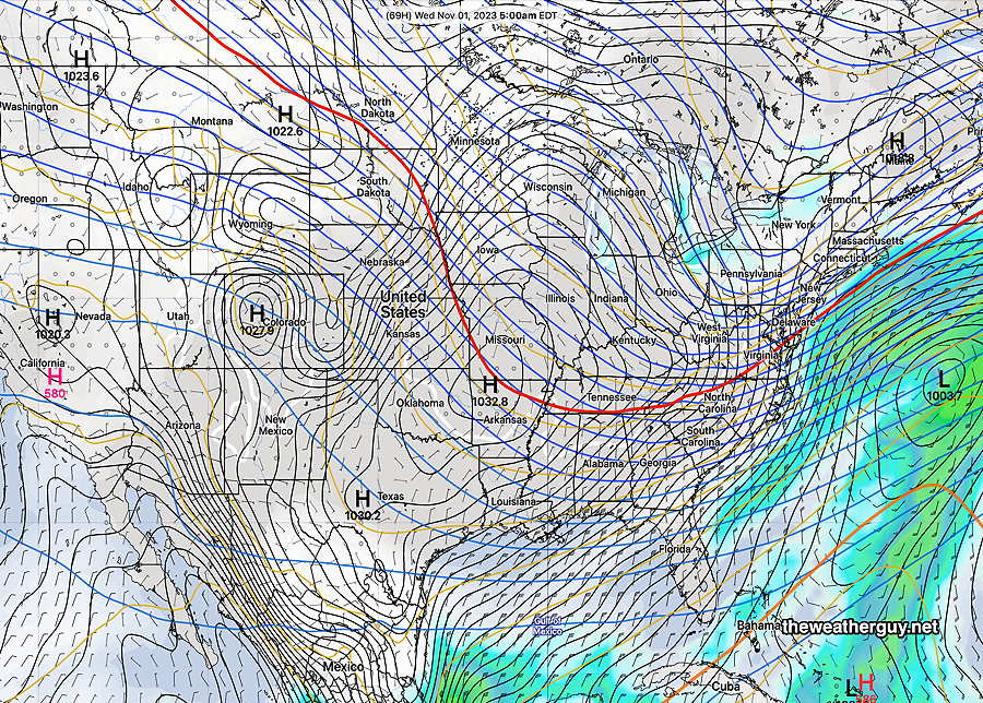
The upper trough visible over North Dakota will move eastward and be over us by Wednesday with much colder temperatures. (Click on image for a larger view.)
The actual front moves through our immediate area late morning on Monday. Ahead of the front, some additional showers are forecast to break out from the city and southeastward before daybreak Monday, but most of the energy with this front is moving up to New England.
Early morning sunshine will be replaced by cloudy conditions later in the morning and windy and gusty conditions as the front moves slowly through our immediate area.
By Wednesday, the trough will move moving over us, as low pressure develops in the western Atlantic.