
#Philadelphia #weather #PAwx
Wednesday
Posted Tuesday 01/30/24 @ 5:28 PM — Low pressure developing to our south will move off to the southeast. In the process, some colder air will move in for Wednesday in a narrow trough. We’ll have cloudiness on Wednesday for much of the day, the clouds breaking up towards evening.
By Thursday, high pressure and an upper air ridge to our west will move in and result in milder temperatures.
The ECMWF forecast for Wednesday afternoon captures the next two days—

Tuesday -Wednesday
Posted Monday 01/29/24 @ 5:33 PM — The low pressure system expected to develop in West Virginia Tuesday evening is expected to move to our south.
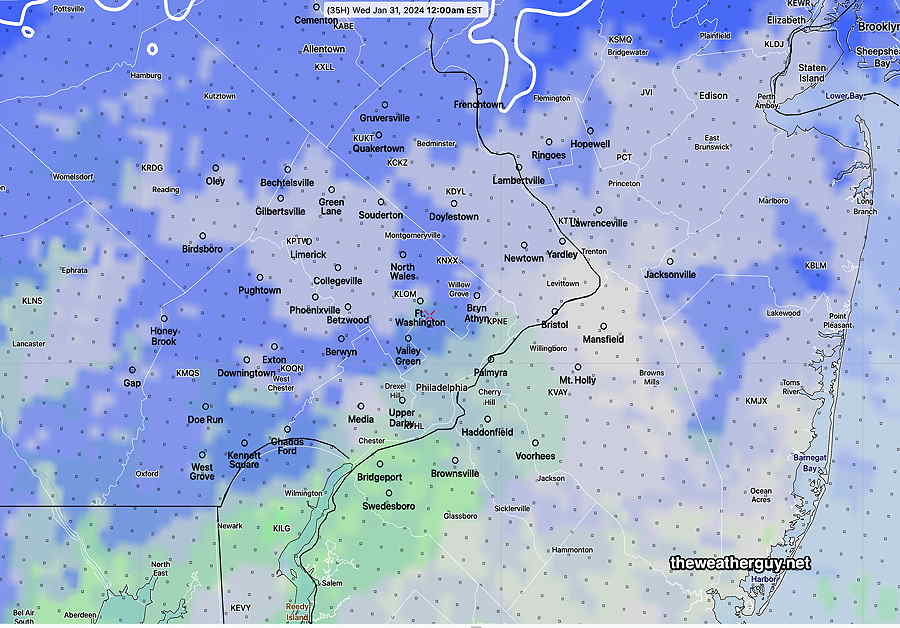
Some models are forecasting some light snow showers and mixed light snow/light rain during the late Tuesday afternoon and evening into Tuesday night. There may be a dusting/coating in parts of Lehigh and Berks counties by Wednesday morning.
With temperatures expected to be above freezing, no accumulation is expected in our immediate area.
Here’s the NBM forecast for precipitation type at midnight—
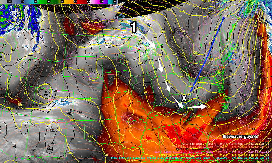
Originally Posted Mon @ 9:49 AM — This week’s weather will be characterized by a very amplified upper ridge in the west and a persistent colder trough in the east that reloads with colder air by the weekend.
The main jet flow will keep any storms, both in the northern jet and southern jet, to our south. (The position of this trough is looking a lot like last year’s persistent eastern trough, in the ‘wrong’ position for snow in our area.)
The forecast image below for the NAEFS captures the setup, expected to persist through the weekend.

Monday —Despite the some sunshine this morning (Monday), expect more cloudiness later this morning into this afternoon, but also with some breaks of sun possible at times. (an uncertain cloud forecast)
Energy dropping down (in central Canada) will cause a storm to form to our west Tuesday into early Wednesday, but light snow with this system should stay to our west and south—
So an interesting jet flow.
Colder over the weekend. Chance of possible snow next Monday.