
Things have stabilized somewhat with my family medical situation, and I will continue posting thoughts and commentary about the current weather over the coming days. For the time being, postings won’t be as frequent or comprehensive as they have been in the recent past.
Weekend Looking Better
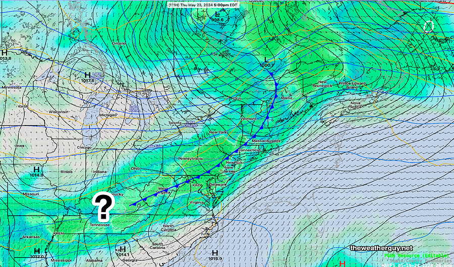
Posted Thursday, 05/23/24 @ 7:35 PM— Timing and position of various disturbances over the weekend continues to be in flux. The gist of this morning’s update still holds, but it would not surprise me if things change radically, either for better weather overall, or worse for Saturday and Sunday. Monday still looks rainy.
Additionally, the weather conditions will be highly location dependent. With a front that will stall to our south, distances of 30-50 miles east-west or north-south of Philadelphia can have very different weather at different times of the day both Saturday and Sunday.
Posted Thursday 05/23/24 @ 12:45 PM — The timing of various disturbances moving across the area will impact the sensible weather this weekend, at least through Sunday. A lingering frontal system will affect mostly South Jersey on Friday with showers. Philadelphia may see sun on Friday.
Another disturbance approaching on Saturday will result in scattered showers/thundershowers late Saturday into Saturday evening in Philadelphia. The Jersey Shore will likely be sunny through high clouds on Saturday. The showers move into NJ Saturday night.
Sunday looks quite nice both in Philadelphia and the shore. There may be some clouds at times at the shore.
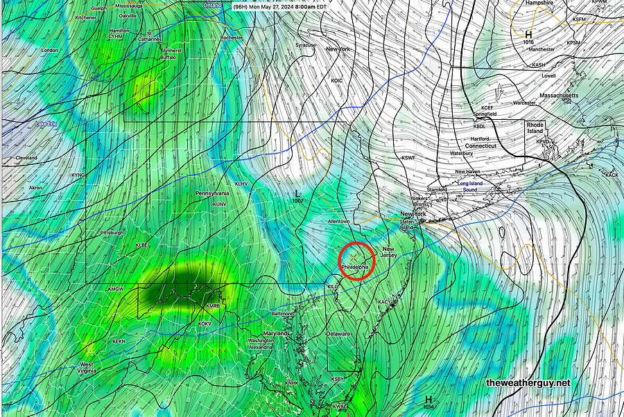
Monday looks cloudy and rainy. The heaviest rain in the early morning, but lingering cloudiness and scattered showers for the rest of the day with heavier rain developing again during the evening.
Posted Wednesday 05/22/24 @ 4:18 PM — Recent model runs have accelerated the passage of the cold front. Originally expected to move through late Thursday, the latest models have showers, perhaps with some thunder, moving through Thursday morning. No major storms are expected. (There’s even a chance of some showers moving in this evening (Wednesday), especially western sections.
Showers may linger through Thursday afternoon and evening as the front slows down.
There’s much uncertainty in the weekend forecast. The Canadian global model has significant rain for us over the weekend. NOAA has been doing planned maintenance on their main server today, and I don’t have the latest NAEFS.
The weekend may be saved by the changes in timing of the next disturbances. It’s possible that shower activity will occur during the evening Saturday instead of the daytime hours. This especially true at the shore.
Sunday does still appear to have showers in the afternoon as does Monday.
Here’s the latest ECMWF forecast for 2 PM Monday—
Posted Tuesday 05/21/24 @ 3:57 PM — What’s really catching my interest over the past week is the extraordinarily high temperatures for May I’m seeing in Florida and Texas. Such severe high temperatures this early in the season is of great concern.
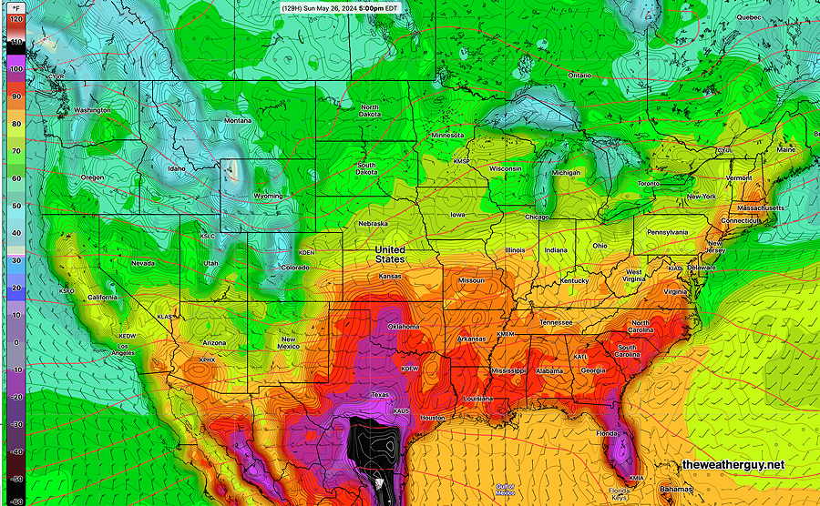
There is evidence that these severe temperatures will be in our area sooner rather than later this upcoming summer season.
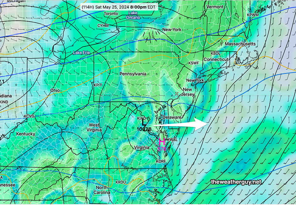
Posted Tue, 05/21/24 @ 11:00 AM— The next notable weather events this week and the upcoming Memorial Day Weekend will be a cold front that moves through later Thursday afternoon/evening and stalls east-west, becoming a focal point for low pressure development.
First, Thursday’s cold front will have plenty of thermodynamic energy for thunderstorms, BUT a weak jet flow and a weak anticyclonic curvature to the upper air winds may limit the development of locally severe weather. Most models are consistent with the heaviest rain and storms to occur to our north and to our south (in Maryland), somewhat skipping the immediate Philadelphia area. Total rainfall in the immediate PHL area will also be limited to under 1/2 inch of rain, as currently forecast.
The Memorial Day Weekend weather outlook is looking less than stellar. The cold front will stall to our south and areas of low pressure are expected to bring several periods of rain/showers Saturday through Monday. It’s too early to time these rainy periods.
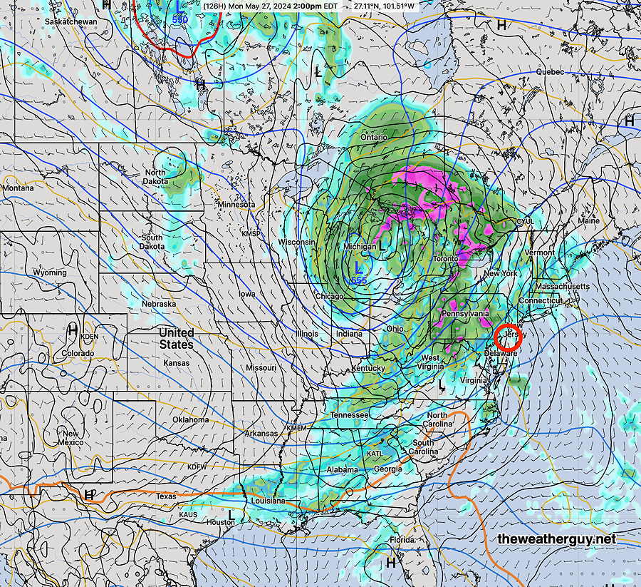
Here’s the latest NAEFS forecast for Saturday evening—
There’s still time for the weekend outlook to improve, but this is how it appears to be shaping up right now.
Previously Posted Sun 7:07 PM —
We finally have some sun and the first part of this upcoming week should feature sunshine and increasing temperatures.
The current water vapor image captures all the elements for this coming week’s weather—

Temperatures will likely get into the mid to upper 80s by Thursday.
Here’s the current NAEFS forecast for Thursday afternoon. A cold front will move through, likely with thunderstorms, and the front may stall east west to our south. —
The upcoming Memorial Day Weekend is likely to start reasonably nice (but cool) but with an increasing chance of showers and clouds from maybe Sunday and more likely into Monday. Much uncertainty, but this is how things look now.