So, I’m wrong about my previous revised forecast. I’m waiting for the changeover to sleet to happen and we’ve already exceeded the snow total I had forecast. It’s clearly not happening as predicted by the NAM and NAM-NEST.
I decided to look at the latest HRRR and the NBM, which I had banked on last night and then abandoned in deference to the NAM this morning.
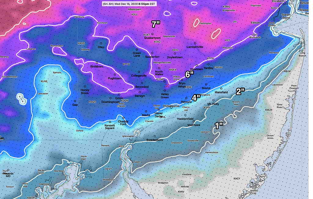
The HRRR shows the changeover from snow to sleet occurring at 9 PM but a switch back to snow after midnight. The HRRR cranks out a much more impressive snow amounts—
Latest HRRR snow totals (Click on image for a larger view.)
So we’re back to 3-6 inches snow for Philadelphia and immediate western suburbs. I’ve learned something. That’s what makes this so interesting. The NAM isn’t going to cut it going forward (I guess there’s a reason that NOAA has abandoned development since 2018.)
Hopefully, there won’t be further upgrades in the snow totals. Maybe I have to come up with a new blog category, “Mea Culpa”?
Despite the impressive snow falling at 3 PM, the revised forecast of only 1-2 (3) inches in the Philadelphia area and immediate northern and western suburbs remains on-track from this morning’s update.
Based on radar, the changeover has just moved north of the Delaware-PA state border.
The high winds (50-60 mph) are still expected this evening and night-time hours.
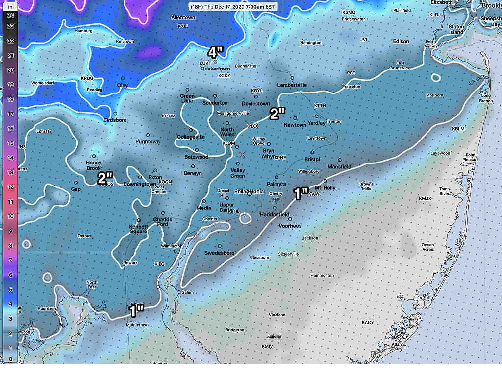
The latest NAM and NAM-NEST continue to show warm air entering the region at 6000 feet (800 mb) with a change to sleet, freezing rain and rain in the 6 – 8 PM timeframe. The higher resolution NAM-NEST shows a possible alternation of precipitation types during the evening hours, especially far north of the city. A changeover to back to snow will occur 2- 5 AM depending upon location. The snow will gradually taper during the morning hours.
The latest NAM NEST snow totals—
Latest NAM-NEST snow totals by 7 AM Thursday (Click on image for a larger view.)