
#Philadelphia #weather #PAwx
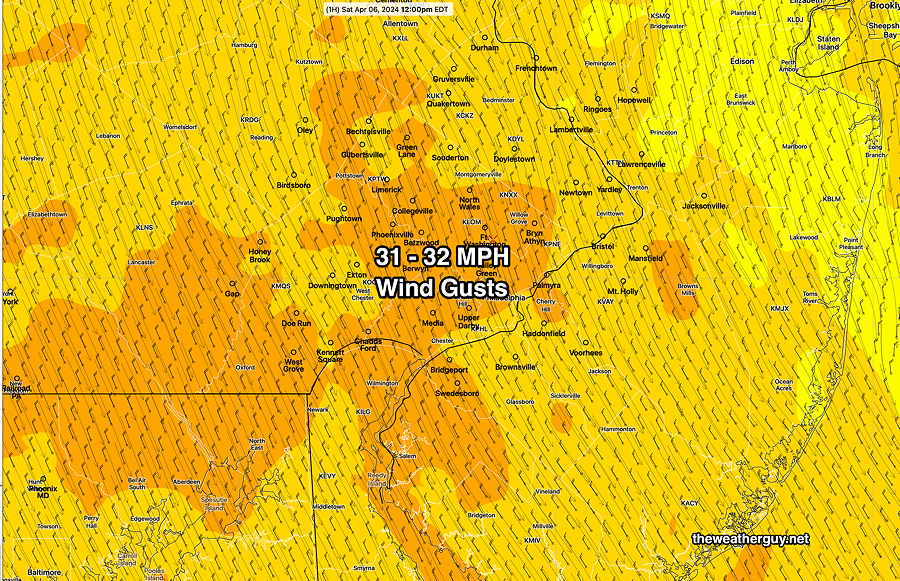
Here’s the actual wind gusts at noon today—
Additionally, there are light sprinkles moving through the area, not forecast by any of yesterday’s models.
I took a look to see if any model last night had forecast these mid-day sprinkles and last night’s 06z ECMWF (not available until this morning) got this right.
However, the NAM-NEST missed it, as did the HRRR, HREF and Canadian models. I’m surprised by that.
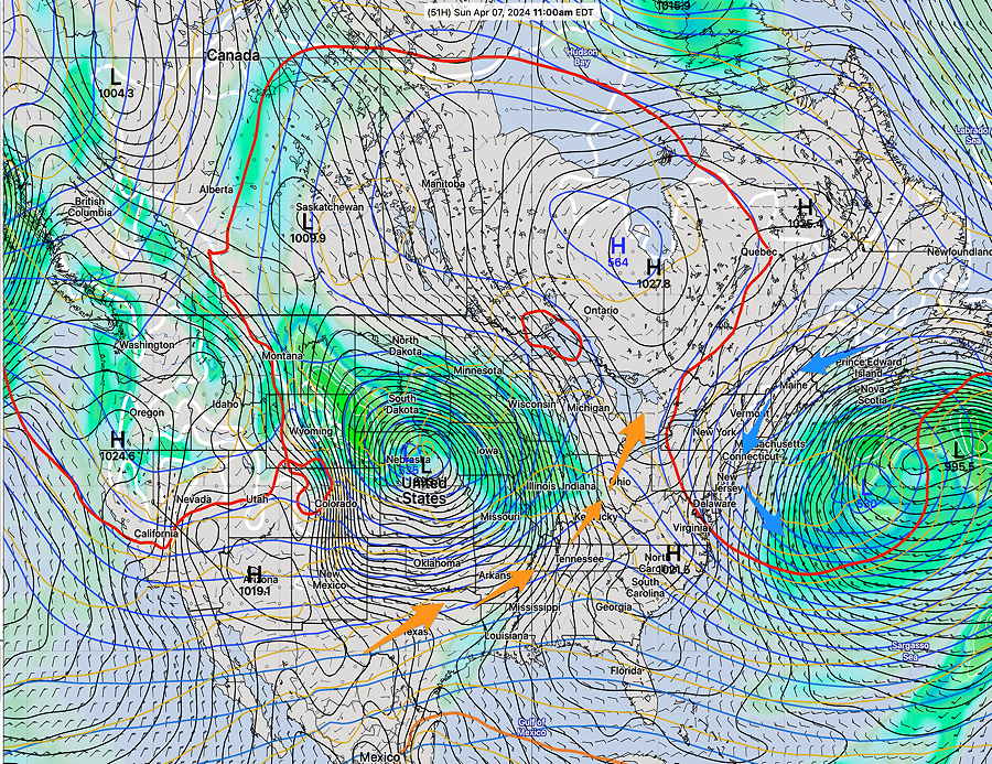
Originally Posted Fri 7:27 PM —The deep upper and surface low of the New England coast will gradually move eastward. We’ll still be in the colder upper cyclonic flow through most of the weekend.
A warm upper ridge is poised to move in starting Monday, however, another storm system is expected by Thursday.
Here’s the current NAEFS forecast synopsis for Sunday at 11AM showing the departing upper low—
Saturday
Saturday’s weather will be similar to the past two days. Considerable sunshine in the morning with clouds and sun in the afternoon. VERY WINDY and gusty. Showers/sprinkles increasingly unlikely. Sunshine very late afternoon.
NBM high temperatures: Blue Bell, PA 52º Philadelphia, PA 54º
Average to low uncertainty (based on standard deviation): ± 1.5º
Sunday
Sunday will be similar to Saturday. Probably no sprinkles. A bit warmer and less windy.
NBM high temperatures: Blue Bell, PA 54º Philadelphia, PA 56º
Average to low uncertainty (based on standard deviation): ± 1.7º