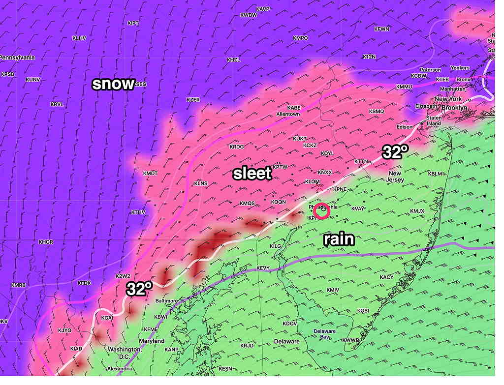
Last night’s models left us in two camps with different predictions about the amount of sleet and rain that will mix in this evening, with the effect of reducing total snow accumulations.
As explained in yesterday’s post, while the “main” model runs are done at 00z and 12z, many models are re-run six hours later at 06z and 18z. At this time of the morning, we have the 06z (1AM) model runs to see what trends have developed.
Here are the trends—
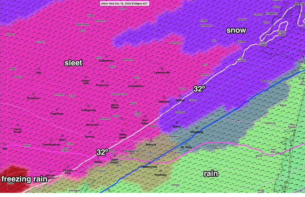
- Snow starts between 12 and 2 PM today
- Change-over to sleet and rain 6 PM- 11 PM
- High gusty winds 40-50 mph this evening
- Change back to snow after midnight
- Snow ends 7-10 AM Thursday morning.
The NAM and NAM-NEST continue with significant sleet and less snow, while several other models which had similar sleet forecasts (Canadian GDPS and RDPS) have more snow now.
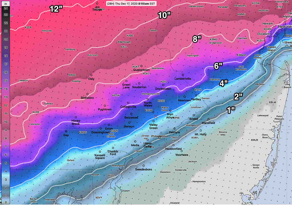
At this point in the model cycle, the NBM (national model blend) 50 percentile forecast is the one to hang one’s hat on and the model’s statistical blend allows us to see the two different camps.
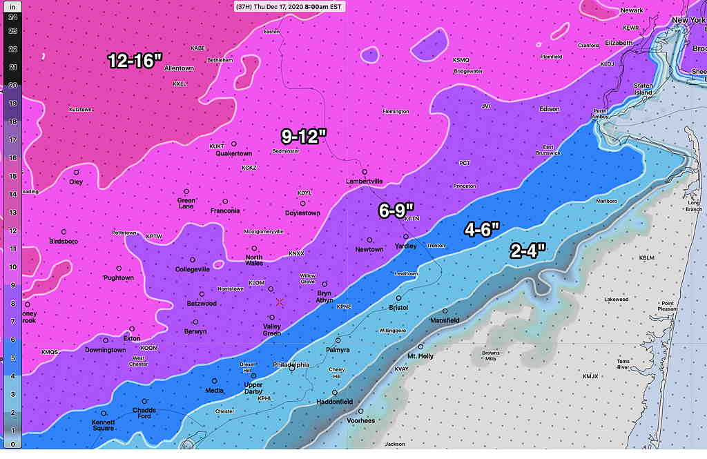
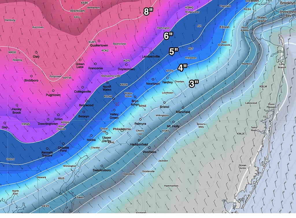
First, let’s look at the 25 Percentile—
The NBM 25 Percentile (meaning that only 25% of its model components have this forecast as its maximum snow depth—
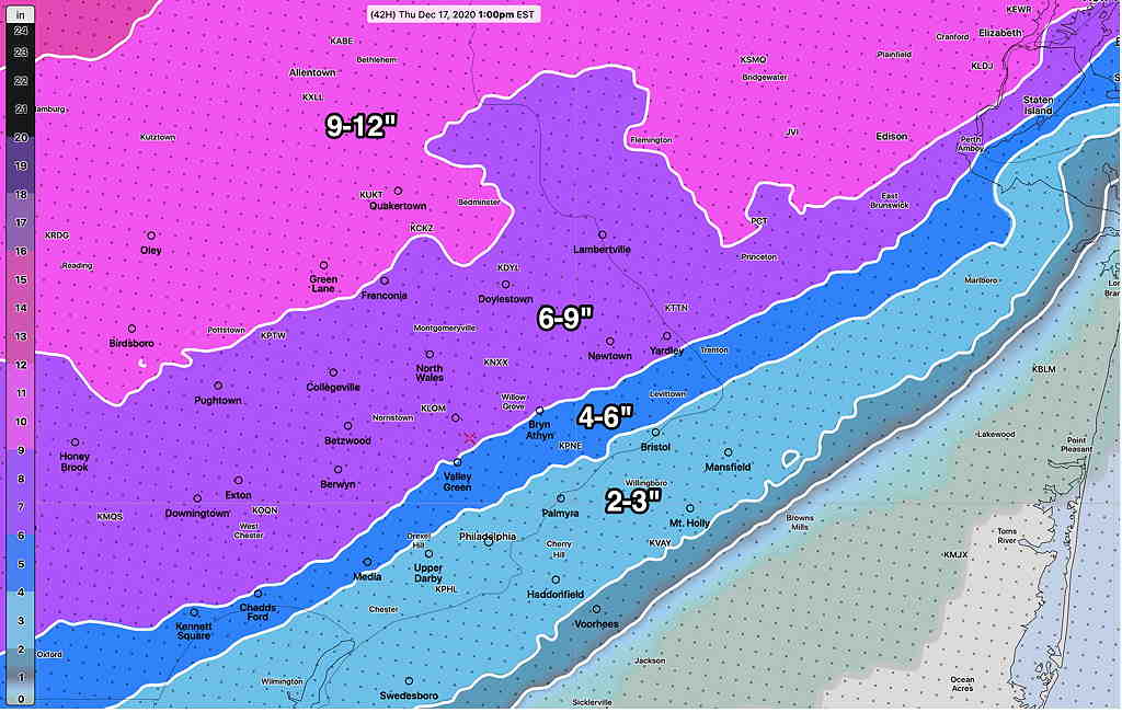
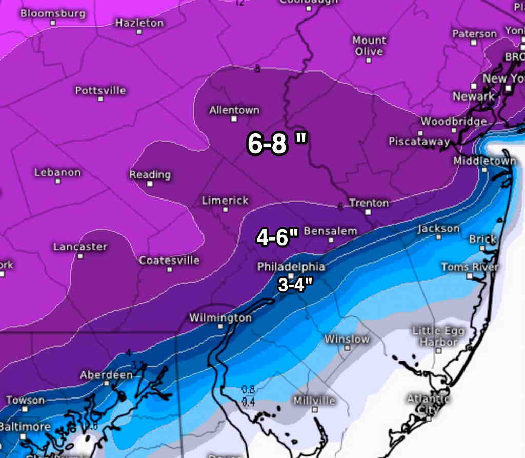
The NBM 50 Percentile (half of its models are above this value, half are below) is most representative of the current GFS, HRRR, CMC and ECMWF forecasts.
This is most likely total snow accumulations to expect—
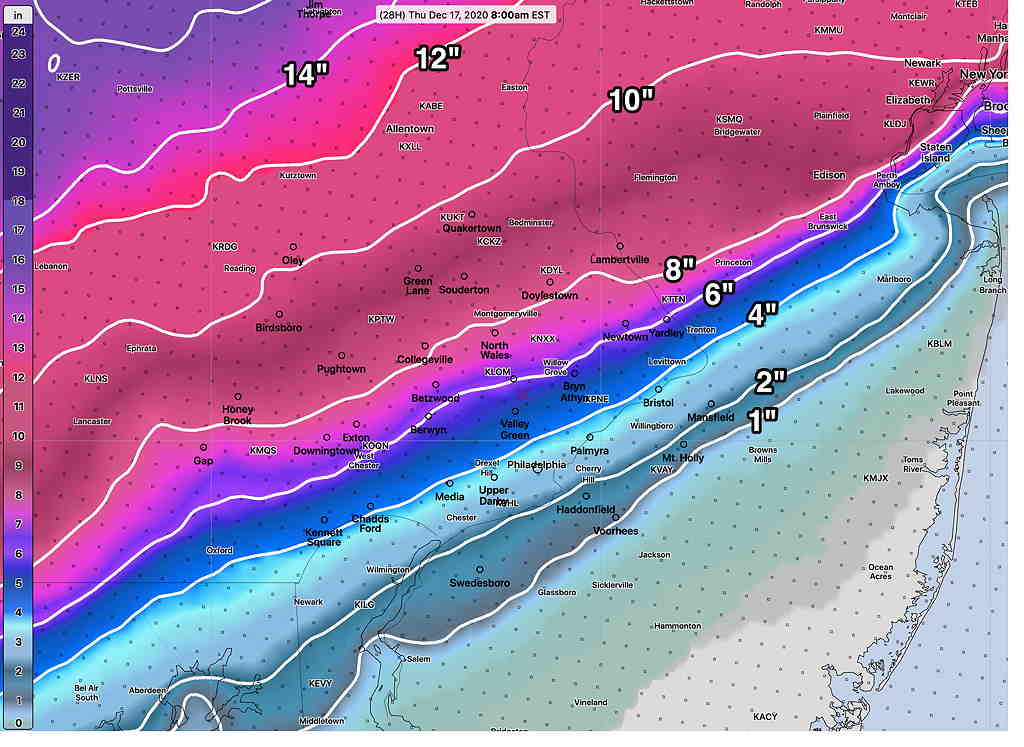
The above 50 percentile is the most likely snow totals to expect with this storm by Thursday morning.
I’ll keep an eye on things. Stay tuned