
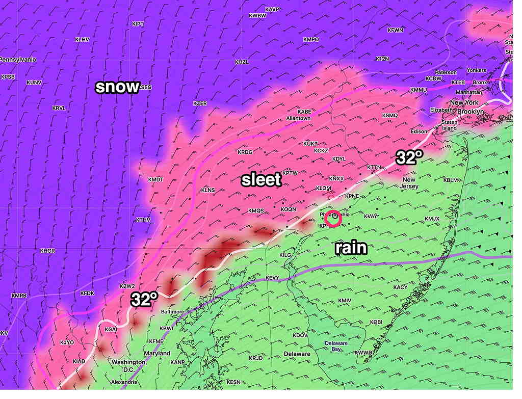
Tue 04:31 PM Update — This afternoon’s NAM captures the expected decrease in total final accumulation (3-5 inches in the PHL area immediate suburbs) due to a changeover to sleet and even rain for several hours during Wednesday evening. (It will change back to snow)—
I’ll be doing an update around 10 PM this evening with the latest model info.
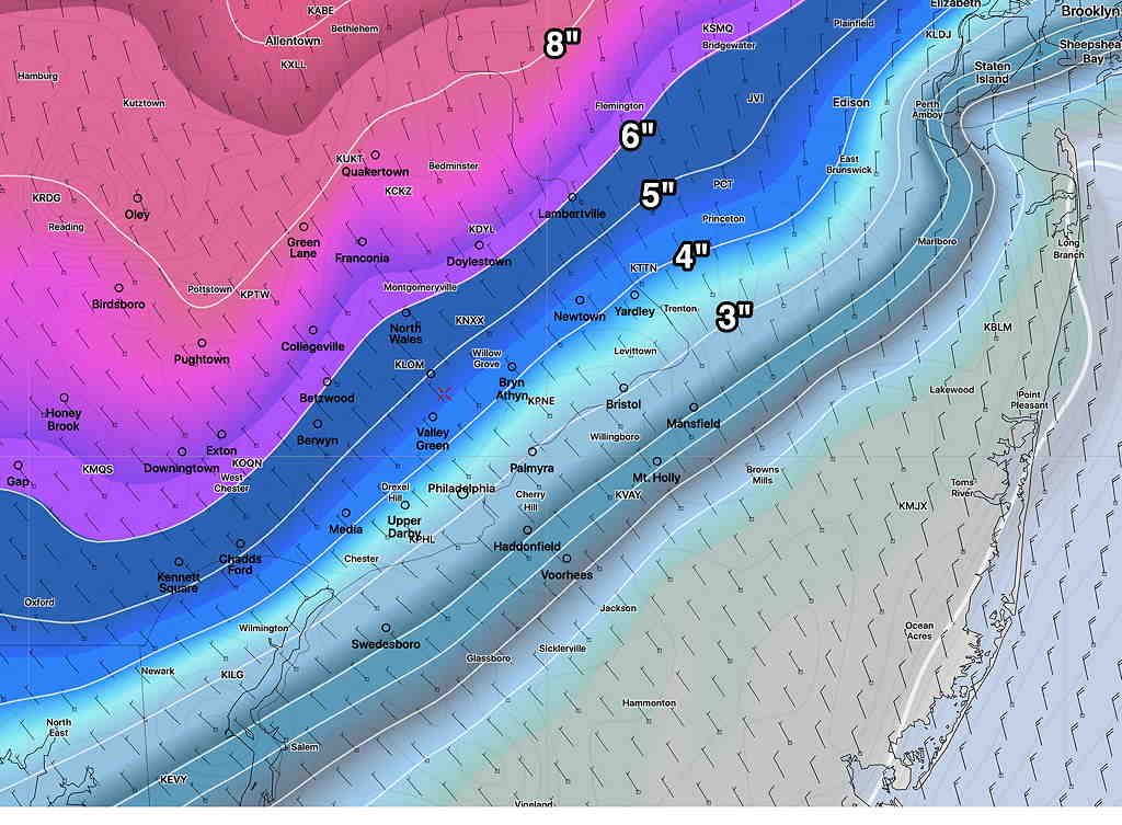
Another update: here’s the latest ECMWF (European) snow total forecast:
from earlier today…
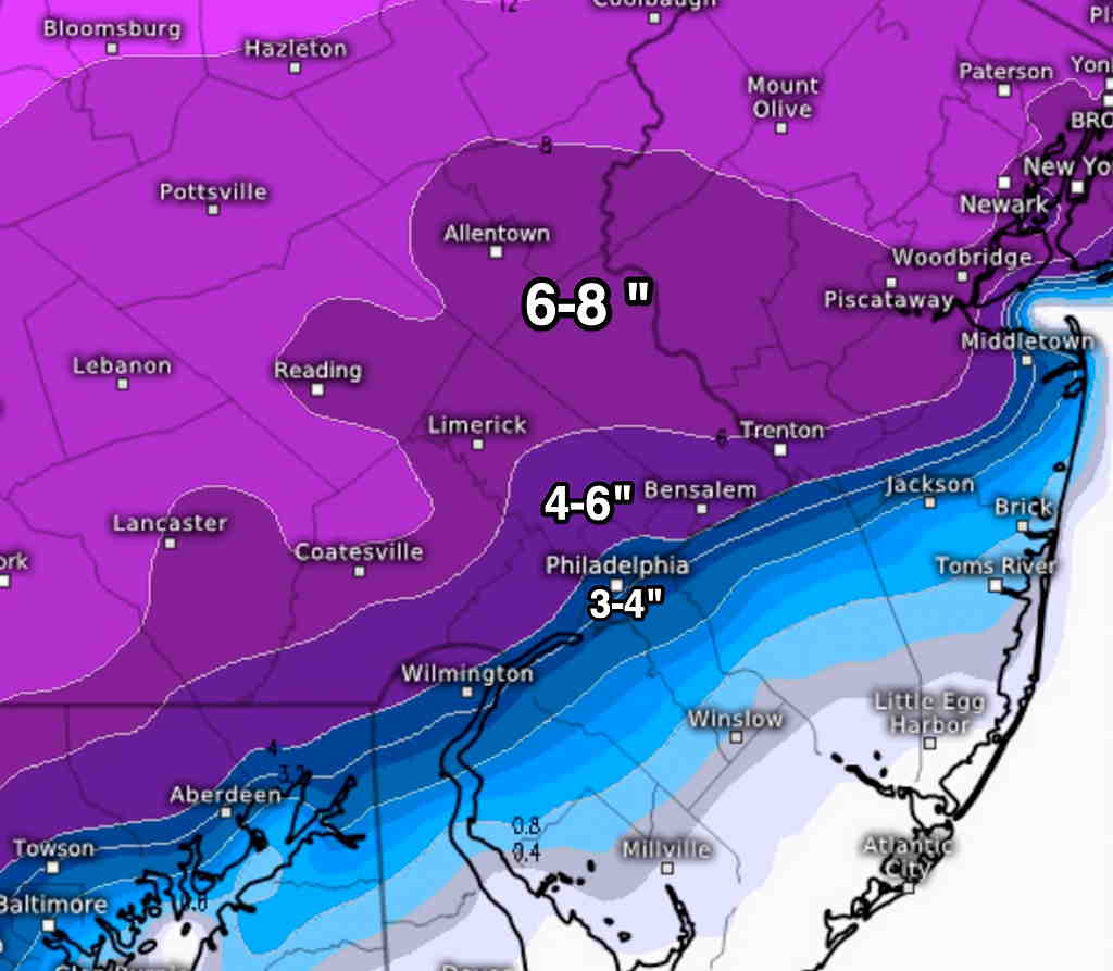
This morning’s later models (Canadian HRDPS and Regional GEM, GFS) continue with the trend of the NAM and ICON models from last night and this morning— of having more warm air aloft in the PHL area and immediate western suburbs reducing forecast snow totals
No time right now to provide a graphic, but snow totals have reduced to 3-5 inches in the immediate PHL area and immediate suburbs with a rapid tail-off lower going east.
I’ll be updating later…
Thanks a lot – do you know when the snow will be starting on Wednesday?
The start time is still 12 PM to 2PM, depending on your location