Update Sat @ 9:30 PM — Sunday’sforecast for sunshine still looks good. High 49° ± 2°. Watching the Monday forecast.
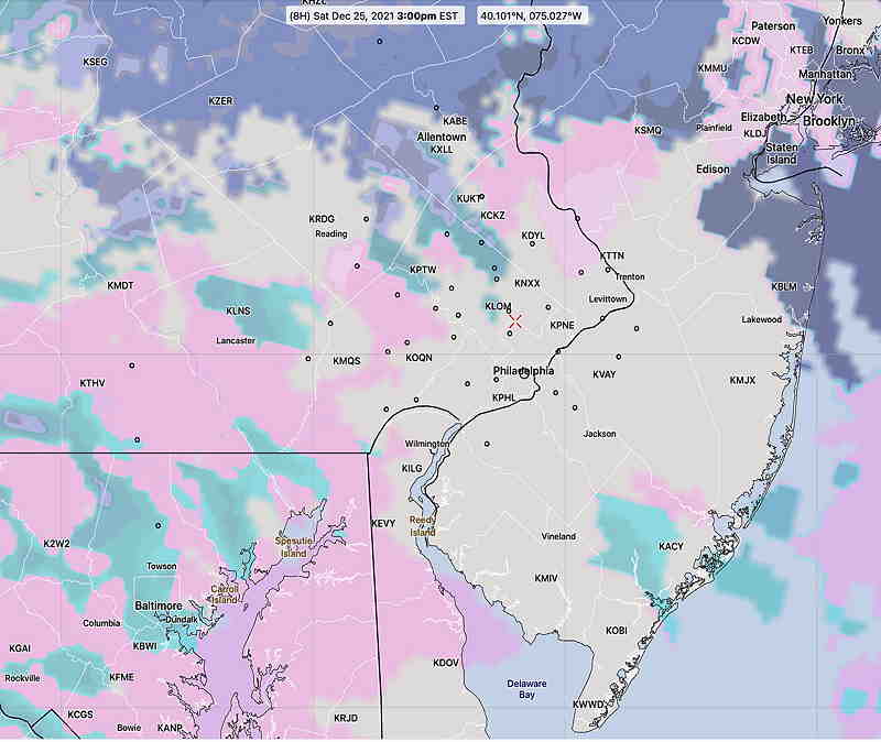
This morning’s latest HRRR and RAP models have the sun breaking out between 2 and 3 PM in many areas.
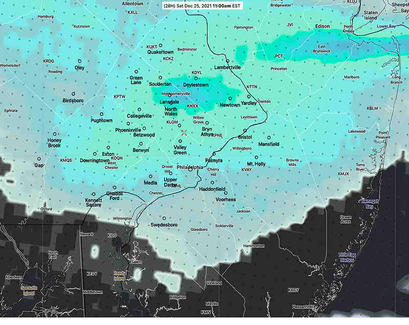
HRRR 12z – Cloud ceiling height forecast for 3 PM Saturday. Many areas will have breaks in the overcast and sun at times. (Click on image for a larger view.)
Updated Sat @ 7:36 AM— Merry Christmas! The forecast specifics for today remain hard to pin down time-wise. The general trend is that there will be showers early, then a break and even some sun for a bit, then more showers about noon, followed by another break and even some sun about 1-2 PM, then more clouds and showers.
High temp 55.6º ± 3.7º Blue Bell based on the latest NBM model. (The high standard deviation -3.7º reflects the uncertainty in the model forecasts for today.)
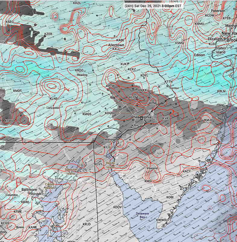
The current radar doesn’t match favorably with any model forecasts, so it’s still a lower than usual confidence forecast.
Sunday still looks sunny.
A low pressure system in western NY state will have it’s associated warm front move through after midnight tonight (Friday). It’s associated cold front will move through during the evening Saturday. The front will stall to our south and return on Monday as a warm front. In between, Sunday will be sunny.
There’s been a lack of clarity about Saturday’s forecast details, as covered in my previous post.
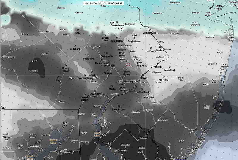
NAM model forecast for 8 AM Saturday. Showers depart early morning, but the showers well ahead of the associated cold front arrive late morning. (Click on image for a larger view.)
Saturday
The showers associated with the warm front will move through before daybreak and into the early morning. There’s been a lack of clarity regarding the early morning showers placement, but I’m going to lean on the latest NBM to make the call.
Most models are in agreement with showers returning late morning well ahead of a weak cold front. (The main front moves through on the evening.) Showers will be light. It will become WINDY late morning. There may be some clearing after 1-2 PM although that’s not a certainty.
High temperature 56º ± 3.0º (NBM Blue Bell)
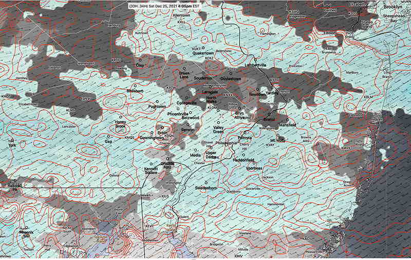
NBM (20z) clouds and precipitation 3PM. Some clearing but high uncertainty about cloud cover (red contours) with showers remaining north. The showers to our west move in the late afternoon and evening with the cold front.
The main cold front moves in in the evening (possibly with additional showers, but a low chance.)
Sunday
The front moves to our south and fair weather moves in. It will still be mild.
High temperature 50.3º ± 2.4º (NBM Blue Bell)
Looking Ahead…
The front that moved through Saturday will return as a warm front Monday. There’s the possibility of light, non-accumulating snow early Monday morning.
Update Fri @ 10:37 AM — Some of us woke up to some snow pellets (graupel) on the ground from an upper air disturbance that went through about 2 AM. ( FYI – was predicted by the models, but not mentioned here.)
Today, Friday, mostly sunny although a few areas will have some brief periods of cloudiness.
Clouds move in about 4-6 PM this evening.
I’ve updated this forecast from the update earlier this morning. The NAM-NEST kept the showers to our north as shown below. The HIRESW models have more showers in the Philadelphia area on Saturday.
Saturday- cloudy early, then some breaks of sun, then cloudy again. The latest NAM-NEST has the showers Saturday remaining north of our area for the morning and early afternoon—
NAM-NEST forecast for Saturday 10 AM shows areas of clouds and sun over our area with rain from Quakertown northward.
But the HIRESW models have showers as early as mid morning Saturday. So uncertainty remains about Saturday’s cloud cover and showers.All models keep the showers very light (< 0.10″)Further complicating things is that the HREFensemble has clearing skies mid afternoon.
HIRESW-ARW 2.5 KM model shows heavier showers further southward than the NAM-NEST at 11 AM Saturday. (Click on image for a larger view.)
High temp 54º ± 3º Becoming WINDY in the afternoon.
Showers move in later Saturday afternoon with the “cold” front, according to the new NBM—
The updated NBM (13z) is closer to the HIRESW and HREF showing showers in the morning, then partial clearing and windy in the afternoon.
Sunday will be sunny. 50-52º Still above average temps.
I’ll try to nail down the details with tonight’s “Weekend Weather Forecast”.
Update Thu @ 7:19 PM — The main scenario with a warm front followed by a cold front moving Saturday remains intact, although the low pressure system and fronts will be moving through about six hours earlier than previously forecast. Clouds move in Friday afternoon, as warm air aloft moves towards over us.
There’s a lack of clarity for Saturday’s forecast details. The general trend is for milder weather (50-53º) (53º ± 4º. The unusually high spread captures the uncertainty in the forecast.). Some showers in the early morning mostly north of the city, but the model blend (NBM) has some very light (0.01″) sprinkles moving in here early afternoon. Clouds in the morning, possible breaks in the clouds late morning, but overall cloudy. Becoming VERY WINDY late afternoon and early evening.
So very little rain Saturday, but enough clouds and wind to reduce the full enjoyment of the mild temperatures.
Skies clear for Sunday with temperatures somewhat chillier, but still above average seasonal norms. It will remain windy.
I’ll try to nail down the details with tomorrow’s “Weekend Weather Forecast”.
Update Wed @ 9:47 PM — Christmas eve will be dry and relatively mild with temps in the 40s.
We’ll find ourselves Saturday with an approaching warm front with showers developing by afternoon, especially north of the city. While it will be mild on Saturday, things really warm up Saturday night after the warm front moves north of us. VERY WINDY!
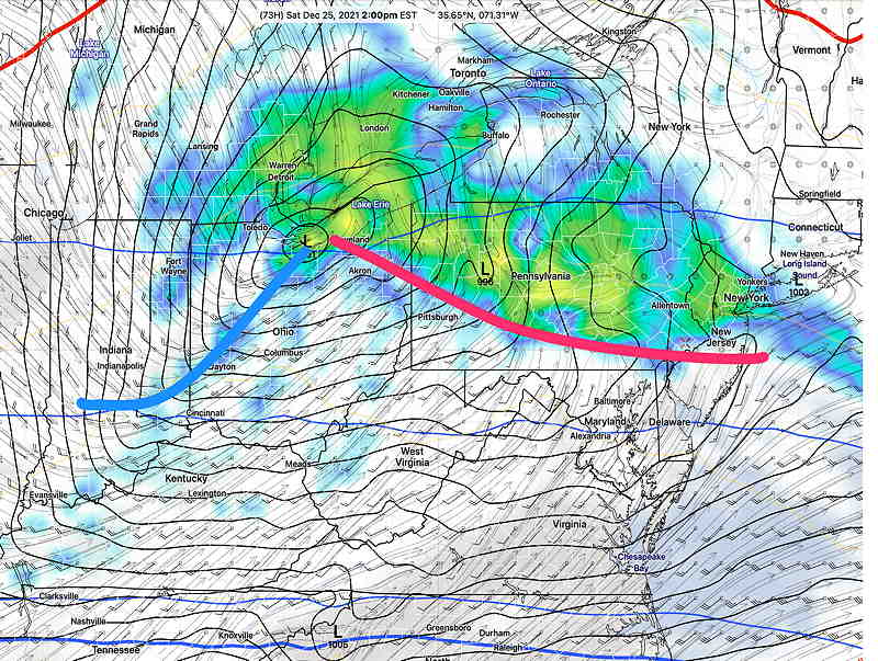
GFS forecast for 2 PM Saturday (Click on image for a larger view.)
A cold front moves through after midnight Saturday with windy conditions and somewhat cooler temperatures for Sunday.
Update Wed @ 6:45 AM — Saturday is looking wetter than previously forecast. Updates this evening.
Previously Posted Tue 6:06 PM —
Our uneventful weather continues this week, as the cold air we have on Tuesday will be gradually displaced by milder air by Christmas and the weekend.
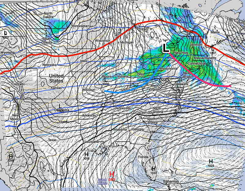
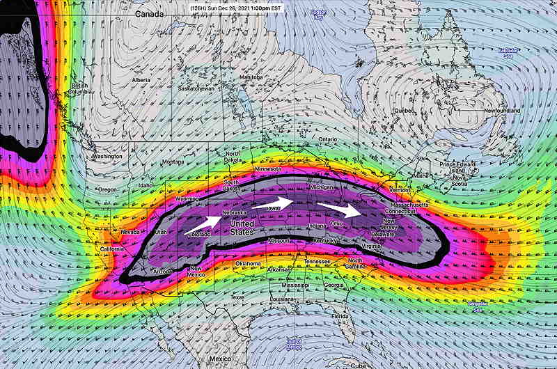
GEFS jet stream wind flow forecast for Sunday 1 PM. (Click on image for a larger view.)
The extended range ensemble models continue to forecast this flat ridge flow. There will be weak disturbances that move through this flat flow, giving us varying amounts of sunshine or clouds, depending upon the day. The weekend will be relatively mild with highs on Saturday near or above 50º (±3º) and Sunday in the upper 40s!
(Seasonal average highs are 42º – Blue Bell and 44º – Philadelphia.)
There may be some showers on Saturday, although the current GFS is down-playing those. There will be cloudiness at times from these weak disturbances, but there may be some sunshine for us over the weekend as well. Timing these weak disturbances will be main forecast challenge.
No snow is forecast at this time through the end of year! Of course, the pattern may change.
I still don’t detect any buildup of very cold air in Canada. (I mean minus 40º F, not the ‘mild’ minus 25º currently in place. ) Also absent is the usual extremely cold Greenland. It’s just very cold, not extremely cold.