Category Archives: Weather Updates

SATURDAY FORECAST UPDATE

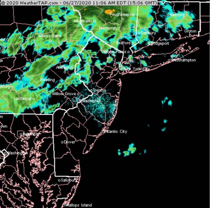
[su_note note_color=”#ffffff”]Updated Sat 11:14 AM — After looking at this morning’s models, I’m trying to get out for a bike ride before the next batch of showers moves in.  To my surprise, here’s the current radar—

NEXRAD Radar 11:06 AM courtesy of WeatherTAP.com

I’m looking back at all the models.  The Canadian High Resolution  (HRDPS) model which isn’t bad but its timing is often not correct, has these rounds of showers moving through during the late morning and early afternoon. [/su_note]

What I meant by uncertainty in the forecast from last night is when we get showers moving through this morning not predicted by last night’s models.

(This morning’s showers WERE predicted by some of the late night models (2AM EDT runs) that became available around 4 AM.)

So what can we expect of the rest of the day?  I’m going to approach as a probability forecast, not a deterministic forecast.

Here’s the latest model blend (NBM) 1 hour rain probability for 5 PM Saturday afternoon—

NBM Model blend 5 PM – 1 hour precip probability (Click on image for a larger view.)

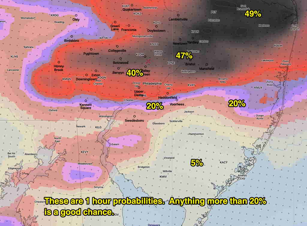
Note that these probabilities are 1 hour probabilities and generally anything greater than 20% is meaningful.

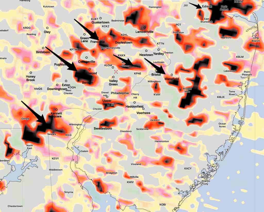
The NAM model just available this morning has showers and thunderstorms developing 2:30 PM northwestern suburbs and moving through between 3 and 6 PM.  The NAM’s showers are more widespread.

Southern areas will be least affected today, according the the model blend, but the NAM has a wider area affected.

THURSDAY THUNDERSTORM UPDATE

[su_note note_color=”#bceaed”]Forecast Review— The HIRESW models did the best with this forecast. The 11 AM -1 PM timeframe was very close. The RAP model picked up the early morning showers. The NAM and NAM NEST over-predicted the second line of showers during the afternoon.[/su_note]

Last night’s early models showed considerable spread with the timing of thunderstorms and showers today. I’ve had more time to look at those models as well as subsequent newer model runs from 2 AM (“06 Z model runs”).

So what’s happening?

The surface front moves through between 11 AM and 1 PM today with showers and thunderstorms as previously forecast.  Prior to this time, expect windy and gusty conditions and possibly some scattered showers ahead of the front.

However, at the upper/mid levels of the atmosphere, additional disturbances (areas of “vorticity and vertical motion”) continue to move through in the upper level flow during the afternoon.

NAM NEST Vertical Velocity 700 mb (10,000 feet) at 3 PM  (Black= maxima)  (Click on image for a larger view.)

The actual upper air trough moves through slowly with these areas of vorticity triggering showers.   Additional scattered showers and thunderstorms are possible during the afternoon until the upper air trough moves through.  The NAM NEST shows this activity may be most enhanced at 2-4 PM.

CHANGE IN FORECAST

The model runs done at 2 AM (06 UTC) show some large changes in the forecast.

I’ve put the posts earlier this week under the title “Forecast Uncertainty” because there’s been a disconnect between the GFS model (and also the Canadian model) and the higher resolution models (NAM, NAMNEST, HIRESW, and HIREF.)

Last night, the higher resolution models changed their tune.

In essence, they now lean towards the GFS model which has been most consistent about having most of the energy move to our far north and east earlier in the afternoon, with a second line moving mostly to our south.

The earlier line looks to stay north of Trenton.

The immediate PHL area will get some thunderstorms, but they don’t look to be too severe. Most likely timing is 5-6 PM. 

This morning’s most recent HRRR also has become less impressive with the storms in our area.

Could things change again with this morning’s models?  Yes.  But what had looked to be a very stormy 8 hours now appears to be run of the mill late afternoon thunderstorms.

It’s always more prudent for a forecaster to maintain a forecast that’s more dire, “just in case”, but you’re here to get the real scoop, not the hype.