#Philadelphia #weather #PAwx #Drought #Hurricane
Sunday Rain Update
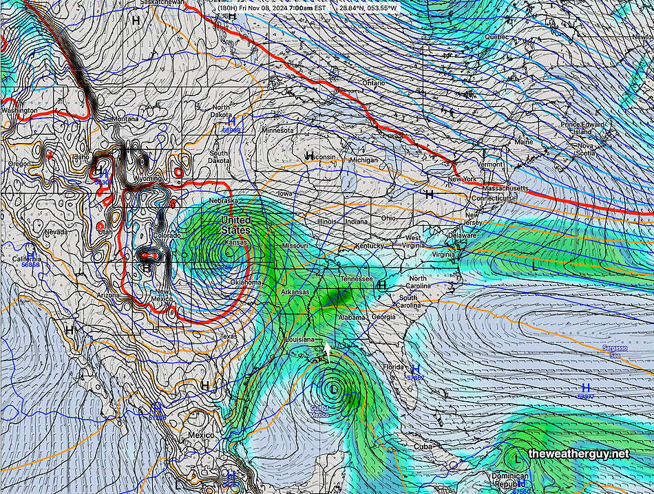
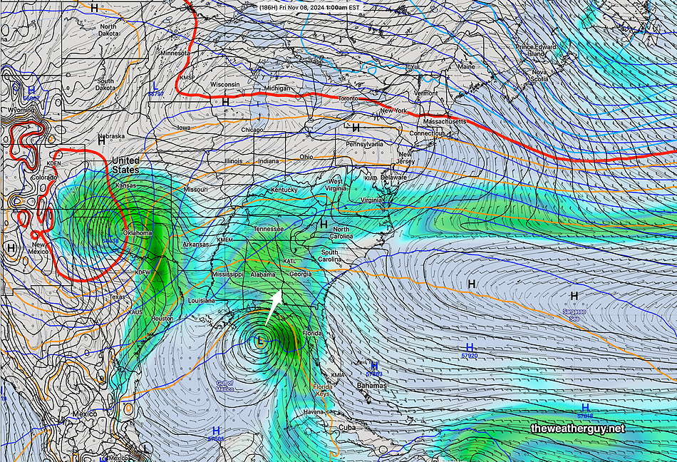
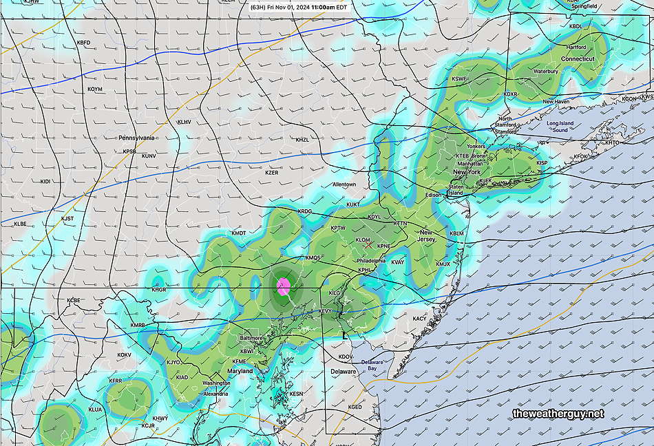
Posted Thursday 11/07/24 @ 8:19 AM — We may finally get some rain on Sunday, which has been a somewhat consistent forecast. What has been inconsistent and changeable is the amount rain based on the available moisture all dependent upon the track of Rafael and its moisture outflow. The main trigger for any rain here remains a cold front and a low pressure system in the Midwest.
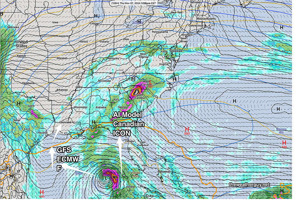
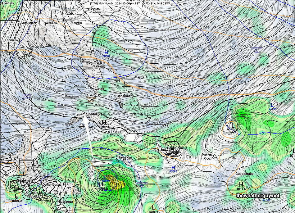
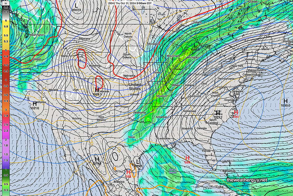
Complicating this forecast is the likelihood of two tropical systems—
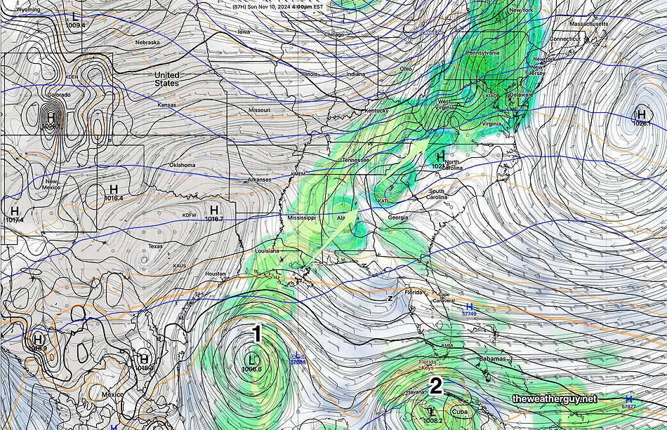
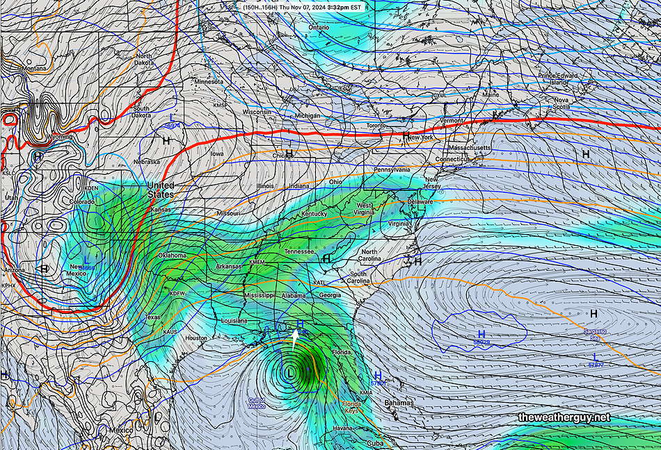
The models still lack agreement about Rafael but are trending towards yesterday’s GFS with a loop and eastward track that never makes landfall on the Gulf coast. As has been the case all week, a reasonable rainfall here is dependent on moisture at least indirectly from Rafael.
Many models are down to forecasting only 0.20″ of rain. The ICON model shows as much as 0.60″ due to more moisture from Rafael.
This will not be a drought buster by any stretch.
Forecast Update
Posted Wednesday 11/06/24 @ 4:04 PM —Hurricane Rafael continues to confound the forecast models. The AI version of the ECMWF, which did so well with Milton and Helene, also seems to be having issues forecasting the movement of this storm although it did quite well predicting its formation and movement to this point.
Most most models have the storm lingering off the Gulf coast or being sheared off and absorbed in the general flow. Even the German ICON has joined this forecast. An exception is the deterministic ECMWF which has it moving southwestward towards Mexico and this path is supported by the NOAA hurricane model, the HAFS-B—
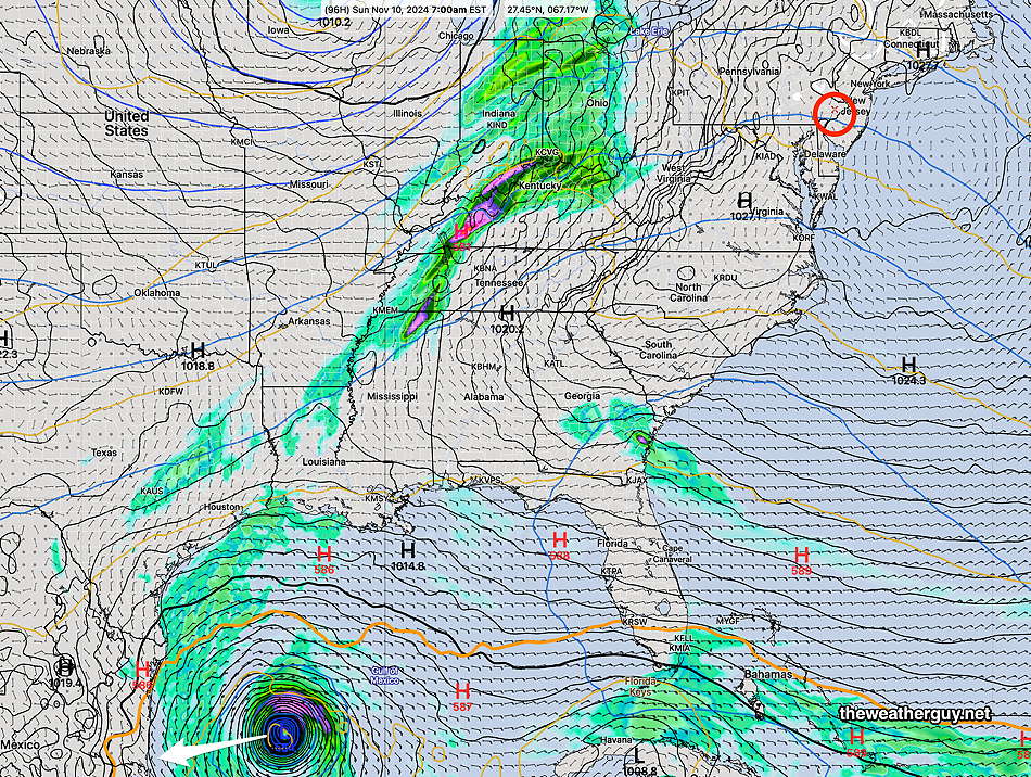
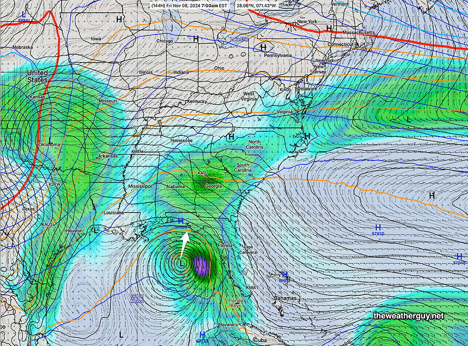
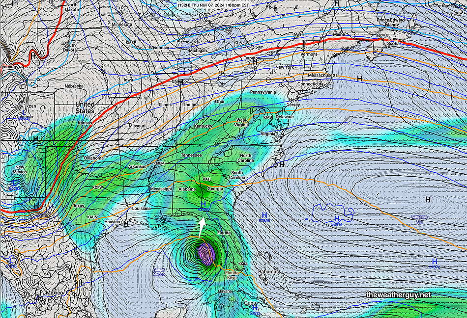
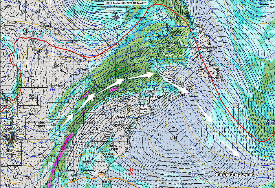
The current GFS is similar to the latest ECMWF-AIFS and continues to be the forecast I’m leaning towards. It has the storm remaining off the Gulf coast. Here’s its forecast for Sunday evening, showing rain in our area, mostly from an approaching frontal system with some added moisture from the hurricane outflow—
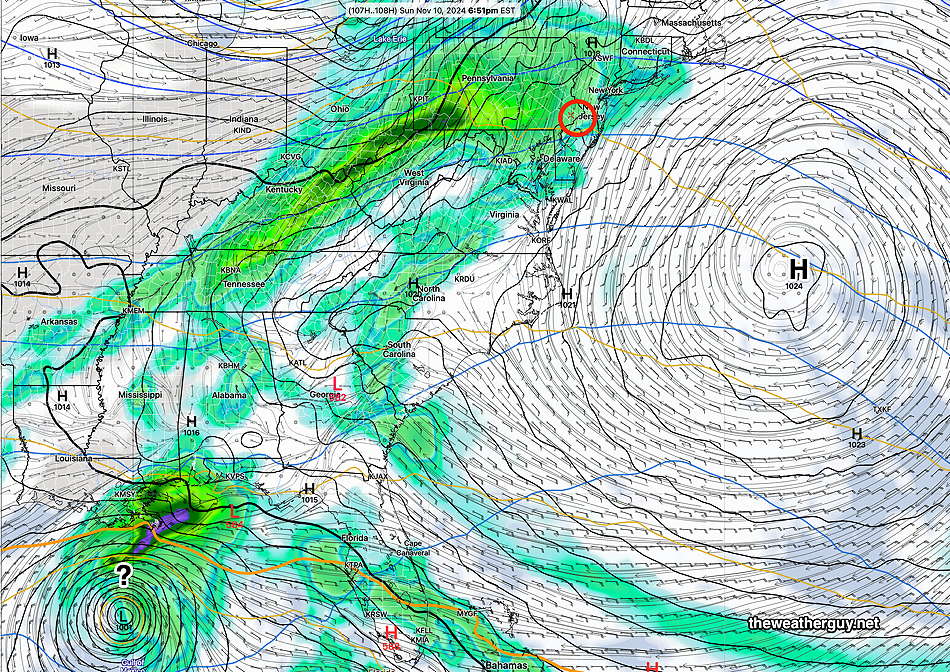
Here’s the latest ECMWF-AIFS forecast—
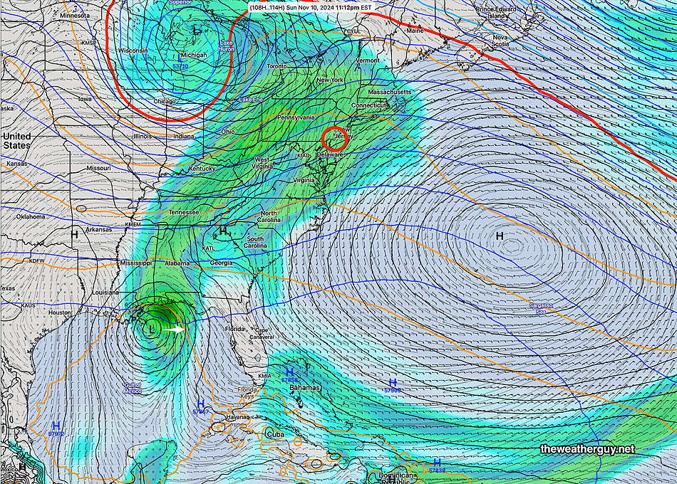
Those models which have greater assimilation of the hurricane’s moisture (Canadian, German ICON) show rainfall for our area as much as 0.75 inches by Monday morning. The GFS shows about 0.50″ and the ECMWF only shows less than 0.20″ of rainfall here later Sunday.
Some Rain Late Sunday- Hurricane Stagnates?
Posted Wednesday 11/06/24 @ 9:00 AM — There continues to be an uncertain forecast for Hurricane Rafael’s track and for the amount (if any) of moisture it will add to a frontal type rainfall for us late Sunday.
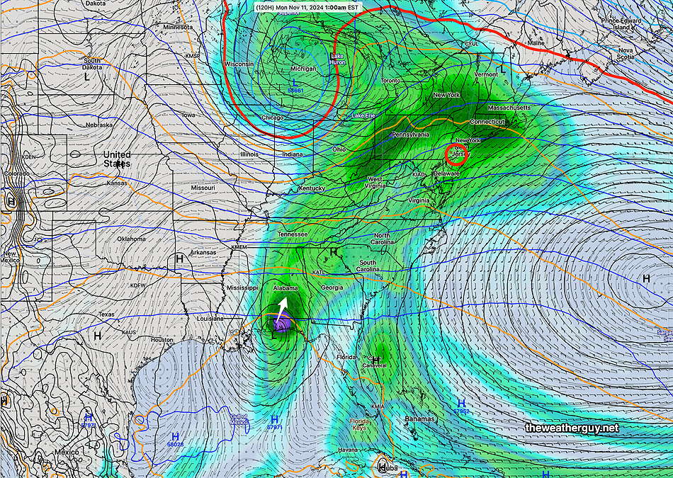
The latest AI model of the ECMWF still shows the hurricane (or tropical storm) making landfall later Sunday night adding to rainfall here—
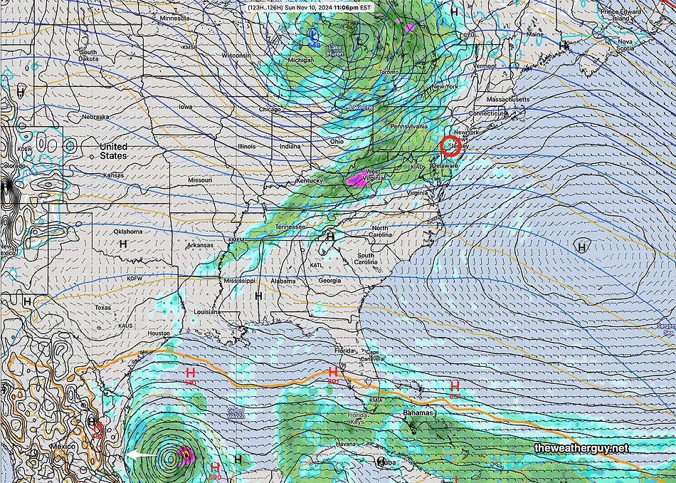
In contrast, the latest ECMWF deterministic model shows the hurricane moving westward into Mexico!
Closer to the AI mode is the latest GFS—
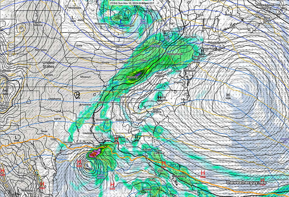
Any northern landfall will increase available moisture for much needed rain here in Philadelphia. Quite an uncertain forecast. Stay tuned.
Forecast Update
Posted Tuesday 11/05/24 @ 9:02 PM — More of this afternoon’s models (the 18z runs) have moved away from the forecasts of the AI models and have joined the forecast trends first set by the ECMWF and German ICON models— Basically the models are showing Rafael to stagnate in the Gulf of Mexico and not make landfall. The NOAA hurricane model, the HAFS-B, has joined this forecast as well—
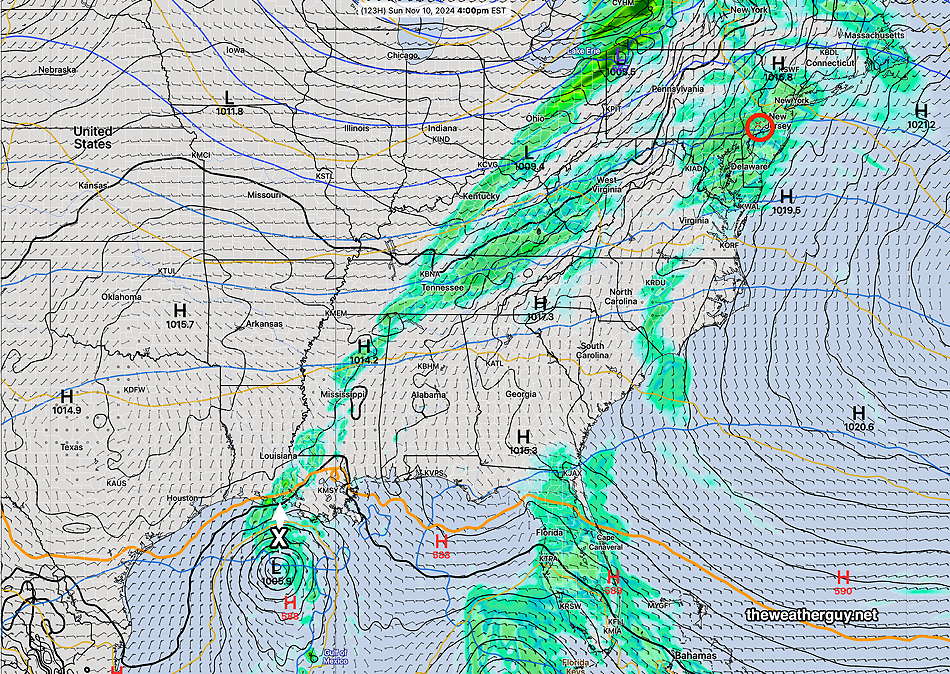
This mean less moisture brought up for less rainfall here and any rain here my shift into later Sunday or Monday. Stay tuned.
Any Chance for Rain Here?
Posted Tuesday 11/05/24 @ 9:34 AM — What had looked to be almost a slam-dunk for rain here on Sunday is now looking a bit more uncertain. Much of that forecast depended upon the remnants of Rafael to move up over our area, merging with a closed low to our west.
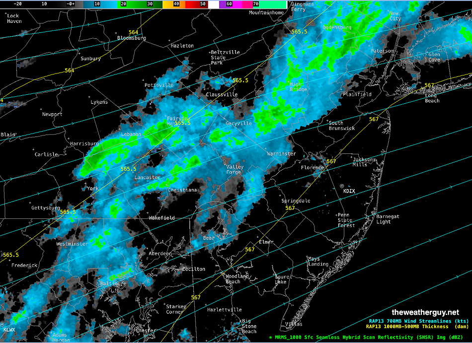
BTW, we may has some showers here Thursday with the passage of a cold front, but much of the rainfall is expected to falll just to our south.
The forecast track and timing of Rafael remains uncertain, but the trend is for a later landfall as the storm meanders a bit in the Gulf. According to the Hurricane Analysis and Forecast System Model (HAFS-B), NOAA’s newest hurricane model—
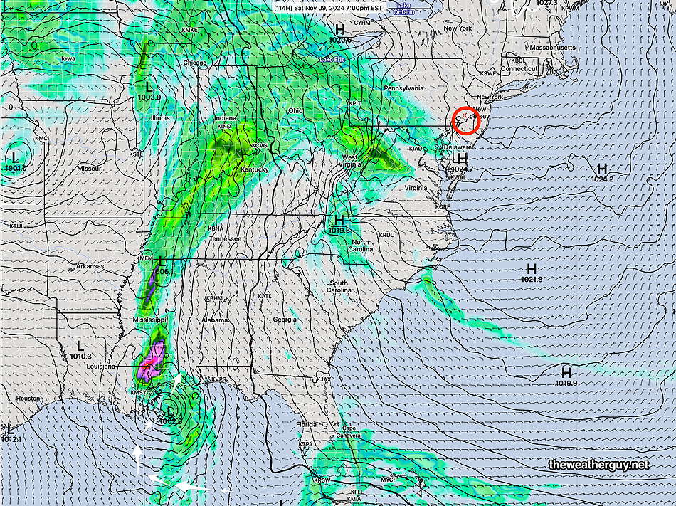
The AI version of the ECMWF, the ECMWF-AIFS shows a similar landfall but is almost 14 hours later. Rain from this system here would be Monday, not Sunday.
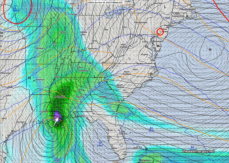
The operational ECMWF and the German ICON still keep the storm stuck in the Gulf, further complicating the forecast. Stay tuned.
Tropical Storm/Hurricane Rafael Update
Posted Monday 11/04/24 @ 4:09 PM — Large forecast differences exist for the track, intensification and speed of what has been named Tropical Storm Rafael, soon to be Hurricane Rafael, for the time period after Thursday.
The ECMWF-AIFS model is now consistent forecasting landfall near New Orleans with a rapid decrease in intensification due to expected vertical shear. It’s track is supported by the latest GFS and the HAFS-B model, but with different timing. Here are two of the models—
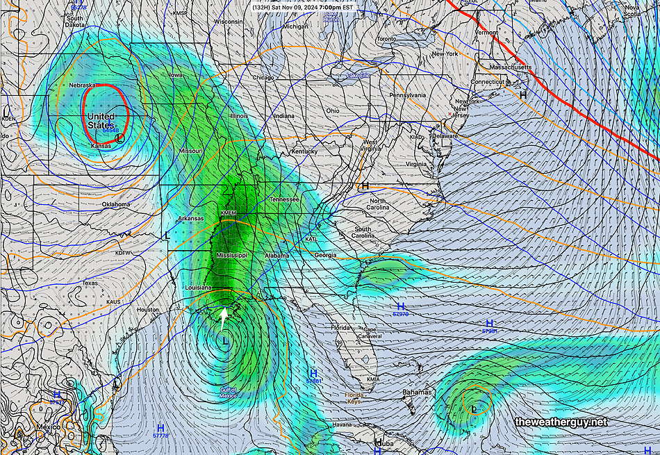
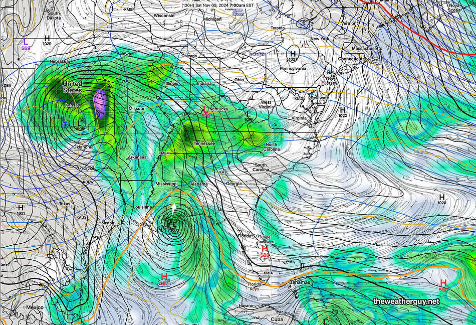
Adding to the uncertainty is the latest ECMWF which keeps the hurricane in the western Gulf of Mexico, not really making landfall before diminishing in intensity. The German ICON model has a similar track—
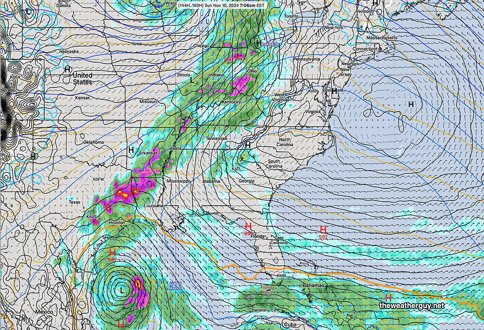
Too early to tell which way this storm will move, but my money is currently on the ECMWF-AIFS /GFS/ HAFS-B with landfall near New Orleans. This would bring us rain sometime on Sunday.
Regarding our Dry Weather
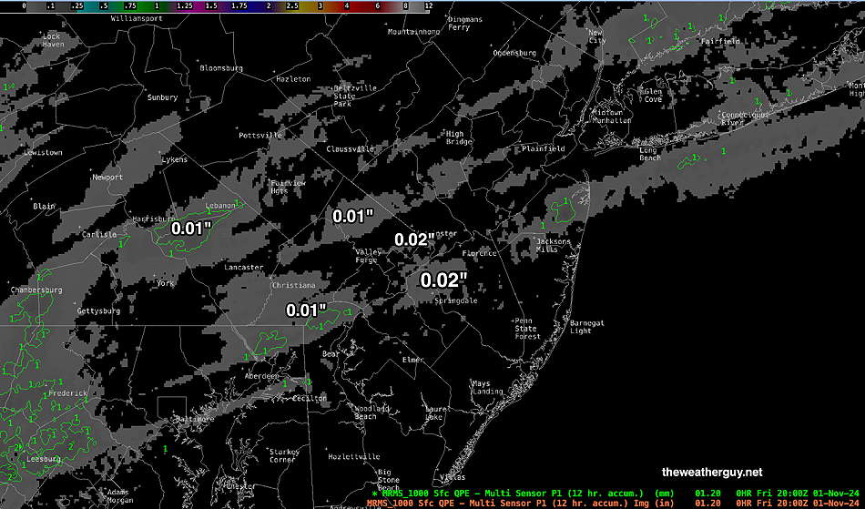
Regarding our dry weather, back in July, I saw this drought pattern possibly emerging and I advanced some theories about it then. At least in Philadelphia, the tell-tale sign seems to be storms that repeatedly fall apart just to our west.
Tropical Storm/Hurricane Update
Posted Monday 11/04/24 @ 7:05 AM — Considerable forecast differences and uncertainties remain with the developing tropical system (and likely hurricane) in the Gulf of Mexico. This system is likely to become a hurricane by Wednesday or Thursday.
Some consistency exists between models until Thursday; then the tracks and intensity greatly diverge.
I’ve drawn the forecast tracks superimposed on the ECMWF-AIFS model forecast for Thursday—
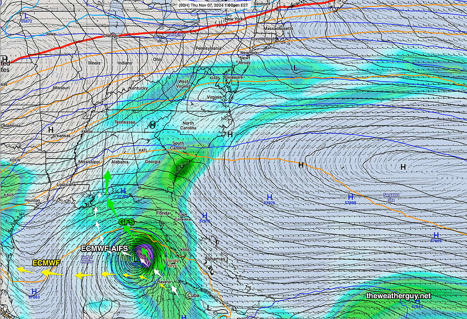
Here’s the main takeaways—
- The ECMWF-AIFS has adopted the westward track of the operational models. It has the storm dissipating just as it makes landfall.
- The operational ECMWF maintains a westward track into Mexico
- The operational GFS maintains the strongest storm with a direct track and landfall similar to the ECMWF-AIFS. The GFS forecasts a stronger storm that maintains tropical characteristics at landfall.
- Not drawn is the Canadian Global with a similar track to the GFS, but the storm falls apart near landfall.
- Not drawn on the map, the German ICON is similar to the ECMWF with a westward track into Mexico.
I’m leaning towards a GFS/ECMWF-AIFS composite with landfall near Louisiana/ Mississippi around Saturday and maintaining some strength.
Most (but not all models) are still forecasting the moisture to give us a 1/2″ rainfall on Sunday.
Tropical Storm Update
Posted Sunday 11/03/24 @ 9:22 PM — For the past two days, most models have had the expected tropical system/hurricane veer towards the west. The exception has been the AI model of the ECMWF (ECMWF-AIFS)
The most recent ECMWF-AIFS has captured much of what the operational models (GFS, ICON, ECMWF, Canadian Global GEM) have been forecasting; a pause on Thursday and a jog to the west. It still shows it veering northward again but with a more westward landfall—
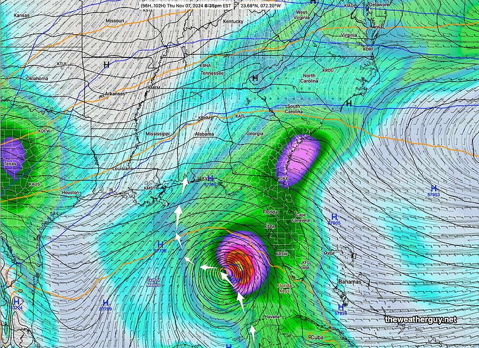
It should be mentioned that many models have this system shearing off and weakening considerably and even dying before making landfall. This ECMWF-AIFS does not weaken the storm considerably.
The system is of interest to us since its remnant moisture is still forecast to (possibly) bring us some rain next Sunday.
You may be wondering about our (NOAA) GraphCast-GFS AI model. Unfortunately, NOAA posts this model’s data with a 14 hour processing delay and so far, it hasn’t shown itself to be very useful.
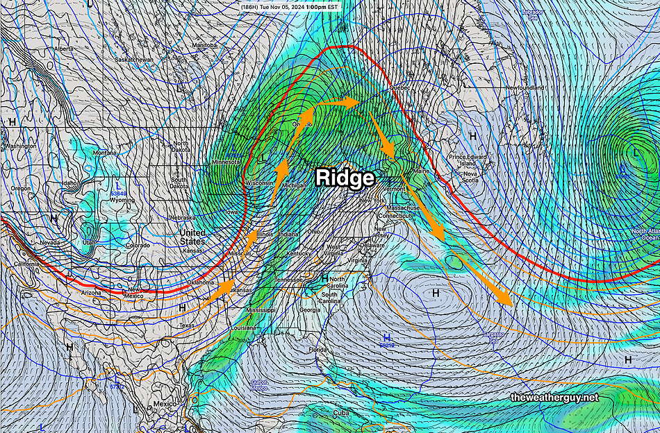
Originally Posted Sun @ 10:15 AM — —The big weather stories this week will first be an anomalous sharp upper air ridge over the eastern US and the development of at least one, possibly two, hurricanes to affect the Gulf states sometime late Thursday into Friday. The moisture plume and eventual path from the hurricane remnant may finally bring us some rainfall next weekend
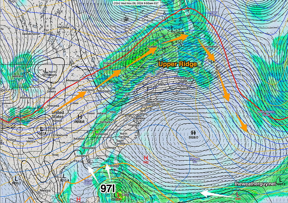
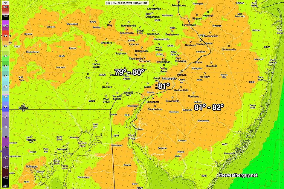
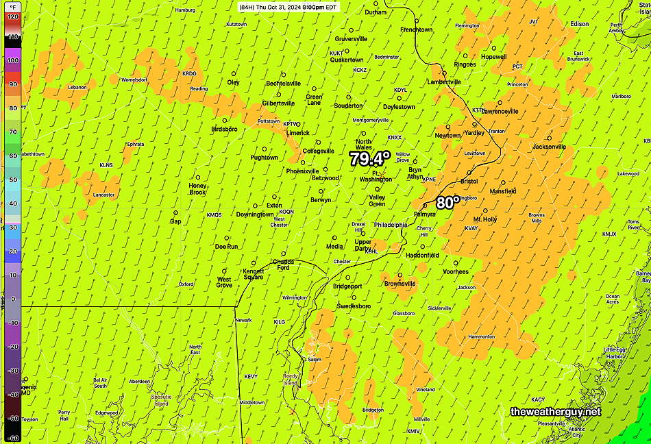
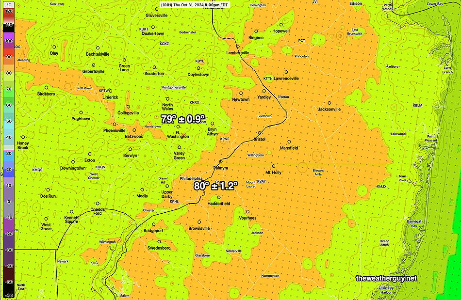
Expect very warm temperatures here from late Tuesday into Thursday due to the upper ridge.
A likely hurricane, currently forecast to be weak, will move either across the Florida Panhandle area or closer to New Orleans. The operational models have consistently had a western track. The ECMWF-AIFS, which did so well forecasting Milton and Helene, has an eastern track into the Florida Panhandle.
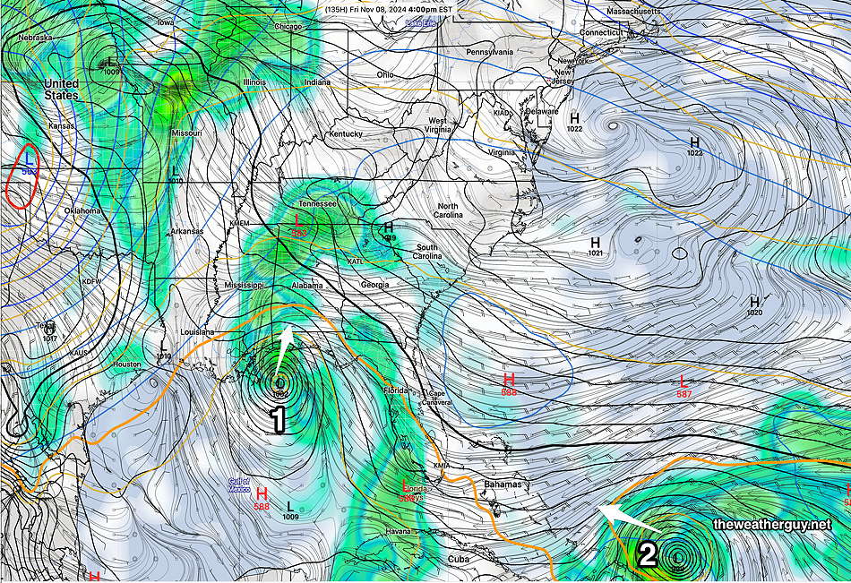
The AI model, the ECMWF-AIFS, was the first to predict this system and has been totally consistent with its track. Here’s the latest—
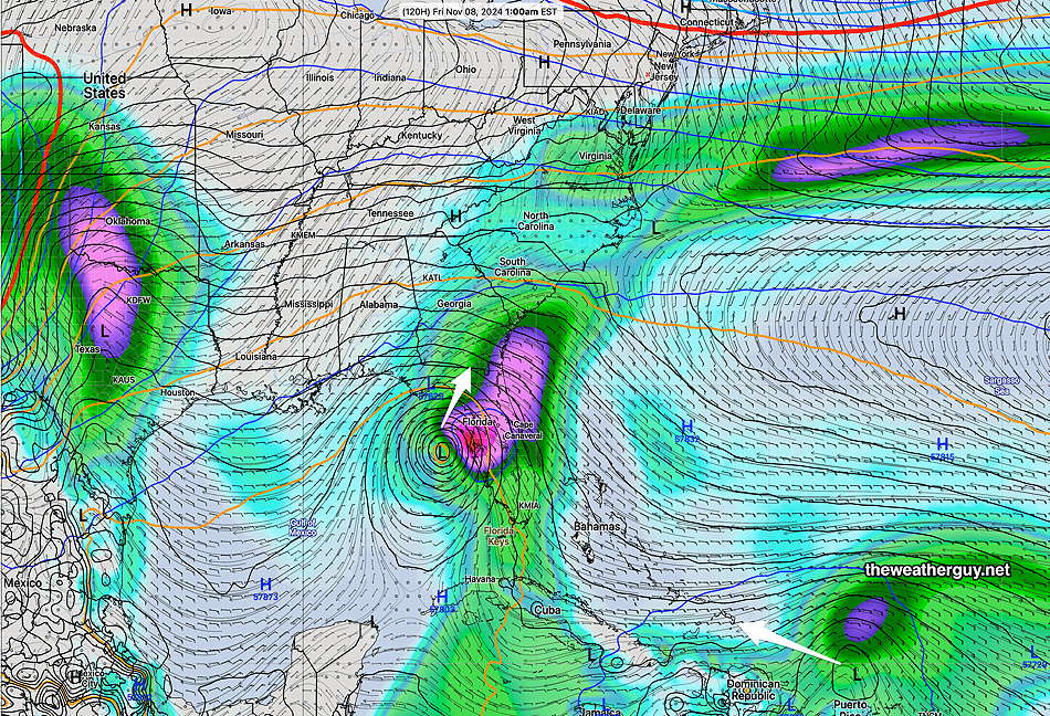
It appears possible that some of the moisture from this system will bring us some rain next weekend. Stay tuned.

