#Philadelphia #weather #PAwx
Rain Update
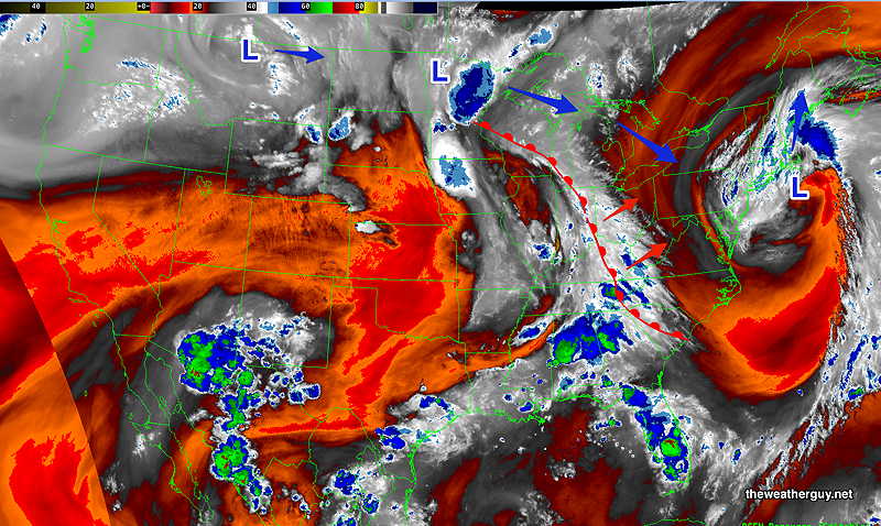
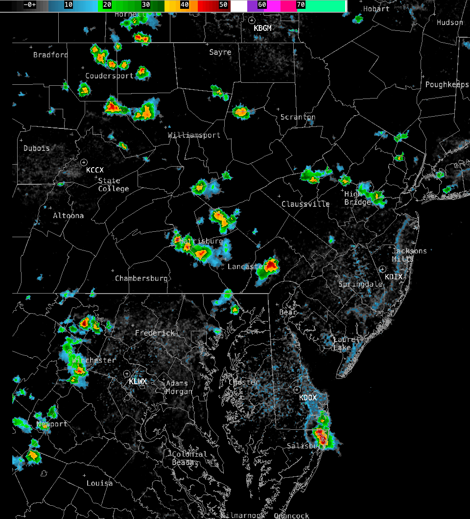
Posted Friday 08/02/24 @ 4:26 PM — Obviously, the models were about 3 hours too slow with the passage of the showers and thunderstorms. Indeed, the entire forecast from yesterday has changed; instead of the storms lingering and developing over the I-95 corridor this evening, this line of storms is now forecast to move east and away this evening.
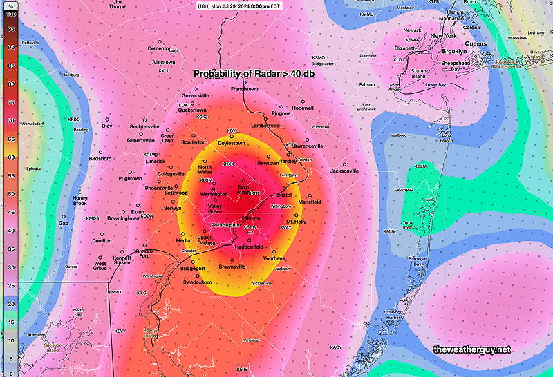
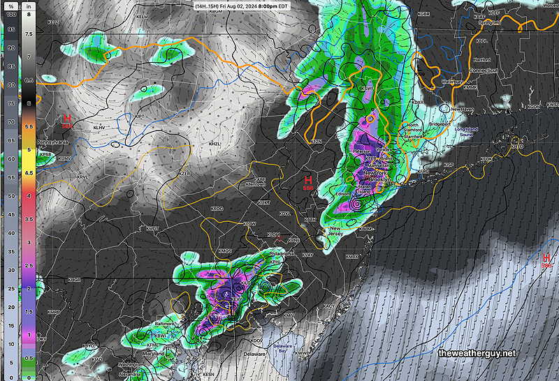
Posted Friday 08/02/24 @ 12:57 PM — A quick update. This morning’s models have returned to forecasting some showers and thunderstorms in most areas. Most likely timing is- starting 5 PM or so in western Montgomery, Bucks and Chester counties, between 6-7 PM in Philadelphia and eastward into NJ. Heaviest rainfall is still forecast north and south of Philadelphia.
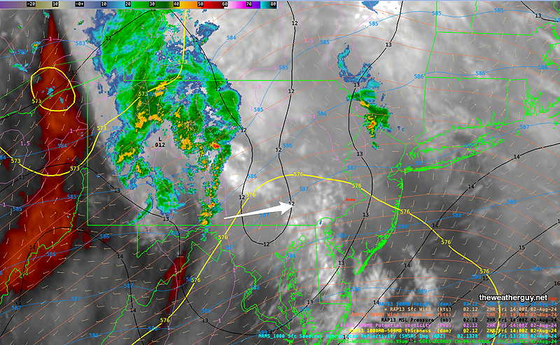
Posted Friday 08/02/24 @ 9:42 AM — What was looking like a slam-dunk drought-buster of a rainfall later today is now looking questionable. The latest HRRR shows most of the rain shearing off to our far northwest.
Just to see, I downloaded the latest hourly experimental RRFS 10z and it has heavier rain in some places, but also has large parts of the Delaware Valley with little to no rain! Here’s the latest RRFS—
To add to the uncertainty, the NAM-NEST and HRES are showing showers and storms right now, not occurring on actual radar. That undermines the rest of their forecasts. So an uncertain forecast. Some areas here will have some substantial rain, some will have little or none.
I’ll update later.
A Pattern Change. Rain?
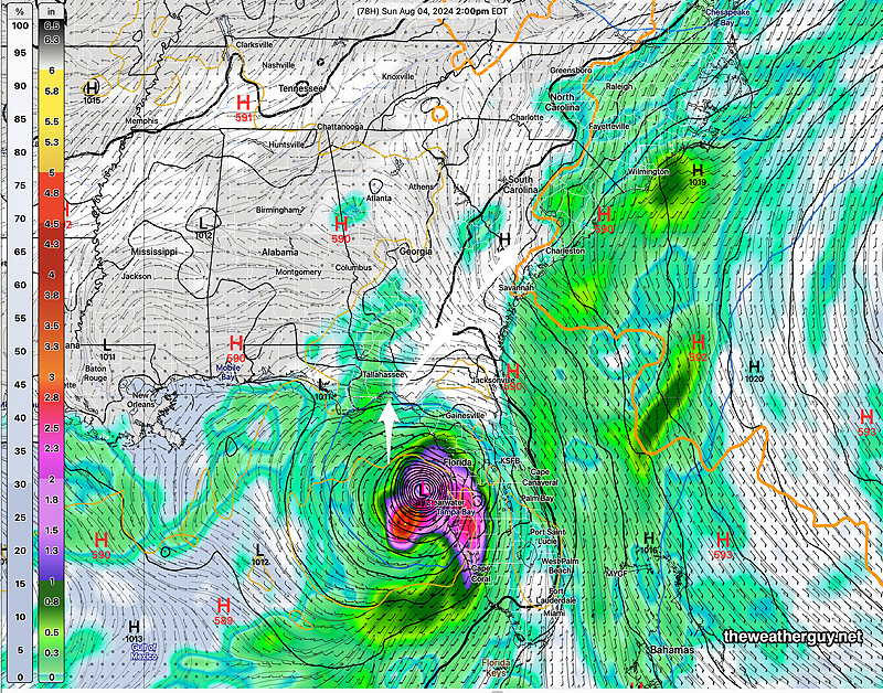
Posted Thursday 08/01/24 @ 4:59 PM — Just when I started to use the word “drought”, the models are forecasting a pattern change for the coming week. Additionally a tropical system is expected to form near Florida and the moisture may move up the coastline towards us next week.
We’ll see the first evidence of the pattern change late Friday and over the weekend— A deepening upper level trough will have embedded waves of low pressure bring showers and thunderstorms to our area—
For Friday, a mix of sun and clouds will still allow high temperatures to be 95º-96º. An increasing likelihood of showers and thunderstorms, from west to east from 2 PM into the nighttime hours. Yes, the rain is actually forecast for the immediate Philadelphia area.
Additionally, a tropical system will form somewhere near Florida. It may or may not reach hurricane strength. The GFS has the storm quite developed by Sunday afternoon on the west coast of Florida. as does the Canadian Global. The ECMWF isn’t on the same page, though. So we’ll have to see what happens in the coming day.
[note note_color=”#bceaed” text_color=”#333333″ radius=”3″]Thu 4:52 PM —Forecast Review — Once again, the strongest 500mb vorticity couplets predicted the general locations of the showers and thundershowers today, basically northeast and southwest of the Delaware Valley—
Things are usually more complex with thunderstorm development (moisture convergence, frontal movement, jet stream influence), so I don’t think this is any magic forecast solution.
[/note]
Hot Thursday
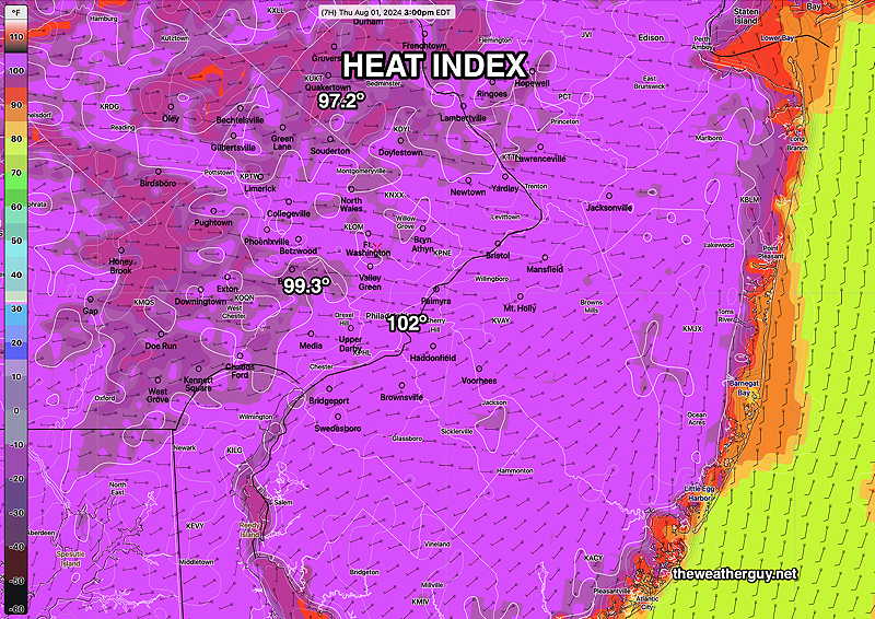
Posted Thursday 08/01/24 @ 11:12 AM — Today’s high temperatures will be between 95º and 97º, depending upon your location. With forecast dew points in the upper 60s to low 70s, the apparent temperature (heat index) in most areas will exceed 100º—
Thunderstorms, if any, look to be even more isolated than yesterday.
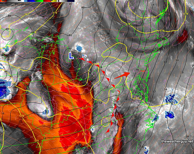
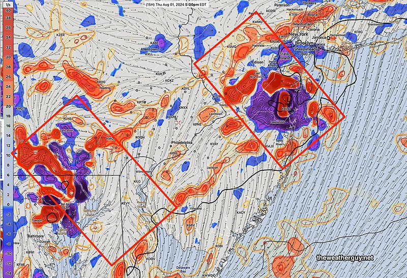
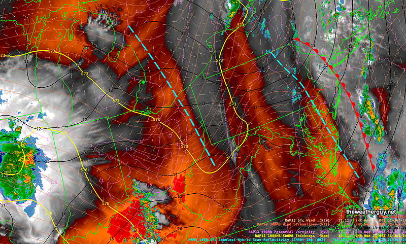
Yesterday’s NAM-NEST 500 mb vorticity was pretty good at identifying the likely areas for development of showers. Storms will be less likely and more isolated. Likely development is 3:30 PM to 6 PM. Today, we’ll use the experimental RRFS absolute vorticity—
Showers Thundershowers?
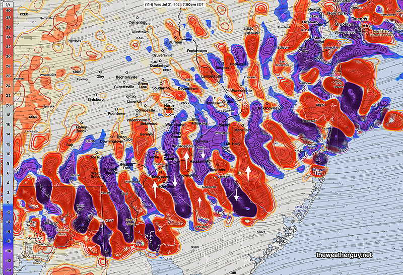
[note note_color=”#bceaed” text_color=”#333333″ radius=”3″]Wed 5:43 PM —Forecast Review — Showers and storms did develop east of the I-95 corridor as suggested by the morning’s NAM-NEST—
The showers west of the city died out as they approached.
[/note]
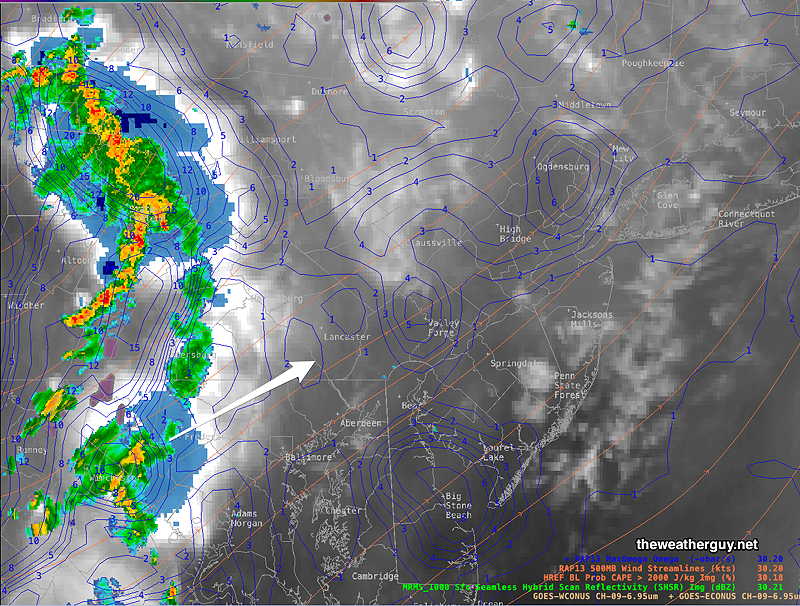
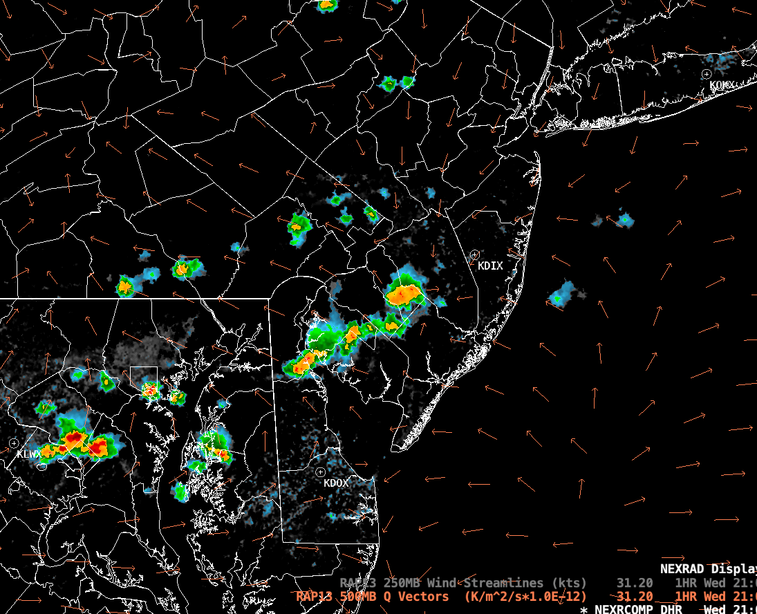
Posted Wednesday 07/31/24 @ 1:47 PM — A review of upper air parameters suggests showers and thundershowers between 4 and 8 PM from the city and eastward. Here’s the NAM-NEST
Our Dry Weather
Posted Wednesday 07/31/24 @ 9:29 AM —The warm front went through last night; the rain and dynamics sheared off to our northwest.
We’ve been in an extended pattern where storms dissipate as they approach the Philadelphia area resulting in very dry conditions locally.
I’ve seen this before and I have, in the past, passed along several theories for the phenomenon, none of which totally satisfy. Most recently, this occurred in the summer of 2022.
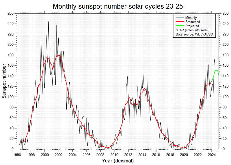
The overall feeling is that “dry begets dry” and the lack of soil moisture is a negative feedback loop for thunderstorm (convection) development. The other factor, although esoteric, are the dry patterns associated with the upswing in the sunspot cycle, although we are just past peak—
As an additional thought, they call our area the Delaware Valley for a reason; there’s a drop off in geographic altitude as we move east from Berks and Chester counties to the coastal plain of New Jersey. That descent results in air moving downward, negating any weak upward motion that was available for rain and convection.
None of these fully explain the purely local phenomenon of repeated collapse of thunderstorm development in the immediate PHL area during some seasons.
As for today, Wednesday, the models are showing a chance of isolated showers in NJ and northward near Lehigh county late afternoon. Hot and humid is the story for today.
Update
Posted Tuesday 07/30/24 @ 9:52PM — Tonight’s models have backed away from the showers and storms tonight. They are falling apart as they approach our area. The latest HRRR has little rainfall. How do you spell the word “DROUGHT”?