#Philadelphia #weather #PAwx
Fine Tuning Monday’s Forecast
Update Mon 5/27 6:08 PM — The TV forecast I heard about an hour earlier was still emphasizing severe weather, tornados, hail this evening. I wish I saw evidence for this in the models. Some thunderstorms still possible with gusty winds.
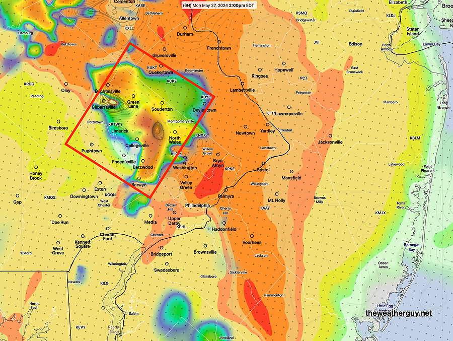
Posted Monday 05/27/24 @ 10:39 AM — This morning’s HRRR (12z) shows some moderately elevated severity parameters (CAPE, Vertical Shear and Helicity) about 2 PM in upper Montgomery county.
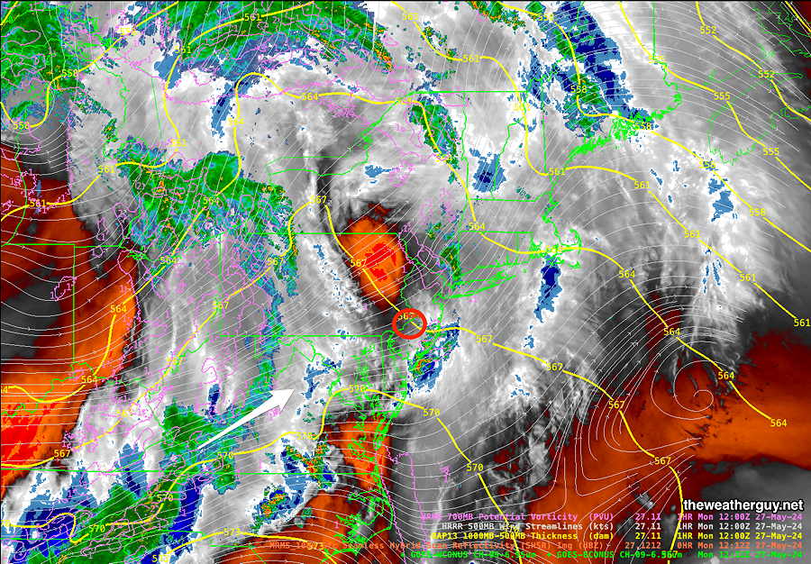
Posted Monday 05/27/24 @ 8:38 AM — Here’s the latest satellite water vapor image with superimposed MRMS radar—
Update Mon 5/27 7:32 AM — Last night’s model capture the following trends — We may see a brief period of sun or bright skies late morning. It appears that the heaviest rain will fall in far northern areas, closer to Allentown.
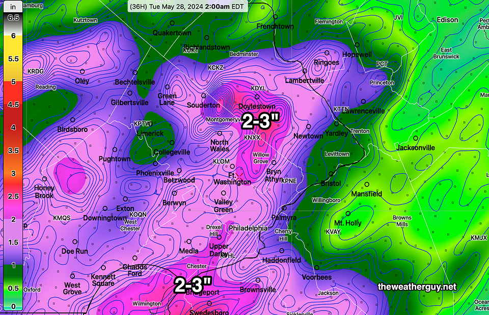
The showery rain with embedded thunderstorms will begin in the early afternoon and continue on and off through about 10 to 11PM. Wind gusts and localized heavy rain expected especially this evening, but severe weather will be most likely far north into Lehigh county and to our south in Maryland. Rainfall totals will be closer to 1 inch in the immediate Delaware Valley, rather than the 2-3 inches posted last night.
I’ll update if this morning’s models show significant changes.
Rainy Monday on Tap
Posted Sun, 05/26/24 @ 5:37 PM— Several rounds of rain will move through during the day on Monday, beginning before daybreak and continuing through mid-evening. The rain will be showery in nature, not a continuous rainfall, and there will be embedded thunderstorms.
The heaviest rainfall will likely occur early Monday evening with some heavier, stronger thunderstorms. While severe weather doesn’t appear to be likely, it never can be ruled out
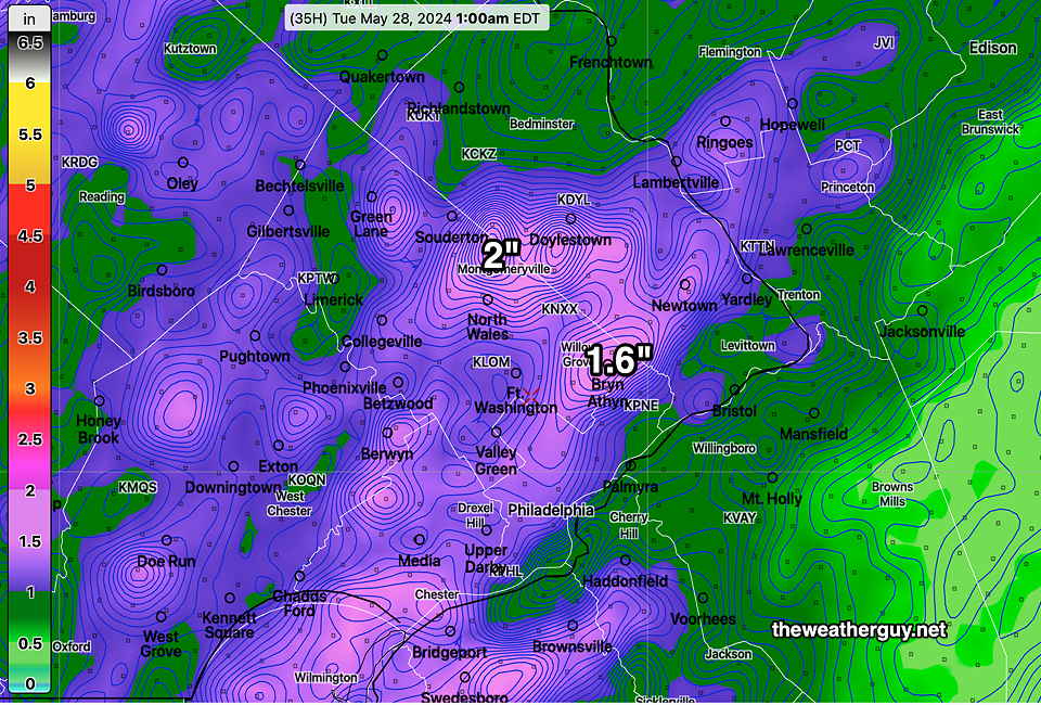
The NBM and HREF show anywhere from 1.5 to almost 3 inches of rain, mostly in the immediate Delaware Valley area—
Increased Signal for Thunderstorms Sunday
Posted Sun 5/26 4:04 PM — Storms developed, just east of the I-95 corridor, this afternoon. That’s about as good models can get with this sort of thing.
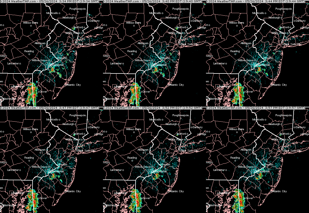
Despite many days of forecasting heavy rain for Monday, some models have backed off from this. Will update later.
Posted Sun, 05/26/24 @ 10:21 AM— The latest NAM-NEST continues with a forecast of pop-up storms Sunday, between 4 PM and 6 PM along the I-95 corridor.
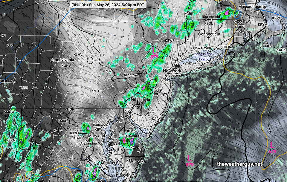
Update Sun 5/26 7:32 AM — Yesterday’s forecast for thundershowers didn’t materialize, as storms to our west dissipated as they approached our area last night and pop-ups didn’t occur as forecast during the daytime.
Unlike yesterday, there’s greater model consensus that some pop up storms will develop in and around the I-95 corridor during this afternoon. A stalled frontal boundary along with high CAPE values (approaching 2000 j/kg2) should provide enough of a trigger.
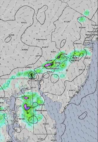
Update Sat 5/25 8:32 PM — We may still see some showers move in this evening, especially western suburbs, but I have to say that the Canadian models over-forecast the scattered shower potential for today.
The weak boundary moving through this evening will stall and move north as a warm front early Sunday. As that happens, some new showers and thunderstorms may spring up early Sunday morning but coverage will be limited.
As the warm front moves north, a mostly sunny Sunday is expected, but there may be periods of clouds at times in some areas. Limited, widely scattered showers are possible again Sunday afternoon and more so Sunday evening. It will be more humid. Monday still looks rainy in the morning with heavier showers and thunderstorms in the evening.
Previously Posted Fri 3:24 PM —
This weekend’s weather will be dependent upon a a series of frontal passages that include a stalled cold front returning as a warm front on Sunday morning and then stalling again. Passing along that front will be a series of disturbances, that along with daytime heating instability, will trigger isolated or scattered thunderstorms. Plenty of sunshine will also add to the unstable mix.
Exact timing and placement of these frontal passages will be difficult to forecast. After reviewing numerous models, I’m leaning towards the Canadian RGEM and HRDPS which did exceptionally well with last season’s thunderstorm forecasts. Adding credence to their forecast is the GFS, the experimental RRFS, and the ICON EPS which seems to have a somewhat similar forecasts.
Not in support of this forecast is the latest HREF which downplays showers significantly in our area for Saturday and Sunday. The ECMWF is similar for Sunday’s forecast, but not so much for Saturday. So a difficult forecast to pin down.
Saturday
Sunny in the morning, sunshine through thin high clouds in the afternoon. Increasing cloudiness late afternoon. A chance of widely scattered thunderstorms especially west of Philadelphia after 2-4 PM and more organized showers and thunderstorms moving in from the west after 8 PM.
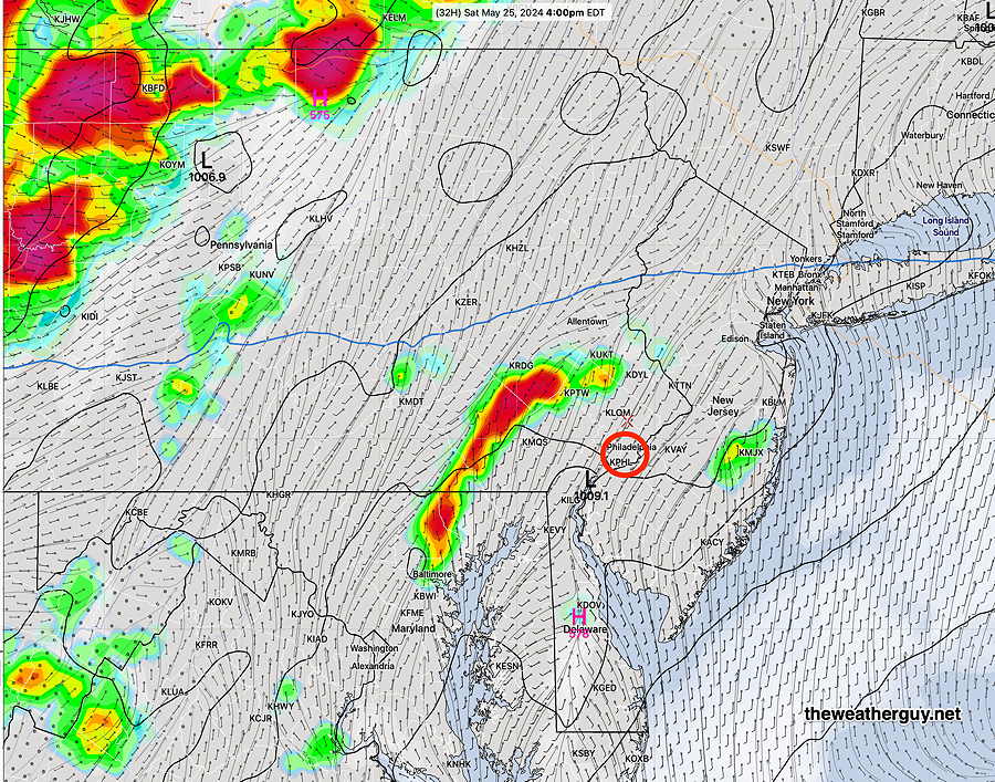
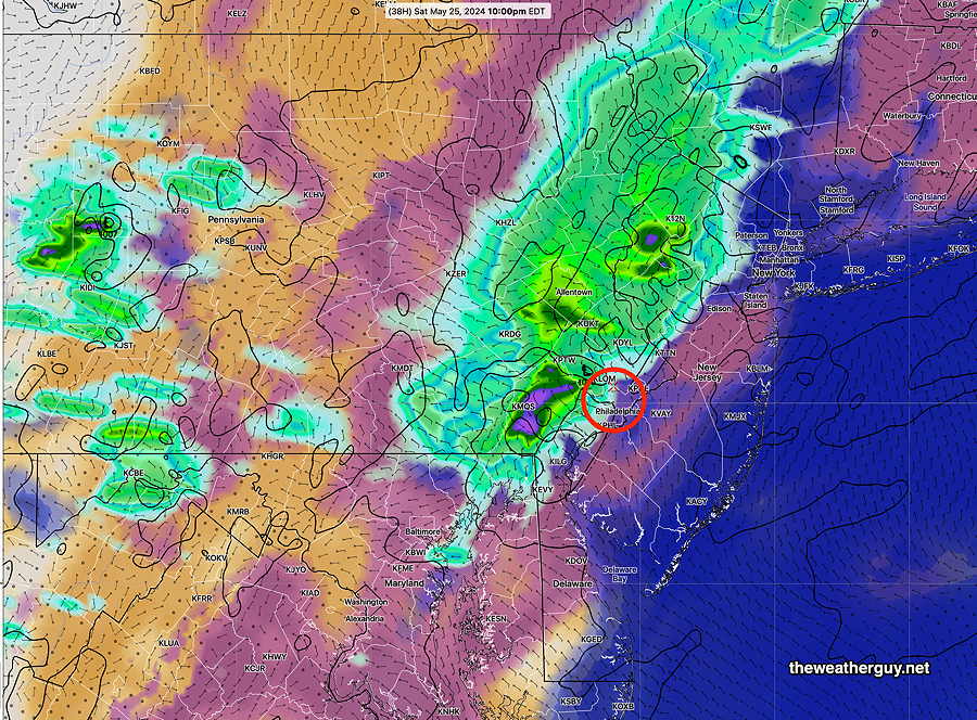
NBM high temperatures: Blue Bell, PA 86º Philadelphia, PA 87º
uncertainty (based on standard deviation): low
Sunday
Becoming mostly sunny after some morning residual showers/storms. The front that moved through Saturday night stalls and moves back as a warm front. Instability will result in pop-up showers/thunderstorms during the afternoon .
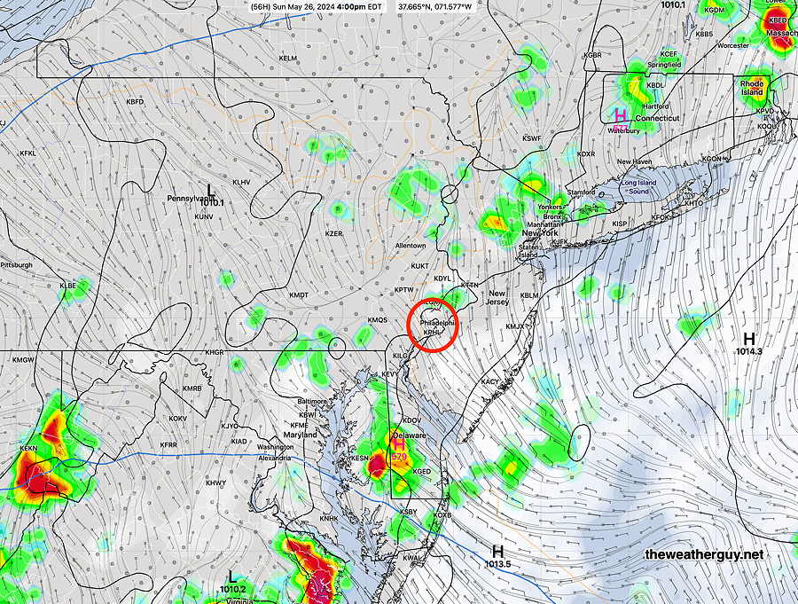
NBM high temperatures: Blue Bell, PA 85º Philadelphia, PA 86º
uncertainty (based on standard deviation): low
Monday
Showers and thunderstorms beginning daybreak or early morning and continuing off and on. There may be a taper in the afternoon. Heavier rain and storms beginning Monday evening.
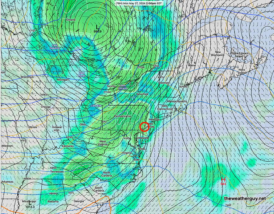
NBM high temperatures: Blue Bell, PA 78º Philadelphia, PA 80º
uncertainty (based on standard deviation): high uncertainty
