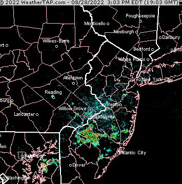
Forecast Review— 08/28 @ 5:01 PM — Some showers did develop about 2-4 PM today as forecast but most areas just saw clouds—
NEXRAD radar loop this afternoon. Some showers did actually develop, but most areas saw only increased cloudiness
Note that NOAA model data is still delayed or partially unavailable due server issues as described over recent days.
Update Sun 08/28 @ 11:31 AM — There were some showers in NJ yesterday and this morning’s models continue to forecast some pop-up showers moving in from the east by 4 PM today, Sunday —
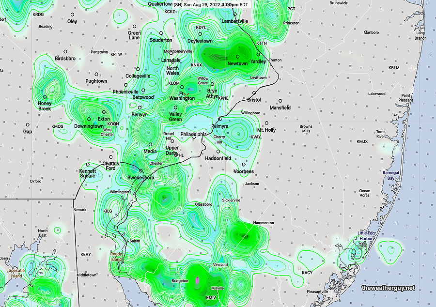
Today’s 12zHREF forecast model shows considerable showers at 4 PM today. Many models have been over-forecasting rain over the past day and I’m not all that confident that we’ll see so many areas with showers today. (Click on image for a larger view.)
Updated Sun 8/28 1:30 AM —Several of tonight’s models show showers and thunderstorms developing over the immediate Philadelphia area Sunday afternoon into Sunday evening.
Update Sat 08/27 @ 9:45 AM —Last night’s GFS continues with the forecast of an easterly flow causing some very widely scattered showers at the Jersey Shore later today with clouds moving in from the east towards Philadelphia during the latter part of the afternoon (4-7 PM). Some light showers may also just make it into Philadelphia from the east.
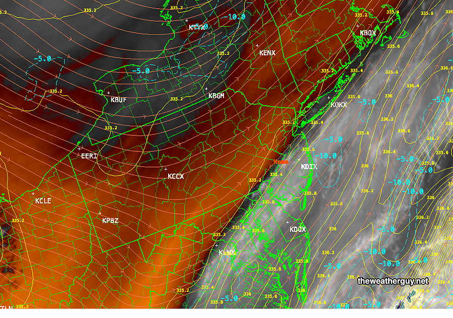
The likely western boundary for any showers is visible on the current water vapor imagery, running right through Philadelphia—
Water Vapor Satellite Image shows dry, warm air west of Philadelphia (orange) with colder higher level water vapor east of Philadelphia. Blue contours show beginning moisture convergence offshore, expected to move westward Orange contours are wind contours at jet stream level -250 mb (RAP model) (Click on image for a larger view.)
Despite forecasts of 90º on radio and TV, the NBM has only been showing upper 80s for most of the area.
Note that NOAA model data is still delayed or unavailable due server issues as described yesterday.
Previously Posted Fri 9:46 PM —
A weak front, expected to move through Friday afternoon, has slowed and will stall south of the area. High pressure tries to build in for the weekend.
Latest ECMWF (18z) shows high pressure over New England by Saturday afternoon. An easterly flow may bring some showers to South Jersey.
Ordinarily, this would mean fair weather, but this high will move to our northeast and an easterly flow around the high may result in low level moisture convergence with some clouds and some showers possible during the afternoons, especially in NJ on Saturday and from Philadelphia east on Sunday.
Saturday
Mostly sunny with some periods of clouds mid to late afternoon. A few scattered showers, mostly in South Jersey. High 87.2° sd 1.6° NBM model, Blue Bell.
Previously Posted Fri 9:46 PM —
Sunday
Partly sunny, again with periods of clouds and a few widely scattered showers from Philadelphia and east. High 87.3° sd 3.2° (higher than average spread) NBM model, Blue Bell.