Update Fri @ 1:13 PM — Latest models have the rain likely ending in the immediate PHL area between 12 and 2 PM Saturday. Clouds break later in the afternoon. There’s still a lack of complete consensus regarding when the rain ends. A steep gradient with the rain— southern areas will receive much more rain than areas north of Philadelphia.
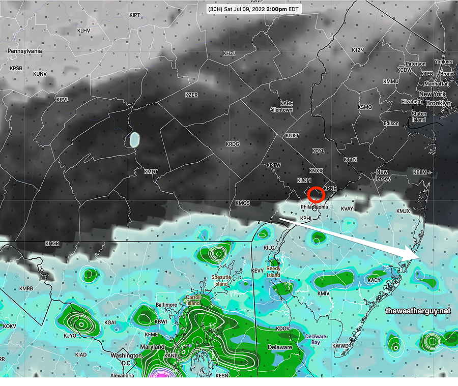
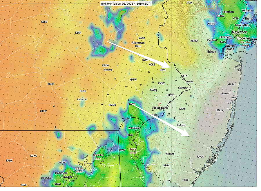
Today’s 12zHREF shows back edge of rain (1 hour prior accumulation) moving southward about 1 PM. Clouds are black, dark grey. (Click on image for a larger view.)
Updates this evening with the regular Weekend Weather Forecast feature.
Updated Thu 9:28 PM —The latest ECMWF just became available. It shows a very rainy Saturday, quite different than the GFS and NAM-NEST.
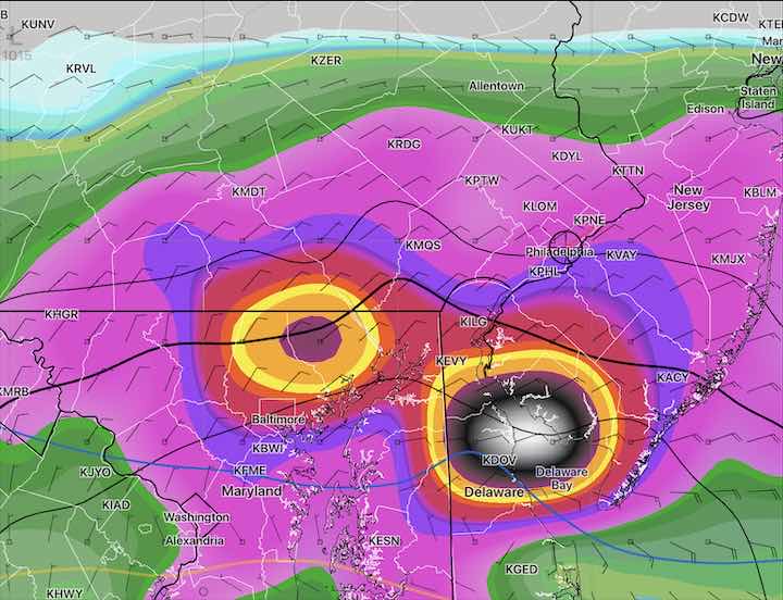
Today’s 18z ECMWF rain accumulation 2PM Areas of flooding rains in Maryland and Delaware (Click on image for a larger view.)
Update Thu @ 8:27 PM — Friday looks to be very warm and humid. Most models have us fairly rain-free during the day, but the model blend has widely scattered showers. High near 87º ± 2.2º
Rain moves in after midnight Friday. Heaviest rain south of Philadelphia.
There are large differences in timing and placement of this rain. Also uncertainty about when it clears up on Saturday. The NAM-NEST keeps the rain south of us and has it lingering The GFS has rain in our immediate area but tapers after 11 AM. The model blend (NBM) has considerable rain throughout the day, but I’ve seen the NBM overly prolong rain duration.
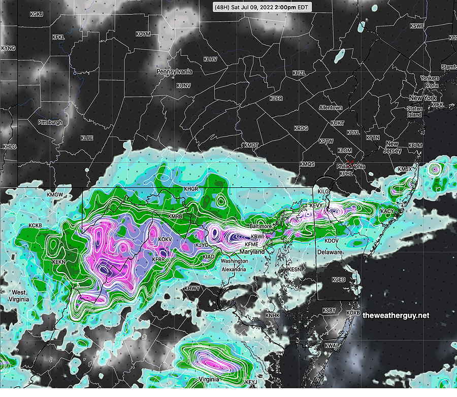
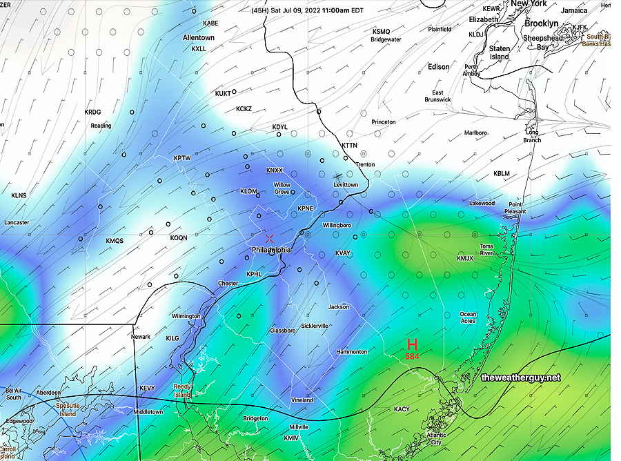
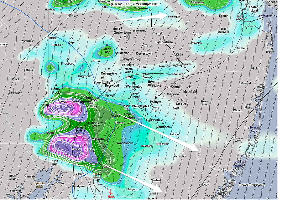
NAM-NEST Forecast for Saturday at 2 PM. Plenty of clouds (black shading), till raining in some areas. (Click on image for a larger view.)GFS forecast (simulated radar) and clouds (white) for 11 AM, showing rain departing PHL area but clouds linger into afternoon. (Click on image for a larger view.)
So uncertainty about clearing on Saturday, but I’m leaning towards the GFS. Updates Friday.
Updated Thursday Forecast, Wed 10:43 PM —The high resolution models are available again tonight. Several show an area of rain showers moving through western, southern suburbs and Philadelphia before daybreak and ending about 11AM Thursday. (The HRRR keeps all the rain south of our area.) The sun breaks out after noon.
Update Wed @ 8:58 PM — Several changes to the forecast. (FYI, there have been problems with NOAA data servers this afternoon. Many models were unavailable at their usual times. Some models are still giving errors during download. With so many models missing, I’m not going to attempt to retrieve them; this forecast is based heavily on the GFS, Canadian RGEM , German ICON and ECMWF models.)
For Thursday, except for the possibility of some light very widely scattered showers mostly in the morning, much of the area and the day will be dry.
For Friday, the front that was expected to bring rain will arrive much later in the day. Much of Friday will be rain-free.
Unfortunately for Saturday, the front will be slow to move south. Some showers and considerable clouds on Saturday into early afternoon, especially areas south and east of the city. Areas of Maryland and Delaware will have very heavy rain in the morning. Some clearing during the afternoon.
Update Wed @ 9:40 AM —There are changes in the forecast for Thursday through Saturday. Significant differences exist between the ECMWF and the GFS regarding the position of boundary that is to our south and the disturbances that will ride along it for tonight and Thursday.
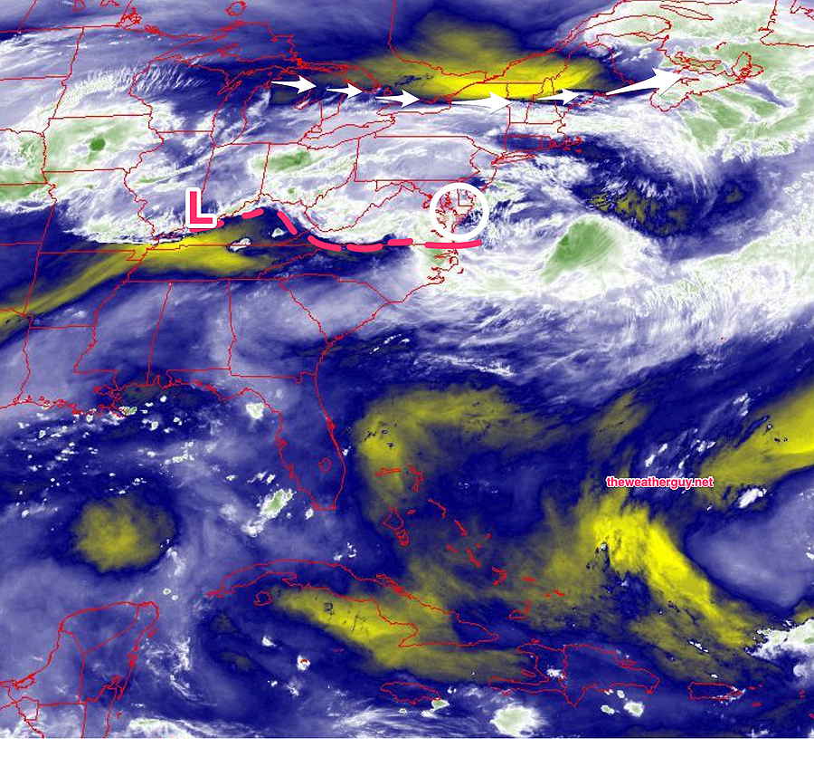
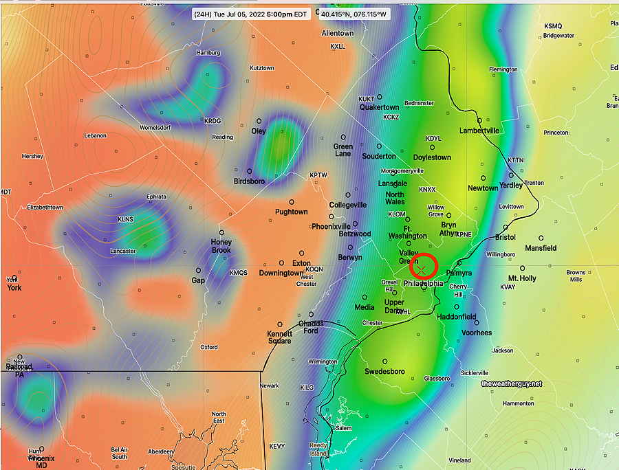
Water Vapor Satellite image 9 AM shows boundary (dotted red line) with weak low pressure in Illinois. Low pressure expected to form (white circle) late Wednesday night into Thursday. It’s unclear whether much rain will make it into our area on Thursday. The ECMWF is more aggressive with the rain, the GFS not so much. (Click on image for a larger view.)
It now appears that showers to our south will not make it into the general Philadelphia area tonight. It’s unclear how much rain (if any) moves into our area on Thursday. The ECMWF is more aggressive with the rain Thursday than the the GFS. Will have to wait until more model runs come in.
Also unclear is the forecast for Saturday. Both the ECMWF and GFS have considerable clouds now for Saturday with a lingering chance of showers, especially in the afternoon and at the Jersey shore. So what appeared to be a clear cut forecast last night for the next few days will be not so clear cut. Updates this evening.
Updated Tue 9:53 PM — A diffuse, stalled frontal boundary just to our south and will remain quasi-stationary through Friday. Upper air disturbances will move along this boundary to our south on Wednesday. Any showers will essentially stay to our south through Wednesday.
It will be quite humid on Wednesday morning. Dew points above 70°, but will drop in the afternoon.
Thursday: This diffuse boundary will attempt to move back northward Wednesday night with some showers that will linger into Thursday morning. The boundary won’t make much progress, but with it somewhat further north, we’ll be in the path of additional upper air disturbances. Showers and thunderstorms likely late Thursday afternoon.
Friday: A stronger kicker will move through on Friday with showers and thunderstorms.
The weekend looks good.
Update Tue @ 5:48 PM — An unsettled week weather-wise coming up. No strong systems. Several chances of some showers or storms. The upcoming weekend weather looks good!
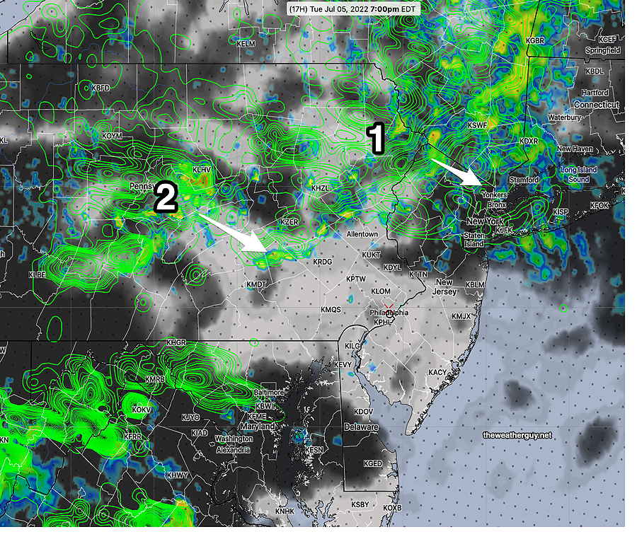
Tue @ 5:46 PM — Forecast Review— As expected, the storms moved off mainly to our south and north. Not much happening in the immediate PHL area. The showers stayed together in NJ more than forecast but no strong thunderstorms with such low CAPE values. The HREF forecast graphic below probably did the best.
Update Tue @ 3:47 PM — Latest HRRR continues with the strongest storms moving south of Philadelphia and another batch north of Allentown.
18z HRRR Strongest storms (6PM) move south of Philadelphia and then dissipate in NJ. Only lighter showers in other areas. (above graphic shows accumulated 1 hour precipitation) (Click on image for a larger view.)
The lower resolution ECMWF does show some activity into Philadelphia. (I waited years to get some access to the ECMWF data. Adding the ECMWF to my forecasting toolkit this past 6 months hasn’t really improved my forecast accuracy, whether it be forecasting snow storms or thunderstorms.)
Update Tue @ 11:34 AM — The morning high resolution models are showing any storms will be scattered in two groups and less impressive than even previously forecast. Many areas may not receive any rain.
12z HREF forecast shows lowering CAPE eastward and scattered storms in two groups. Many areas may not see any rain. (Click on image for a larger view.)Latest HRDPS (12z) shows storms at 6 PM diminishing in intensity as they make it into Philadelphia. Diminishing CAPE value (shading) as one goes eastward. (Click on image for a larger view.)
Update Tue @ 9:50 AM — This morning’s models continue with a forecast of a scattered group of storms affecting our area this afternoon and night. This likely will NOT be an organized solid line of storms.
As was the case last night, the high resolution models show two scattered groupings of storms, one that moves north (Allentown area) and another that moves mostly south of us.
The NAM-NEST shows the storms move through in two waves. One about 5 PM and another about 11 PM. They also move through in two general groupings, north and south of PHL.
NAM-NEST showing the earlier (5 PM group of storms) mostly north of us and the 11 PM group of storms (2)
The latest HRRR shows a somewhat similar scenario for 6 PM—
12z HRRR showing two groups of storms at 6 PM with significant helicity just south and west of PHL. Color shading is CAPE. (Click on image for a larger view.) 12z HRRR showing elevated vertical shear just south of Philadelphia. Also shown is storm motion vectors and Shear direction vectors. (Click on image for a larger view.) Any storms that develop in this area may be severe, although CAPE values still diminish significantly in NJ.
As discussed just below, CAPE values diminish significantly from west to east. Storms will diminish as they move into NJ.
Previously Posted Mon 9:09 PM —
A complex disturbance will affect our area late Tuesday afternoon or evening. There are large differences in the model forecasts, with a number of models having any storms either weaken and/or move off to our north.
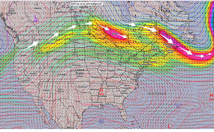
The overall jet flow is depicted here —
GEFS jet wind forecast (250 mb winds) at 5 PM Tuesday. Jet flow breaks up and circles back north of our region. (Click on image for a larger view.)
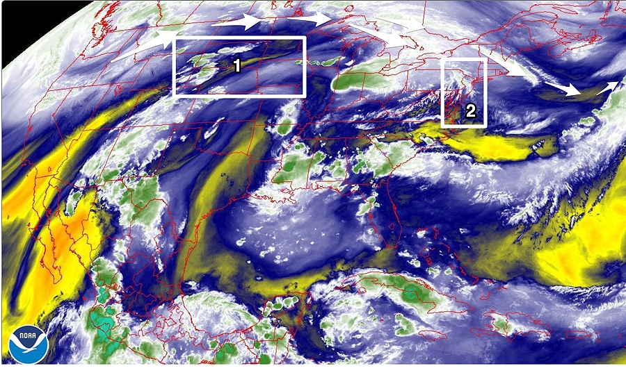
The jet flow complexity over our area is shown in the current water vapor imagery—
Water Vapor image Monday evening shows disturbance (1) that may affect us on Tuesday afternoon. The breakup of the jet flow with a bend eastward is captured by the fine high level water filaments bending back (2) (Click on image for a larger view.)
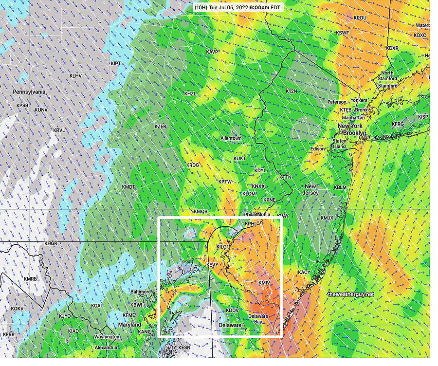
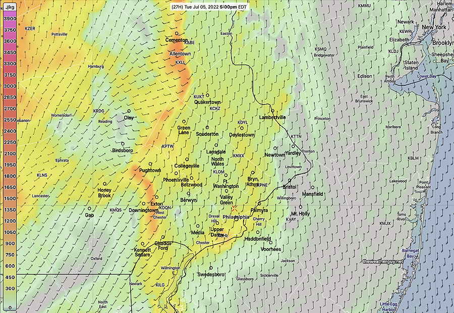
The models have one thing in common: they’re forecasting CAPE values that are high west of Philadelphia but rapidly diminish east of the city.
Here’s the HRDPS which captures this—
Canadian HRDPS forecast surface CAPE values for 5 PM Tuesday, moderately high west of the city and diminishing just east to near zero. (Click on image for a larger view.)
The trajectory of the impulse visible on water vapor (1 above) varies with each model. The NAM-NEST has strong storms north of our area, near Allentown.
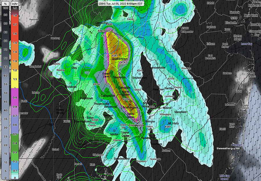
The latest RAP and HRDPS show strong thunderstorms about 4-6 PM moving into the city, but dissipating as they move east. The ICON has the storms closer to 7-9 PM and the ECMWF has most of the strongest activity moving to our north, like the NAM-NEST.
HRDPS forecast for 5 PM Tuesday, showing a line of heavy rain and storms. This line is forecast to fall apart as it moves further eastward. (Click on image for a larger view.)RAP model forecast for 5 PM Tuesday- simulated radar superimposed on CAPE values. (Click on image for a larger view.)
The impulse expected to trigger these storms is quite a distance away at this moment. I expect significant changes in the forecast by tomorrow morning. A couple of things worth noting: CAPE values to our west are high and vertical shear is also forecast to be highly elevated. Helicity values also elevated, especially northern Bucks county. Precipitable water (PWAT) values also very high (2.2-2.4″) indicating potential for heavy rains.