Early Edition
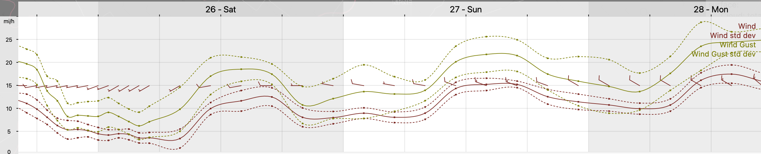
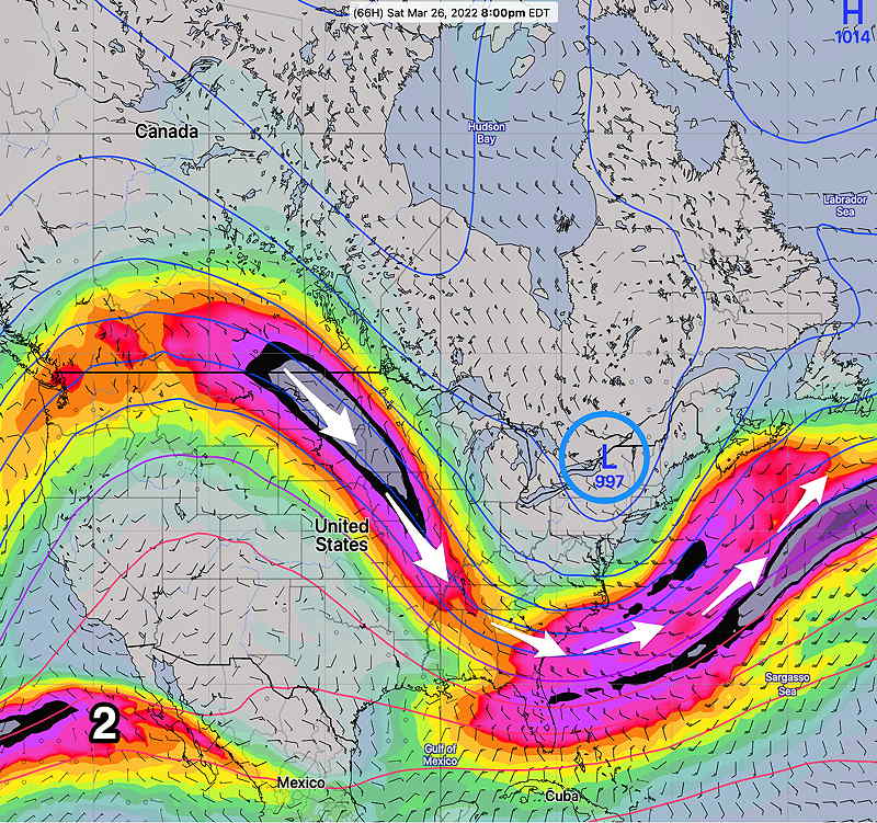
This coming weekend will be influenced by an influx of colder air and a dip in the jet stream to form an upper air trough, pushing a cold front through. The disturbances rotating around an upper low will bring showers on Saturday.
Saturday
Mostly cloudy with very light showers starting mid to late morning and lasting into early afternoon. Showers should be light (about 0.05 inches). Some models have some clearing in the mid afternoon, but most maintain the chance of light scattered showers until 3-4 PM. WINDY. High 54.2º ± 2.2º (NBM model Blue Bell)
Sunday
Mostly sunny, some periods of instability cloudiness. WINDY and chilly. High 46.3º ± 2.4º NBM model Blue Bell)
Winds