INTERESTING WEATHER SETUP THIS WEEKEND

Updated Fri 11:25 PM below highlighted

Sat 03:45 PM Forecast Review — The shower coverage is not what was forecast. Why? The position of the current mid level low is not where it was forecast to be and the strength of the jet streak is less than forecast.  
GFS forecasts comparing yesterday and today differ significantly in the in the position of the mid-level low and the strength of the jet streak  (Click on image for a larger view.)

Here’s where the mid-level low actually is:

Water Vapor Image showing actual position of mid-level low.  Much closer to this morning’s GFS model prediction, not very close to yesterday’s GFS model prediction.   (Click on image for a larger view.)

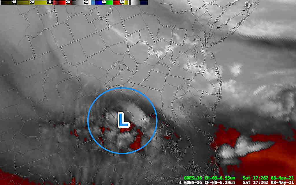
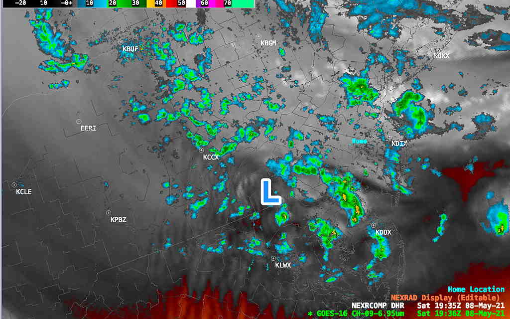
Here’s current radar with water vapor image

Current radar with water vapor.  The showers are near Philadelphia, but much of our area is not seeing showers right now.

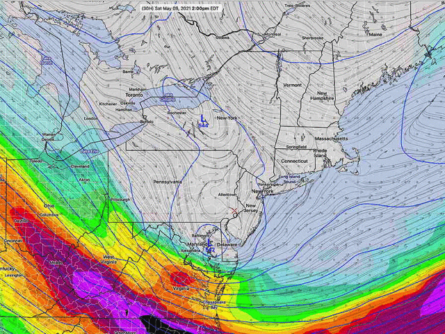
The weather this weekend will be interesting from a basic meteorological viewpoint; several basic weather phenomena will be in motion, including “horizontal wind convergence” and “jet streak exit region” vertical motion.

The bottom line will be unstable, shower-like precipitation with considerable clouds on Saturday (and maybe some breaks of sun). More rain Sunday afternoon with an old fashioned low pressure system.

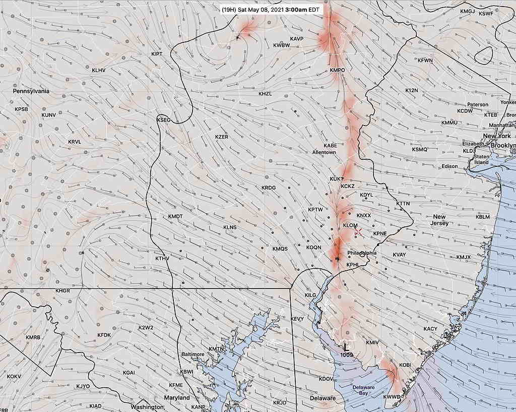
To start, on Saturday, an area of horizontal moisture convergence will result in rain showers very early Saturday morning. (Winds from the east will run directly into winds from the west. Where they meet, the air has nowhere to go but up, resulting in precipitation.)

Horizontal Moisture convergence zone (red shading) where easterly winds run into westerly winds. This phenomenon is not always this easy to see. (Click on image for a larger view.)

This area of low level convergence will lift off to our northeast after daybreak and Saturday mid morning will become drier.

Friday night’s HRRR has sunshine Saturday morning before the showers develop.

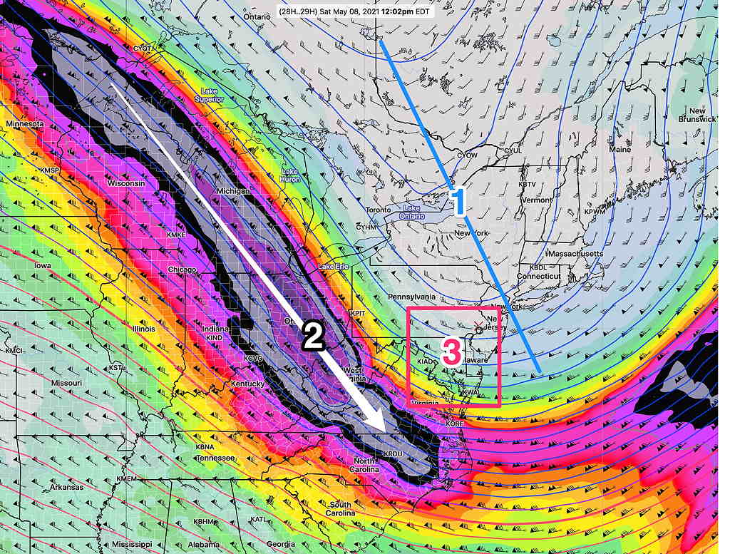
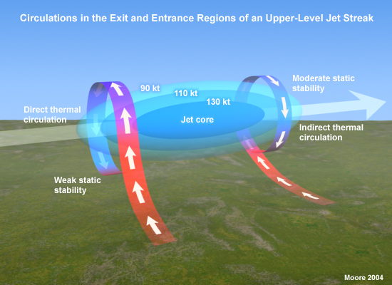
Additional convergence develops in the afternoon along with a negatively tilted upper air trough (1), a very strong jet streak (2) just to our southwest resulting in our area being in the what’s called the “right exit region (3) with vertical lift”.

Negatively tilted upper trough (1) (blue lines), strong jet streak at 145+ mph (2), right exit region (3) The right exit region of a jet streak has considerable vertical motion upward. This jet streak is expected to lift towards us during Saturday afternoon. (Click on image for a larger view.)

From comet.ucar.edu Shows the right exit region of jet streak with vertical motion. Corresponds to area #3 in the map above.

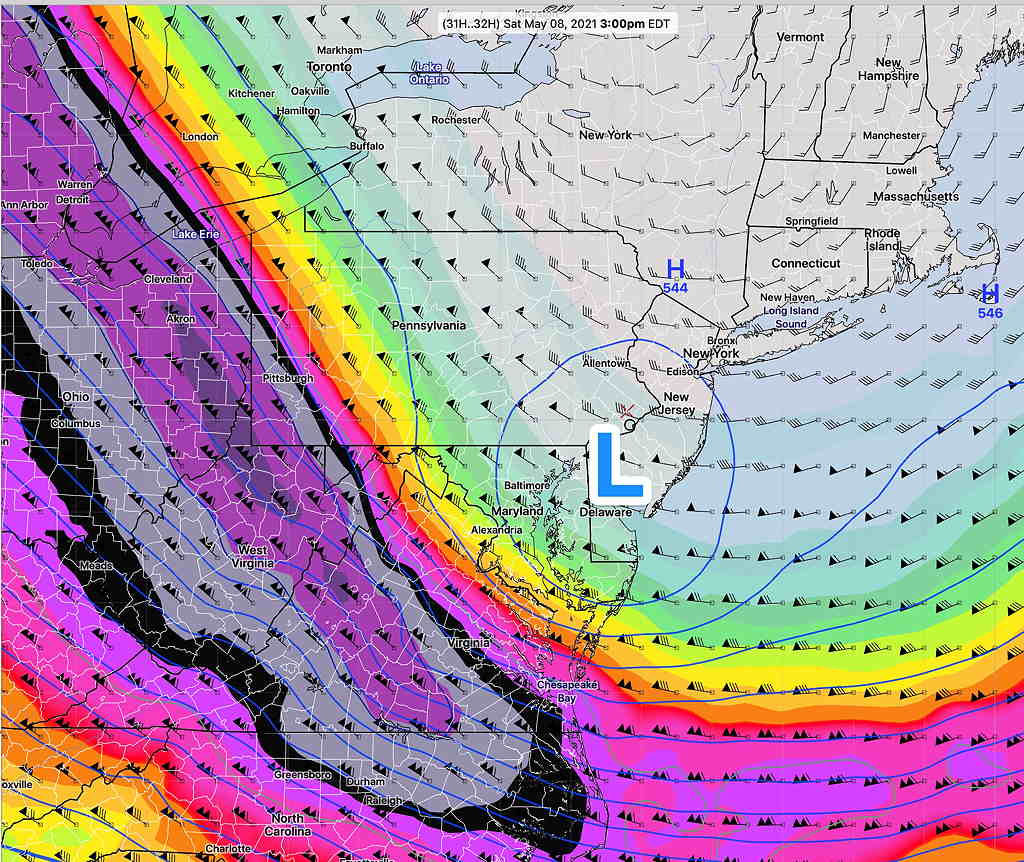
By 3 PM, we’ll be sitting under a strong closed mid-level closed low. Showers will develop under this low. With weak winds, any showers may be slow movers.

500 mb closed mid level low superimposed on jet streak winds. Saturday 3 PM Note that most of the action doesn’t occur right under the jet streak….it occurs in the exit and entrance regions.

Ok, enough! What about the forecast for Saturday and Sunday?

Showers tapering off early, about 8 AM or so. Mostly cloudy mid to late morning with this break in the showers. Periods of sun and clouds possible by late morning and early afternoon.

Any sun will be “self-destructive sunshine” and lead to showers.

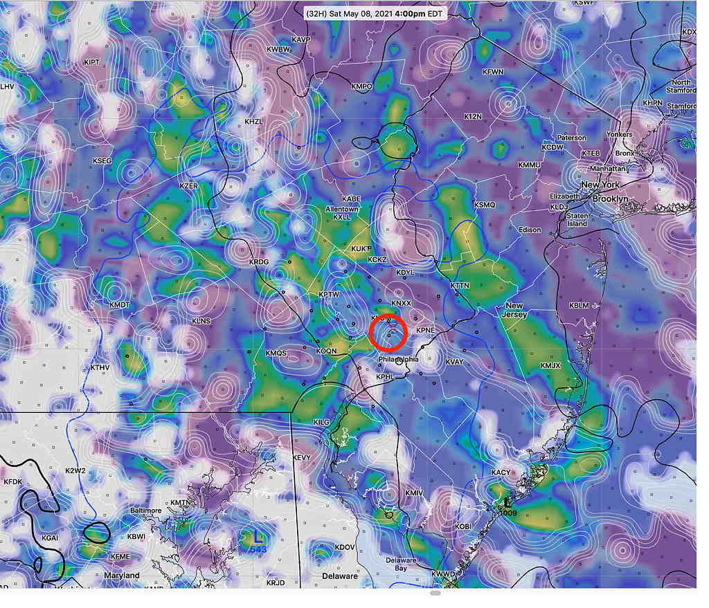
Plenty of dark clouds will develop. Impossible to time, but showers develop about noon and become widespread by 2 -5 PM. The showers will develop in-place and become numerous. High 58.2º sd 2.0º Blue Bell (NBM)

Tonight’s models show the showers to have somewhat less coverage than the map below.

HIRESW-ARW-MEM2 Model captures the situation for Saturday afternoon. Simulated Radar with low/middle level clouds at 4 PM (Click on image for a larger view.)

Showers taper off early Saturday evening.

Weak high pressure builds in for Sunday morning. Some mid-level clouds will lower and thicken by around noontime. An advancing low pressure system in the Midwest will quickly move in with clouds late morning and even some showers by 2 -4 PM according to the latest HRRR. High 61.5 º sd 1.6º NBM Blue Bell.

Friday night’s HREF shows most of the shower activity on Sunday afternoon moving off to our north. A nicer day is possible than previously forecast.
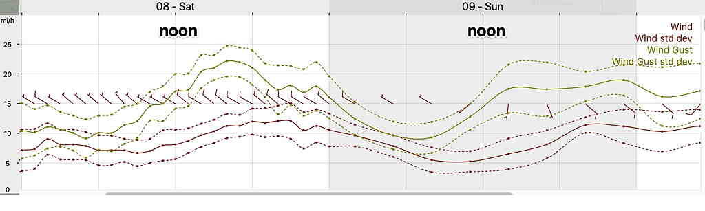
Winds
NBM Wind meteogram Blue Bell PA  (Click on image for a larger view.)

WEDNESDAY RAIN

Updated Wed 8:39 AM — Minor changes from last night. Chance of thunderstorms today is low in the PHL area. Several areas of rain will move through, occurring earlier than previously expected. What best captures the rain is this HREF (High Resolution Ensemble Forecast) meteogram for Blue Bell PA which shows mean hourly rain amounts with the “spread” (which is considerable)—

Updated Tue 9:52 PM highlighted below

For tonight (Tuesday), the latest models are showing a chance of thunderstorms somewhat later, again mostly north and west of the city.

NBM thunderstorm probability 9 PM Thursday (Click on image for a larger view.)

Not much happening tonight in the immediate PHL area. The only thunderstorms are occurring in the orange area as depicted in the NBM probability map above. All models from this morning (HIRESW, RAP, HRRR) and even this afternoon did not get this right.

Wednesday

The models are showing the cold front slowly moving through on Wednesday with two centers of low pressure moving up the front.

There’s a chance of rain throughout the day, with two maxima.

The first batch of rain will start as early as 9-11 AM Wednesday. While embedded thunderstorms are possible, the morning hours generally do not support much in the way of heavy thunderstorms activity.

A second wave of low pressure moves through during the afternoon hours. More rain is likely about 3-5 PM. Thunderstorms are most likely from Philadelphia south and east. (although tonight’s NBM is unimpressive with thunderstorm probability)

Here’s an NBM model hourly rain probability meteogram for Blue Bell PA for Tuesday night and Wednesday—

I’ll be looking at the new models later tonight.

Tonight’s NBM and HRRR is very unimpressive with the chance for thunderstorms on Wednesday, although it continues to show several slugs of rain, very similar to the peaks shown in the meteogram above from an earlier model run this afternoon.

Some embedded thunderstorms still possible from PHL south and east.