WEEKEND WEATHER FORECAST

Forecast Updates Highlighted
Sat 10:40 PM: Updated Sunday Forecast below

Sat AM Update: No significant change. Low clouds linger this morning. Brightening skies through high level cloudiness Saturday afternoon. No rain. Sunday’s forecast below still remains on track.

As mentioned earlier in the week, the timing of showers this weekend will make a difference in the overall forecast and it was hoped that much of the shower activity will occur during the evening hours. I started preparing this forecast this morning. By this evening, things are less clear for Sunday. More about this below.

The omega block influencing our weather is slowly breaking down, as low pressure in the Midwest slowly moves eastward. The upper level ridge of high pressure will maintain its hold on us for Saturday, acting like a wall against the low pressure advance, but it will get squeezed out of the way by Sunday.

SREF model forecast for Saturday 8 PM showing the upper level high.  (Click on image for a larger view.)

Saturday

Showers rotating around the low in the Midwest will move in Friday night but will exit early Saturday morning.

Saturday will be mostly cloudy in the morning as moist air moves from the east. There may be a break in the clouds and some sun Saturday afternoon. High temp 70.8º sd 2.5º (NBM model Blue Bell).

Winds light (see meteogram below)

Sunday

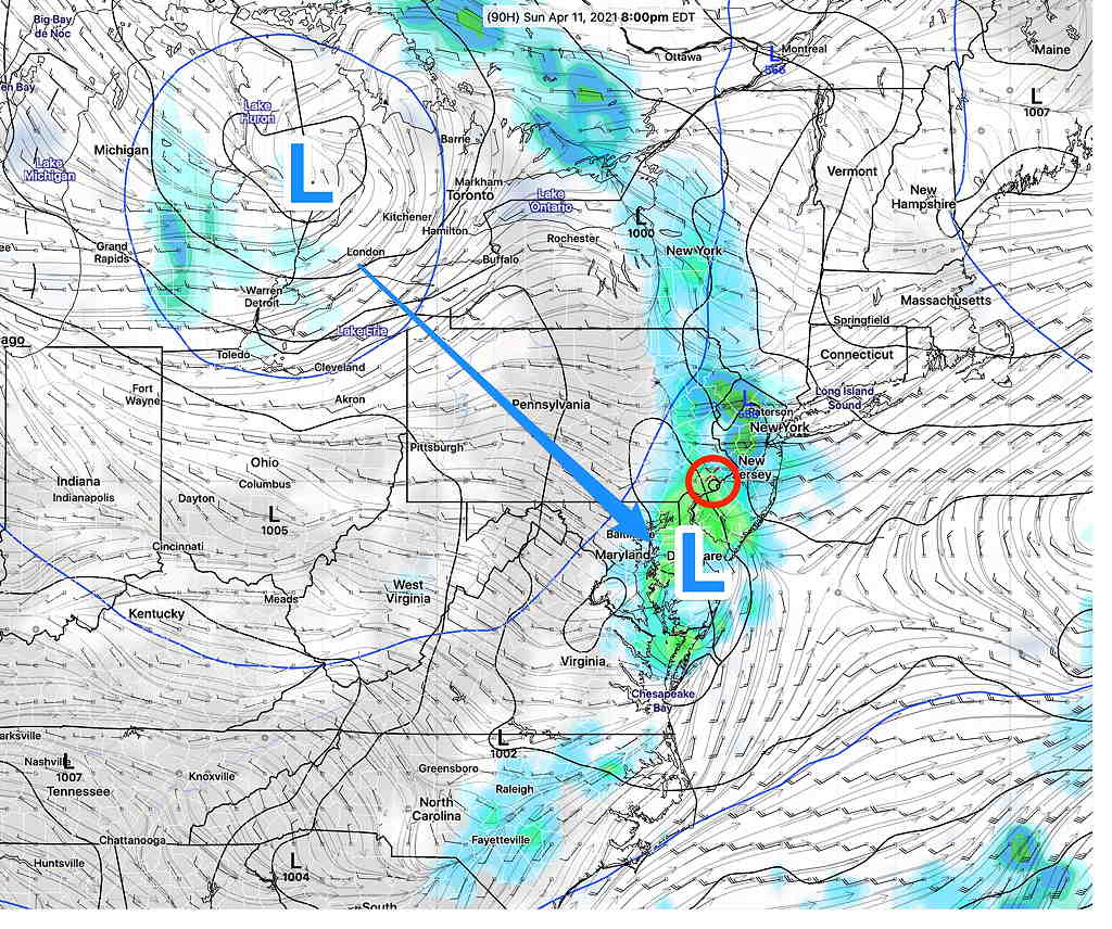
Nonetheless, the precipitation in Virginia (see above graphic) will advance into the Philadelphia region later Saturday night as a warm front. We’ll have showers and maybe some thundershowers late Saturday night.

Sunday will start out cloudy with showers in the early morning, but some sun may break out by noon. Rain ending Sunday about noon to 1:30 PM.

The more sun we get (if any), the more unstable things will get and the Canadian, ICON and to some extent the GFS maintains the chance of scattered showers and thunderstorms in the afternoon.

There still is a question about the amount of sunshine in the afternoon and possibility of additional showers (the NAM and HRRR maintain significant clouds) but the pre-release version of the new HREF (used for much of the forecast this weekend) has clouds thinning for some sun, similar to today..

(The higher resolution models only forecast out to 48 hours and Sunday afternoon is currently beyond this range.) High Temp 74º ± 3º

Also uncertain is the high temperature. The latest NBM has moved the high temp down to 67º but it has the standard deviation very large at 4.6º, showing the uncertainty in cloud cover and position of the warm front.

A weak cold front moves through Sunday night. Showers and possibly thundershowers move through between 6-9 PM Sunday night. Thunderstorms again in the evening 6-11 PM.

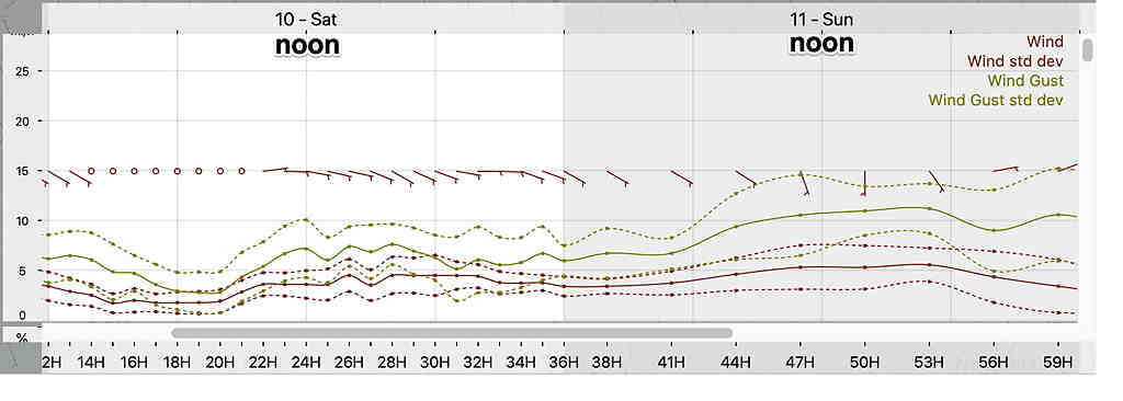
Winds for Saturday and Sunday

NBM wind meteogram  (Click on image for a larger view.)

I expect things go clarify with tonight’s models. Check here for updates during the weekend.

WEEKEND WEATHER OUTLOOK

Forecast Updated Friday 8:38 AM is highlighted.

The omega block mentioned in the previous post has brought persistent nice weather for much of this week.

The blocking pattern will slowly break down as low pressure in the middle of the country pushes eastward and spawns a secondary low off the Delaware coastline later Sunday (as previously forecast).

In terms of timing, we will luck out as much of precipitation that moves in during the weekend will occur in the nighttime Saturday and early morning hours of Sunday and again later on Sunday.

Saturday will be mostly cloudy but with little or no rain. High near 70º
It does appears that Saturday will be mostly cloudy but rain-free for most of the daytime hours.

Rain moves in late Saturday night. Models differ on timing, but much of the rain will end early morning Sunday. We may get some clearing mid day Sunday. High Sunday 72-75º

GFS showing secondary low off Delaware coast Sunday evening with Thundershowers in our area (Click on image for a larger view.)

A cold front moves through later on Sunday afternoon or early evening with rain and thunderstorms likely, enhanced by the secondary low pressure system developing to our south. Following rain in the morning, Sunday should be rain-free from late morning to very late afternoon/early evening.

I’ll be pinning down the timing of the rain with my regular Weekend Weather Forecasts

WEEK & WEEKEND WEATHER OUTLOOK

Updates Tues 7:15 PM & Wed 8:30AM are highlighted

The forecast for the weekend continues to evolve regarding timing of the rain. Based on the latest GFS, we may luck out and have most of the rain fall Friday evening and Saturday evening, leaving much of the daytime hours cloudy, but rain-free.

A blocked weather pattern has been in place for the past several days with low pressure stuck in the middle of the country as well as low pressure system stuck in the Atlantic. This blocking pattern will evolve into a classic “omega block” (the jet stream flow resembles the Greek letter omega “ Ω “) by Friday.

GEFS Jet forecast for Friday.  (Click on image for a larger view.)

The latest GEFS model shows this Atlantic low pressure system remaining even more entrenched as the low pressure in the central US tries to move east.  High pressure caught in the middle will bring a moist, easterly wind flow and cloudiness to our area from Friday through Sunday. 

Periods of showers and rain are most likely Friday and again Sunday.  

Additionally, the Central US  low pressure may induce secondary low pressure formation off the Delaware coast.  This coastal secondary low may make the rain on Sunday moderately heavy (the ICON model cranks out almost 1.5 inches of rain Sunday.)  

GFS Forecast Sunday 8 AM  (Click on image for a larger view.)

The models have backed away from heavy rain. The rain is looking less continuous over the weekend. Indeed there may be periods of cloudy, but dry weather. The exact timing of the rain over the weekend has shifted. Sunday’s rain may occur mostly before daybreak.

Blocked weather patterns result in long stretches of persistent weather.  We never really know when the block will break down until we see some kicker system appear.  So the block will be in place…until it isn’t.  The models aren’t all that good at showing that moment in advance.  As a result, long range forecasts sometimes become totally undone.  

According to the GEFS  that persistent low in the Atlantic and its effects on our weather may be with us much of next week!