The typical summer weather that has finally come to town will be with us through the end of the week and most of the weekend. High temperatures in the low 90s and dew points moving into the increasingly uncomfortable mid to upper 60s will be the trend through Saturday.
Despite thermodynamic instability from the heat and humidity, the high pressure system aloft and at the surface will prevent much vertical motion, greatly reducing the possibility of thundershowers through Friday.
A weak front will move through on Saturday afternoon. Mostly sunny skies still expected with some clouds in the afternoon. Some widely scattered showers and thunderstorms are possible, but many areas will stay dry, according to the NAM and GFS.
Sunday will be partly to mostly sunny and a bit less humid. The forecast for Sunday is a bit lower confidence. There’s a question about how far south the front will drop.
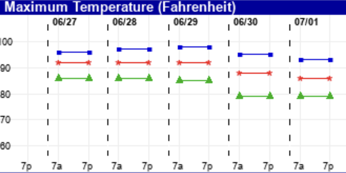
Here are the EKDMOS temperatures for the next few days. There’s a bit more spread in the temps on Sunday, suggesting a lower confidence forecast .