An easy forecast to make for this weekend. High pressure will bring a southwesterly flow of very hot, humid air into our region. Both Saturday and Sunday will be sunny with highs on Saturday 95 and 99-101 on Sunday. ( It’s July and having a heat wave is what happens in the summer!)
On a positive note, the latest model runs have a bit less humidity than previously forecast. Dew points in the mid to upper 60s during the daytime hours. This is a slight improvement over what had previously been predicted by the models; they had been showing dew points in the low 70s during the day. It’s still going to be hot!
GFS Model forecast for Sunday afternoon.
The latest models have highs in the 90s for the next 7+ days!
The models did poorly with yesterday’s forecast; I guess the biggest clue that things weren’t going to go as forecast were the large differences in QPF forecast by the NAM and GFS. The temperatures remained about 69 instead of the forecast 81; essentially, the warm front never moved north as had been forecast.
I am somewhat more confident about today’s forecast, at least based on the short range models (GFS LAMPS; NAM-based HRRR). Both show a mix of clouds and some sun due to an occluded front that has stalled to our west.
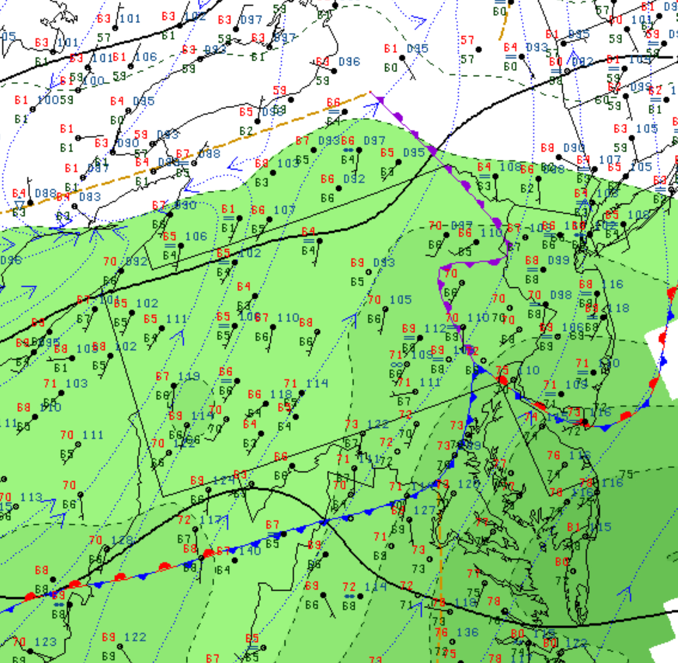
Current Frontal Positions at 8 AM Sunday.
Both models currently show a moderate chance of thunderstorms moving in between 5PM and 8 PM, with highest probability about 7 PM. Still, the overall chance is only about 50%, so it’s possible that not all areas will get the showers and storms today.
High temperatures 87 with dew points in the somewhat uncomfortable upper 60s.
[su_note note_color=”#d9f2da”]Noon Update: My optimism about clearing after the warm front passage was apparently misplaced. This was a “low-confidence forecast” for a reason. The warm front hasn’t really made it past Philadelphia and it won’t until later in the afternoon. A light drizzle has also developed. The GFS model was apparently correct. Showers are beginning to develop to our south and may move in earlier than expected. [/su_note]
[su_note note_color=”#d9f2da”]Yet Another Update 5pm: The FV3-GFS shows lower chance of thunderstorms this evening. The warm front never made it north of Philadelphia! Poor model performance today![/su_note]
The showers have pretty much ended after 8 AM here, so yesterday’s NAM forecast has verified.
The question is – how much clearing and brightening skies will we get? The NBM (National Blend of Models) has things brightening considerably about 1 PM.
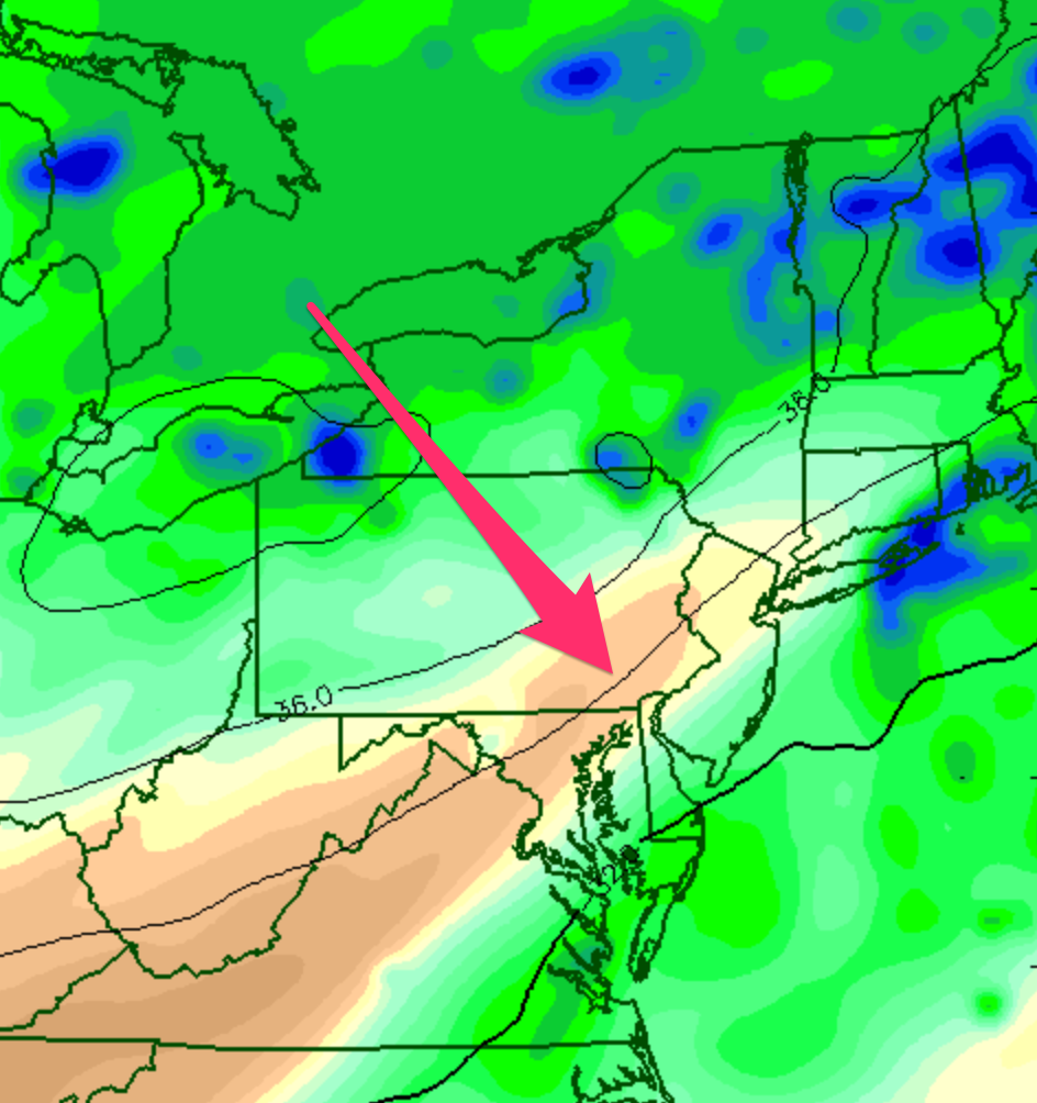
Current upper air analysis shows dry air punching in from the south (see 300 mb humidity graphic below)
But lower levels of the atmosphere are pretty saturated. So I’m not sure if the drab, cloudy conditions will improve, but I think they may.
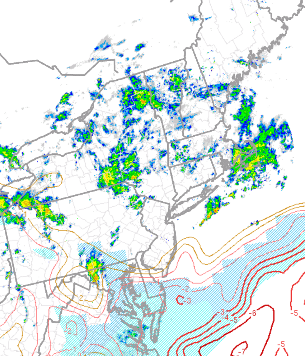
Current analysis shows much of the dynamics for thunderstorms remain to our south:
Current radar and lifted index
Those dynamics supporting thunderstorms are expected to move northward by late afternoon giving us scattered thunderstorms.
So brightening skies (maybe) for much of Saturday with scattered showers and thunderstorms re-developing around 4-5 PM.