
Very hot

Update Sun @ 9:54 AM — New 12z NBM model out continues with the somewhat lower temperatures for Sunday—
Show More
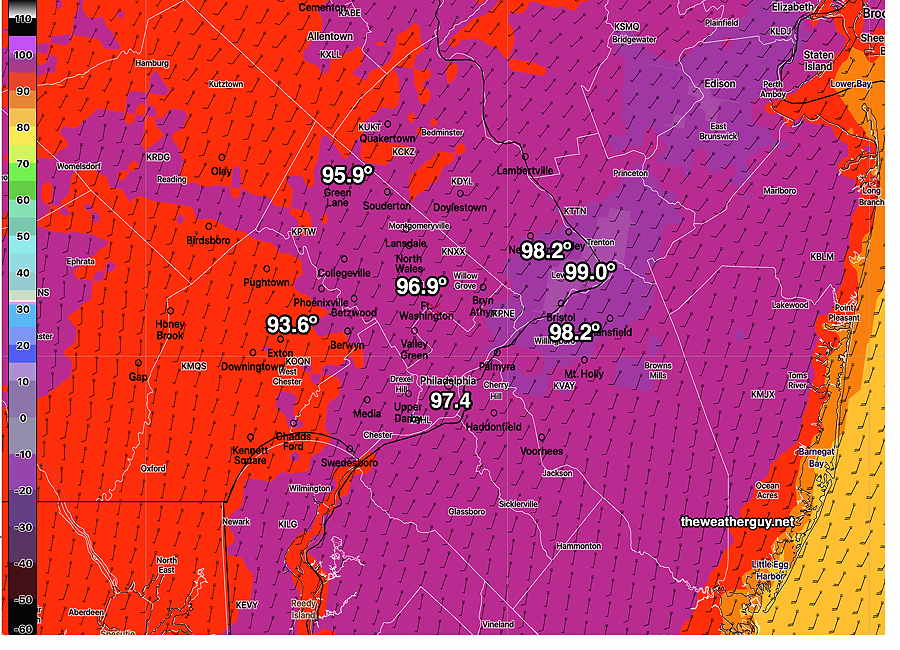
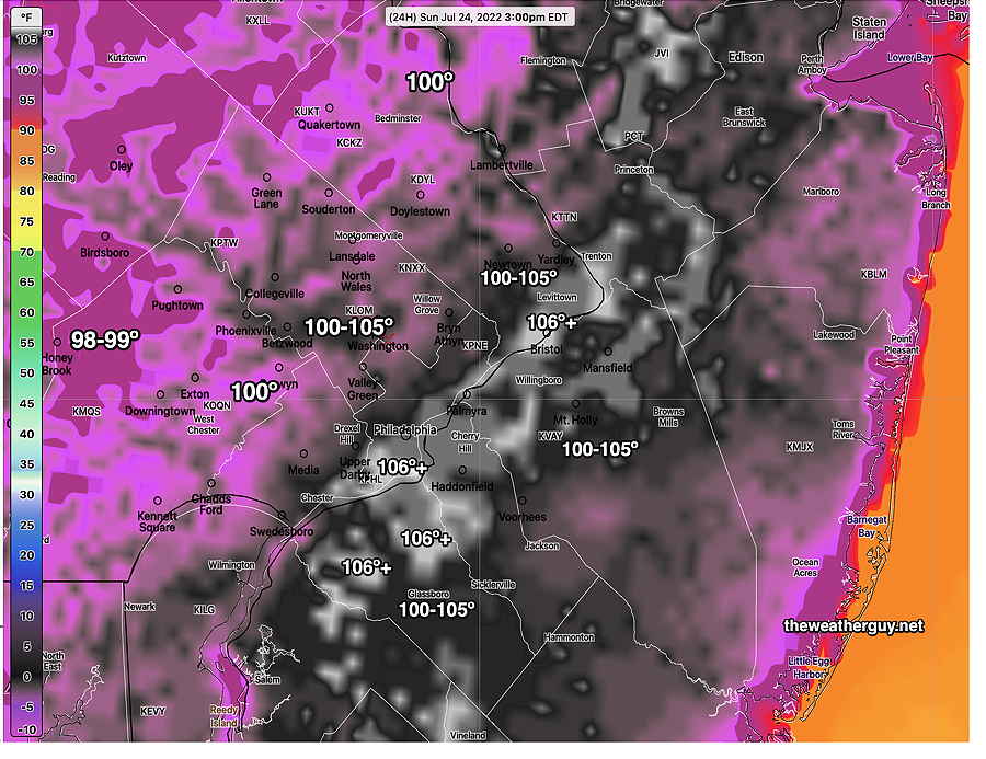
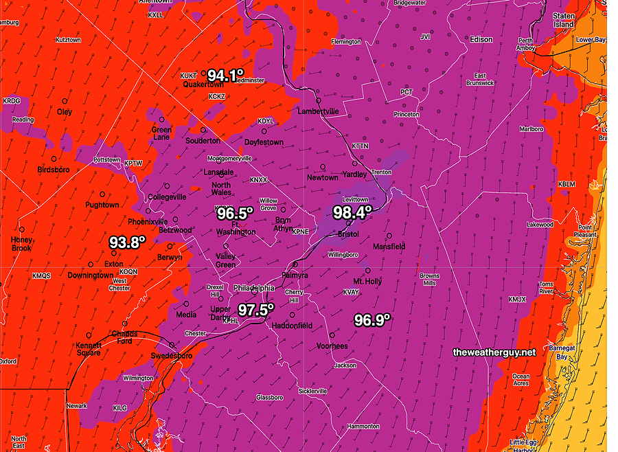
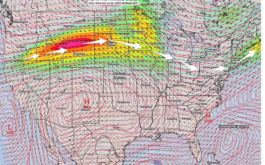
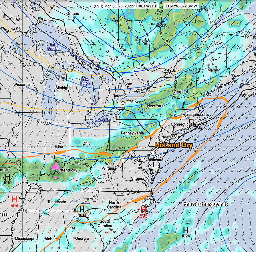
Updated Sun 8:37 AM — Last night’s model blend (NBM) shows high temperatures will not reach the extreme highs forecast yesterday. It appears that highs will be 96-98º with some areas just reaching 99º. Nonetheless, dew points will be higher and heat indexes still forecast to be over 100. Update Sat @ 6:18 PM — Today’s high temperatures were inline with this morning’s NBM temperature forecasts. Sunday appears to be on track for extremely hot weather. The latest NBM high temperature— And heat index (apparent temperature)— Of interest— some models are showing some widely scattered showers and thunderstorms Sunday evening. Update Sat @ 10:17 AM — The latest NBM model forecast high temperatures have trended downward slightly for today, Saturday, from previous model runs— Even heat indexes have trended downward for Saturday, as dew points will also be somewhat lower. I don’t see any 100 heat indexes here today . No change in Sunday’s extreme heat. In fact, the NBM shows higher heat indexes >100 more widespread for Sunday. Update Fri @ 10:08 PM —Updated the Rain Outlook for Monday A continued hot and increasingly moist flow of air will be with us for the weekend. Little chance of rain in our area until later on Monday (more about that later.) Current model jet stream position— Current water vapor imagery (Friday late afternoon) — A southwesterly flow will bring heat and increasing humidity. Sunny and hot. High temperature 97.2º ± 1.2º NBM model Blue Bell, PA Dew points will be still be moderate, despite the temperatures, although higher than Friday— Sunday will continue to be extremely hot and increasingly humid. I expect to see actual temperatures reach 100º+ in several areas. I’m usually not ‘into’ the heat index (what meteorologists call the “apparent temperature”) since it sensationalizes things and I think is confusing. (If a 100 degree temperature always feels different than 100º, how do you know what a 100 degree temperature really feels like? ….And I hate when TV weather people start talking about temperature and then they talk about heat index and then talk about temperature. Too sensational and too confusing. But don’t get me started. ) Anyhow, the heat index for Sunday is forecast to be impressive. All areas will feel like it’s over 100 (whatever that means. I think it means it will feel unusually hot.) Heat Index for Sunday— Just a teaser…we need the rain and the first chance is Monday late afternoon and evening. Will we see this fall apart as it has for several past forecast rains? More about that over the weekend. Rain Outlook for Monday— Latest models suggest a repeat of a low rain amount event for Monday evening. As has been the case for weeks now, the front will run into a wedge of very dry, hot stable air. Total rainfall may be less than 0.3- 0.5 inches, much less than we need. Updated Fri 10:52 PM — Tonight’s NAM shows heavy rain for late Monday ( over 2 inches). I’m not sure I believe it.


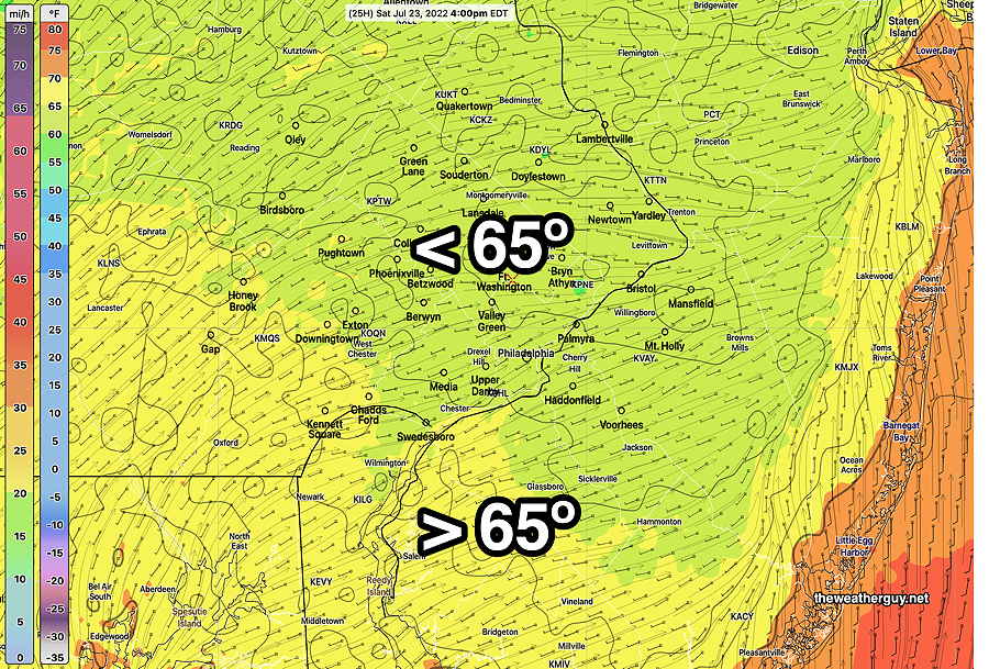
Saturday
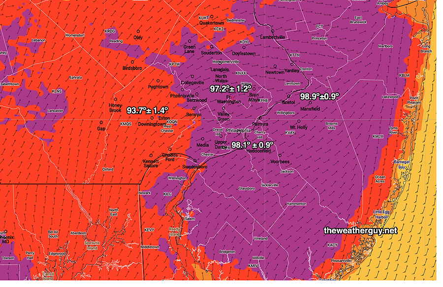
Sunday

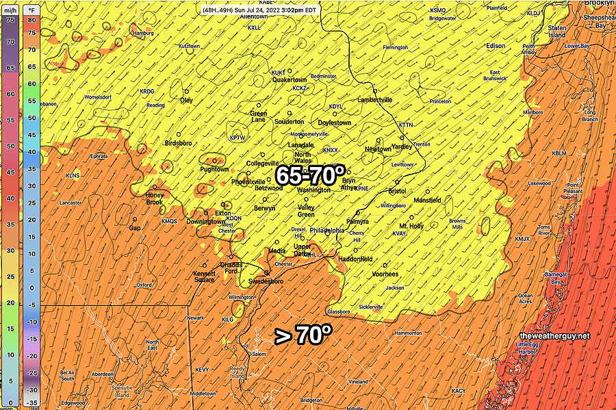

Rain outlook for Monday
Any additional clarity on Monday’s possible rain for PHL?
Not much clarity. The models are all over the place. Most common amount is a disappointing 0.3-0.5”.
Canadian model has almost nothing, German ICON has most falling in Delaware and Maryland. NAM has more (about 0.8”) but GFS about 0.3. ECMWF also less than 0.5” Latest RAP has rain in the late morning instead of the evening! Too early to tell. With all of that, we have to add that “invisible force field” that has developed over the Philadelphia area that keeps all rain away.