Update Thu @ 7:49 AM — A front will move through between 2 PM and 5 PM today. The front is clearly visible on current satellite water vapor imagery—
Water Vapor at 7:41 AM shows distinct front moving through central PA this morning. This front will move through here later this afternoon. The front represents more of a dew point change/wind shift than a temperature change. (Click on image for a larger view.)
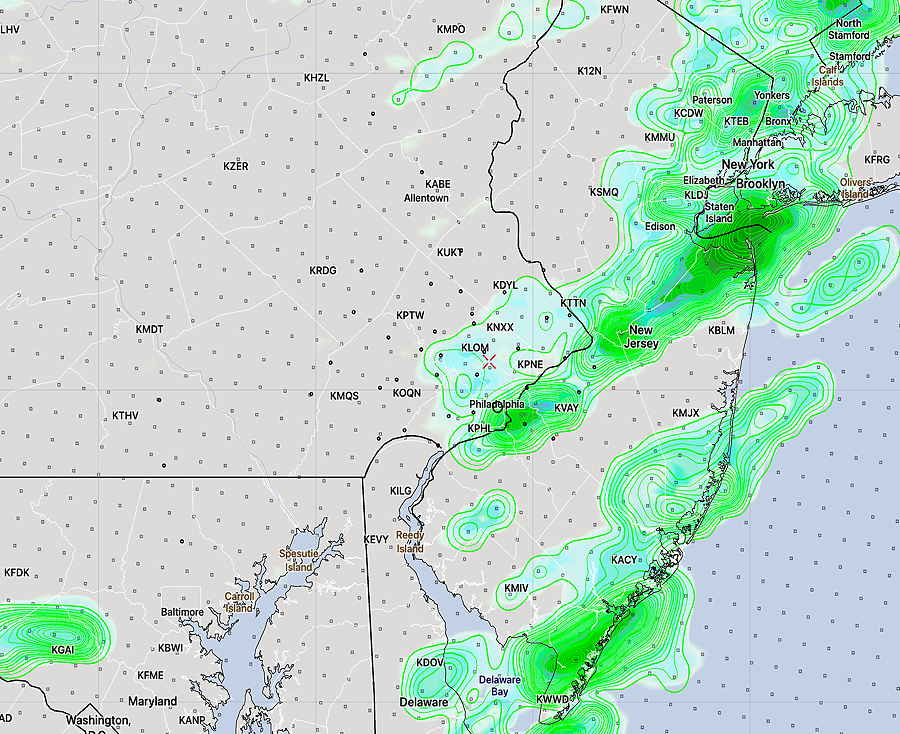
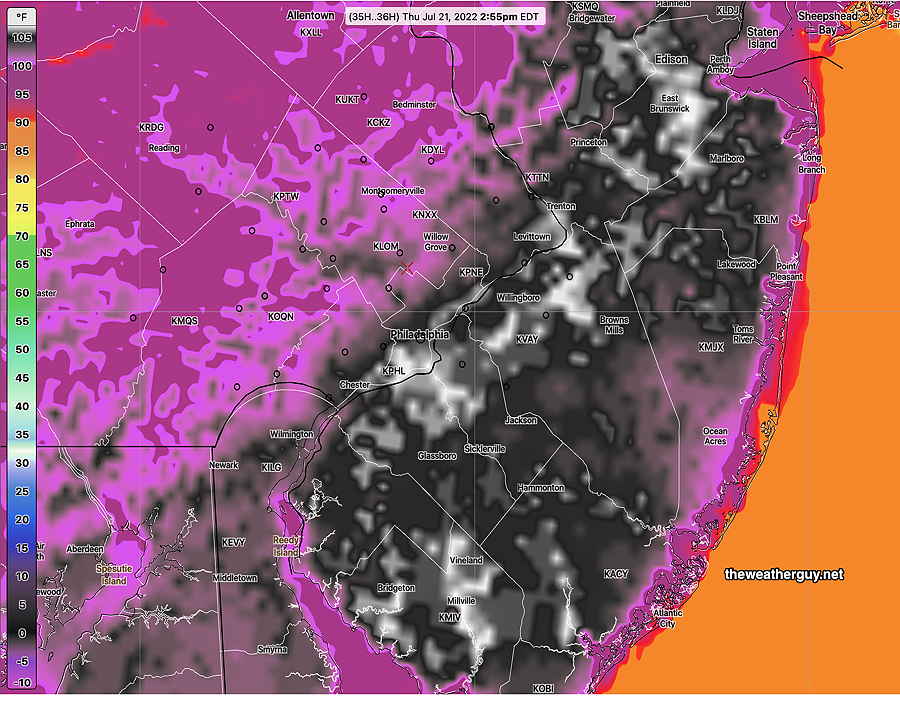
Some models have a few very widely scattered showers and thunderstorms between 2-3 PM around Philadelphia and about 5 PM into NJ. Little in the way of accumulating rain is expected.
Today’s HREF forecast for rain accumulation 2-3 PM Thursday. This may be over-predicting the amount of showers. (0.02-0.20 inches of rain) (Click on image for a larger view.)
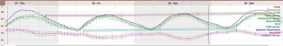
The frontal passage will bring lower dew points (less humidity) later this afternoon and evening. Higher humidity gradually returns by Sunday. The heat continues.
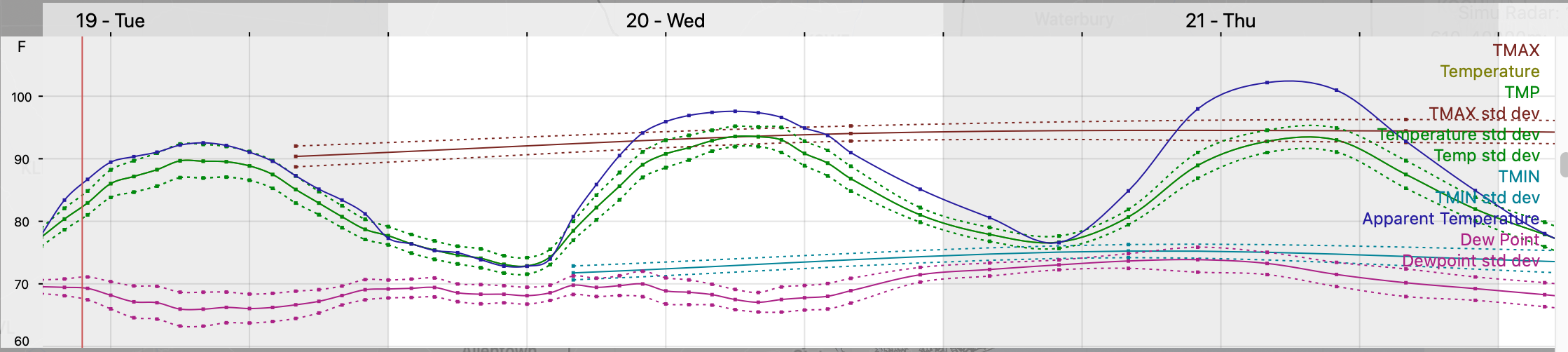
NBM meteogram for Blue Bell, PA temperature dew point and “heat index” (apparent temperature) through Sunday. Note that the dew points are lower Friday and Saturday. (Click on image for a larger view.)
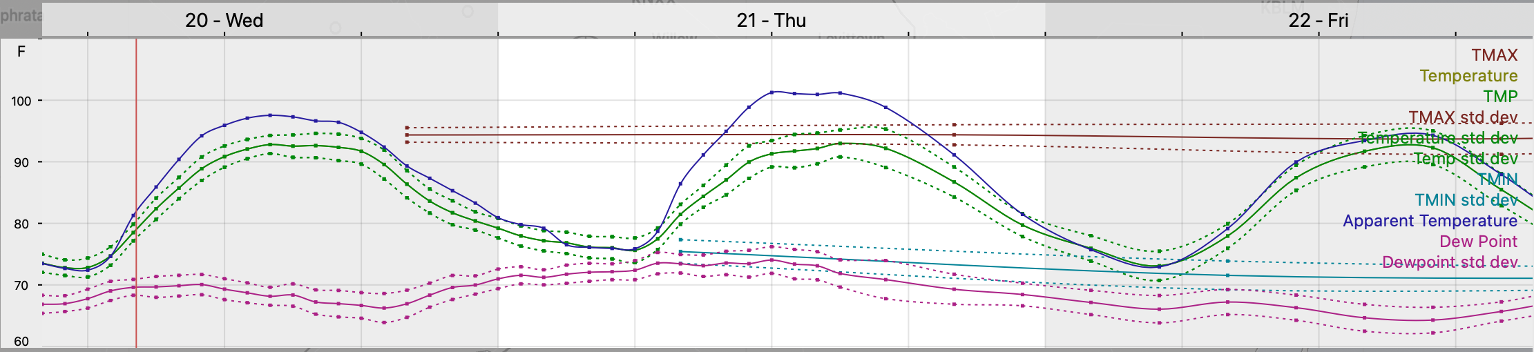
Update Wed @ 8:09 AM — Temperature- dew point meteogram says it all—
NBM meteogram (temperature dew point, max temp and heat index (apparent temp) with standard deviations for Blue Bell PA (Click on image for a larger view.)07z NBM forecast Apparent Temperature (“heat index”) for Thursday at 2:55 PM. (Click on image for a larger view.)
The extended 90º+ stretch we’re entering into has been well-advertised by the media.
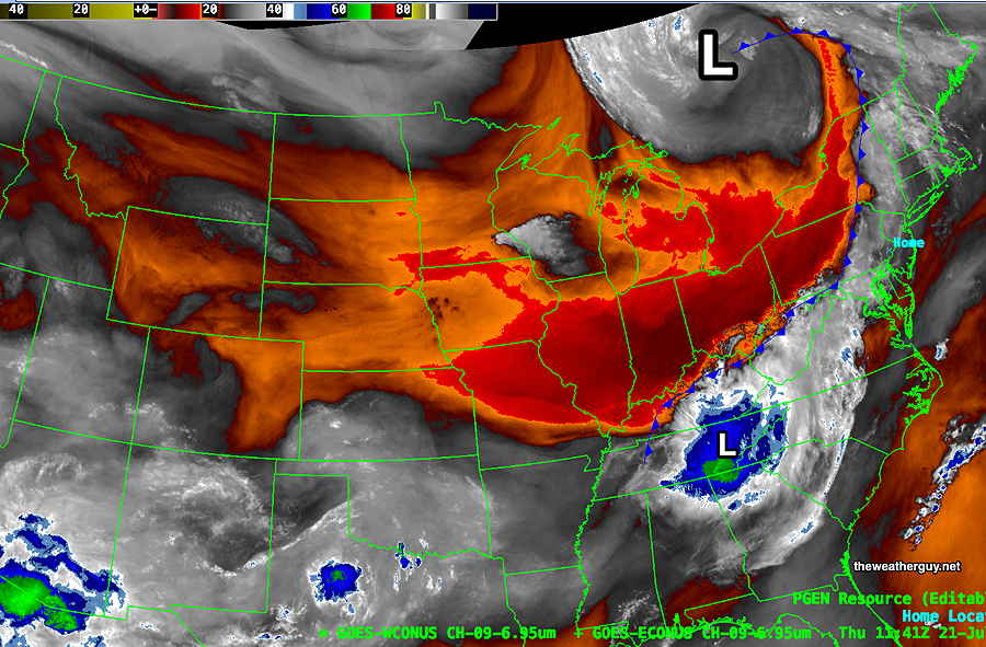
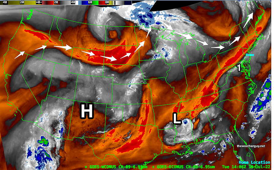
Current satellite water vapor image shows plenty of hot air streaming up from the southwest—
Hot air (orange-red) “conveyor belt” with heat and humidity streaming up from the southwest. Stalled frontal boundary (1) just to our south (Keep in mind that water vapor imagery is NOT showing reflected light from clouds. Water Vapor shows the temperature (and therefore the height) of the very top layer of substantial water vapor. In effect, it shows a three dimensional view of the atmosphere. Cold temperatures, shown in blue and green, indicate rising air — vertical motion. (Click on image for a larger view.)
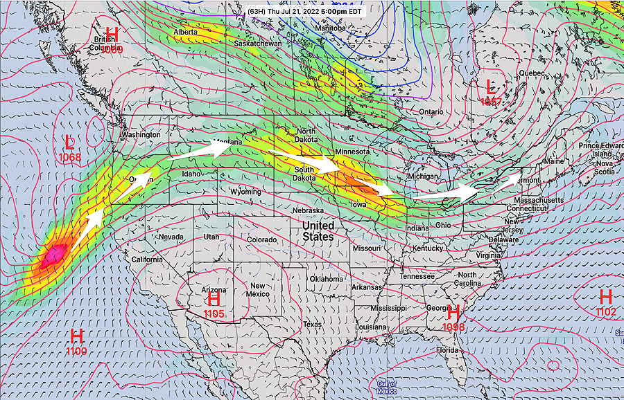
This week’s jet stream is typical for a summer pattern, albeit the temperatures are well above seasonal averages. Our area has been in a consistent, slight upper trough since May and this trough and the current pattern is forecast to remain unchanged for the next 10 days—
GEFS 250 mb jet stream winds on Thursday. Slight upper trough over the Northeast and the hot dry H over the southwest has been with us for a few months/
The big item for us will be the heat—
NBM meteogram temperature/dew point/heat index for Blue Bell PA. Philadelphia is generally 2s-3º hotter. “Apparent Temperature” is the blue line (heat index) Dew points (magenta lines) are in the upper 60s to near 70. (Click on image for a larger view.)
There’s a chance of thunderstorms Thursday evening as a weak front move through.