Updated Sat 7:48 PM — Sunday will be sunny. Still very windy. Wind gusts 30-40 mph. High temp 73.4º ± 1.5º NBM model Blue Bell. (Average seasonal high this time of year is 83-84°)
Update Sat @ 10:25 AM —
Forecast Review— Despite the lack of most models’ support, instability cloudiness did develop during Saturday morning. Why the models don’t seem to forecast this very well is a mystery to me, but I’ve seen it happen many times in similar setups.
Increasing sunny breaks and sunshine should begin during the afternoon; I’m basing this on the ICON and ECMWF models which did show this cloudiness.
Updated Fri 11:06 PM — Tonight’s models have backed away from the Saturday morning cloudiness.
Update Fri @ 5:59 PM — Forecast Updated in below
High pressure builds in behind a cold front Friday. We’ll be under the influence of high pressure at the surface and low pressure aloft—
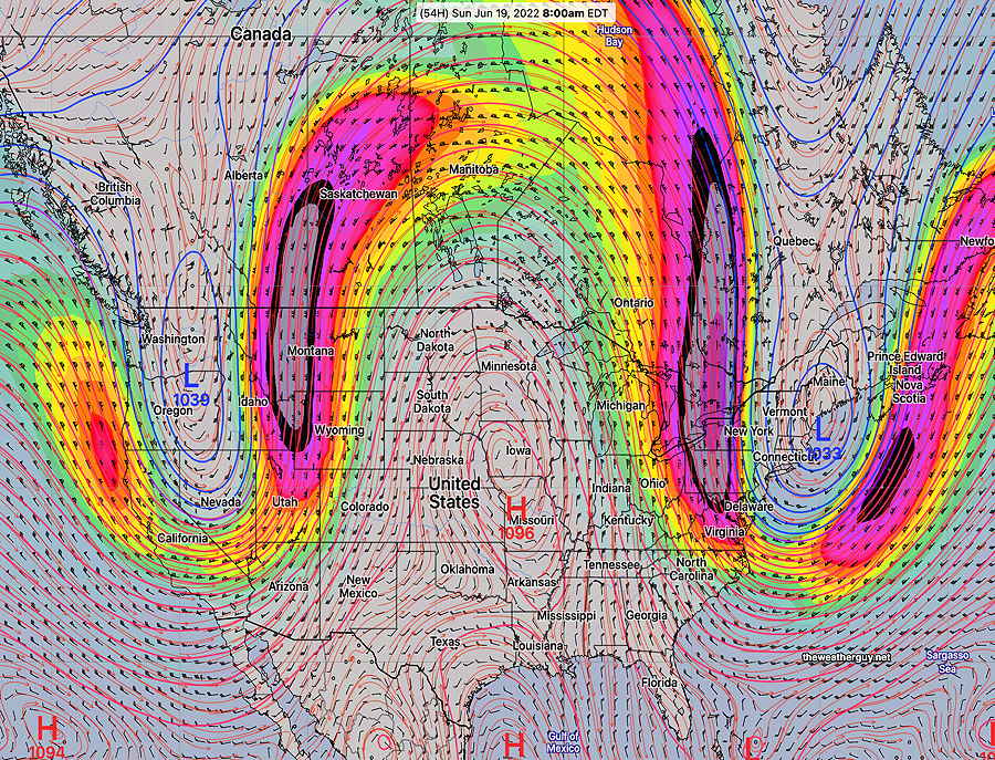
GEFS jet stream wind forecast for Sunday showing low pressure aloft in the northerast. Persistent upper ridge in the Midwest will bring very hot temperatures to that area. We’ll be in the cooler section of the pattern. (Looks like a persistent omega block appearance to me.) Will have to keep an eye on the jet streak in western Pennsylvania. This cold bring some instability cloudiness, although it’s not being forecast. (Click on image for a larger view.)
From this upper wind configuration, expect cooler temperatures, windy conditions and possibly some cloudiness (although the models aren’t forecasting any clouds here right now.)
More specific forecast info later today…
Here’s the Fri 5:59 PM update on the forecast specifics:
Saturday
As mentioned, the above upper air setup often leads to some cloudiness. Earlier models didn’t show it, but this afternoon’s GFS, ICON and ECMWF show upper air disturbances moving through around the upper low pressure system.
Saturday will be a mix of clouds and sun. The GFS is suggesting some significant periods of instability stratocumulus both in the morning and mid day, with fair weather cumulus along with periods of sunshine other times. Somewhat windy! High temperature 70.8º ± 2.6º NBM model, Blue Bell
Sunday
Mostly sunny and delightful. High temp 75.0º ± 2.5º NBM model Blue Bell.